India’s geographical position
- India is the seventh-largest country in the world and forms part of the continent of Asia.
- Together with its neighbours—Pakistan, Bangladesh, Nepal, Bhutan, Sri Lanka, and Myanmar—it constitutes the region known as the Indian Subcontinent.
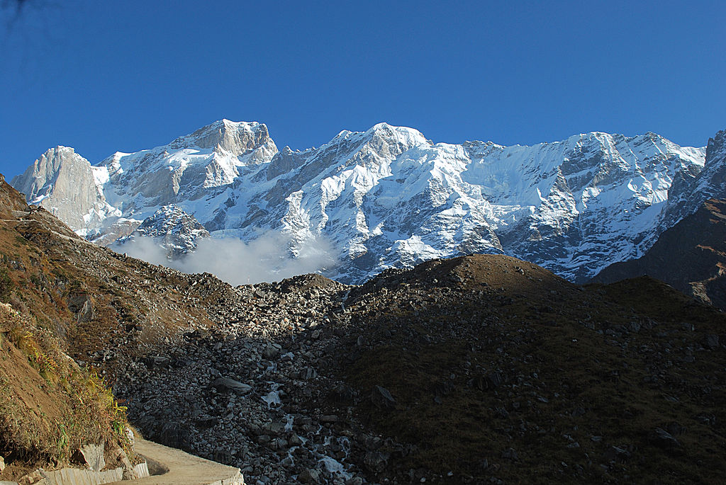
- The country is enclosed by natural boundaries: the Himalayan Mountain range serves as a natural barrier in the north; the Thar Desert and the Arabian Sea mark the western limits; the Bay of Bengal borders it to the east; and the Indian Ocean lies to the south.
- In 1984, Rakesh Sharma, the first Indian astronaut in space, described India to Prime Minister Indira Gandhi as “Sāre jahān se achchha” (better than the whole world).
- For regional discussion, India is grouped into five broad divisions: the great mountain zone, the plains of the Ganga and the Indus, the desert region, the southern peninsula, and the islands.
Geological Evolution and Plate Tectonics
- The earth is approximately 4600 million years old and has evolved through changes brought about by endogenic and exogenic forces.
- These forces played a significant role in shaping the surface and subsurface features of the earth.
- Millions of years ago, the Indian plate was located to the south of the equator, was much larger in size, and included the Australian plate.
- The plate broke into multiple parts; the Australian plate moved towards the southeast, while the Indian plate moved to the north.
- The northward movement of the Indian plate continues to this day, bringing significant consequences to the physical environment of the Indian subcontinent.
- The present geological structure and geomorphologic processes in the Indian subcontinent result from the interplay of endogenic and exogenic forces, as well as the lateral movements of tectonic plates.
Geological Divisions of India
- India can be divided into three geological divisions that broadly follow its physical features: The Peninsular Block, The Himalayas and other Peninsular Mountains, and the Indo-Ganga-Brahmaputra Plain.
- The Peninsular Block:
- The northern boundary is an irregular line running from Kachchh along the western flank of the Aravali Range near Delhi, roughly parallel to the Yamuna and the Ganga, up to the Rajmahal Hills and the Ganga delta.
- Extensions of this block include the Karbi Anglong and the Meghalaya Plateau in the northeast, and Rajasthan in the west.
- The northeastern parts are separated from the Chotanagpur plateau by the Malda fault in West Bengal.
- The block is mainly formed by a great complex of very ancient gneisses and granites.
- Since the Cambrian period, it has stood as a rigid block, with exceptions on the western coast which is submerged beneath the sea and some areas changed by tectonic activity without affecting the original basement.
- As part of the Indo-Australian Plate, it experienced vertical movements and block faulting, resulting in the rift valleys of the Narmada, Tapi, and Mahanadi, and the Satpura block mountains.
- It consists of relict and residual mountains like the Aravali, Nallamala, Javadi, Veliconda, Palkonda, and Mahendragiri hills.
- River valleys are shallow with low gradients, and most east-flowing rivers (Mahanadi, Krishna, Kaveri, Godavari) form deltas before entering the Bay of Bengal.
- The Himalayas and other Peninsular Mountains:
- In contrast to the rigid Peninsular block, these are young, weak, and flexible in geological structure.
- They are subjected to the interplay of exogenic and endogenic forces, resulting in faults, folds, and thrust plains.
- Tectonic in origin, they are dissected by fast-flowing, youthful rivers and feature landforms like gorges, V-shaped valleys, rapids, and waterfalls.
- Indo-Ganga-Brahmaputra Plain:
- Formed by the rivers Indus, Ganga, and Brahmaputra.
- Originally a geo-synclinal depression that attained maximum development during the third phase of Himalayan mountain formation about 64 million years ago.
- It has been gradually filled by sediments from Himalayan and Peninsular rivers, with alluvial deposits averaging 1,000 to 2,000 meters in depth.
6 natural regions of India
- Based on macro variations, India is divided into six physiographic divisions: The Northern and North-eastern Mountains, The Northern Plain, The Peninsular Plateau, The Indian Desert, The Coastal Plains, and The Islands.
1. The Northern and North-eastern Mountains
- Consists of the Himalayas and the Northeastern hills.
- The Himalayas consist of parallel ranges, including the Greater Himalayan range (Great Himalayas and the Shiwalik).
- Orientation: Runs from northwest to southeast in northwestern India, east-west in the Darjiling and Sikkim regions, southwest to northwest in Arunachal Pradesh, and north-south in Nagaland, Manipur, and Mizoram.
- The Great Himalayan range (central axial range) has a length of approximately 2,500 km from east to west and a width of 160-400 km from north to south.
- It acts as a strong wall between the Indian subcontinent and Central and East Asian countries, serving as a physical barrier and a climatic, drainage, and cultural divide.
2. The Northern Plain
- Formed by alluvial deposits of the Indus, Ganga, and Brahmaputra rivers.
- Extends approximately 3,200 km from east to west, with an average width of 150-300 km and a maximum depth of alluvium ranging from 1,000 to 2,000 meters.
- Divided into three major zones from north to south: the Bhabar, the Tarai, and the alluvial plains (further divided into Khadar and Bhangar).
- Bhabar: An 8-10 km narrow belt parallel to the Shiwalik foothills at the break-up of the slope where streams deposit heavy rocks and boulders, sometimes disappearing into the zone.
- Tarai: A 10-20 km wide belt south of the Bhabar where streams re-emerge without demarcated channels, creating marshy and swampy conditions. It has luxurious natural vegetation and varied wildlife.
- Bhangar and Khadar: A belt south of the Tarai containing old and new alluvial deposits respectively. These feature mature-stage fluvial erosional and depositional landforms like sand bars, meanders, ox-bow lakes, and braided channels.
- The Brahmaputra plains are known for riverine islands, sand bars, periodic floods, and shifting river courses that form braided streams.
- River mouths form some of the world’s largest deltas, such as the Sunderbans delta.
- Mostly a featureless plain with a general elevation of 50-150 meters above mean sea level.
- The states of Haryana and Delhi form a water divide between the Indus and Ganga river systems.
- The Brahmaputra flows from northeast to southwest before taking an almost 90° southward turn at Dhubri into Bangladesh.
- Possesses fertile alluvial soil supporting crops like wheat, rice, sugarcane, and jute, sustaining a large population.
3. The Peninsular Plateau
- An irregular triangle rising from 150 meters above the river plains to an elevation of 600-900 meters.
- The outer extent is marked by the Delhi ridge (northwest), the Rajmahal hills (east), the Gir range (west), and the Cardamom hills (south), with an extension in the northeast including the Shillong and Karbi-Anglong plateau.
- Composed of a series of patland plateaus like Hazaribagh, Palamu, Ranchi, Malwa, Coimbatore, and Karnataka.
- It is one of the oldest and most stable landmasses of India, with a general elevation sloping from west to east (as proved by the pattern of river flow).
- Features include tors, block mountains, rift valleys, spurs, bare rocky structures, hummocky hills, wall-like quartzite dykes, and an emphatic presence of black soil in the west and northwest.
- The northwestern part features a complex relief of ravines and gorges (e.g., Chambal, Bhind, and Morena).
- Divided into three broad groups: The Deccan Plateau, The Central Highlands, and The Northeastern Plateau.
- The Deccan Plateau:
- Bordered by the Western Ghats (west), Eastern Ghats (east), and the Satpura, Maikal range, and Mahadeo hills (north).
- Western Ghats (known locally as Sahyadri, Nilgiri hills, Anaimalai hills, and Cardamom hills) are higher (average 1,500 m) and more continuous than Eastern Ghats, with height increasing from north to south.
- Highest peak: Anaimudi (2,695 m) on the Anaimalai hills, followed by Dodabetta (2,637 m) on the Nilgiri hills.
- The discontinuous Eastern Ghats (Javadi hills, Palconda range, Nallamala hills, Mahendragiri hills) are highly eroded by rivers like the Mahanadi, Godavari, Krishna, and Kaveri.
- The Eastern and Western Ghats meet at the Nilgiri hills.
- The Central Highlands:
- Bounded to the west by the Aravali range.
- The southern boundary is formed by the Satpura range, consisting of scarped plateaus (600-900 m) which form the northernmost boundary of the Deccan plateau.
- An extension reaches Jaisalmer in the west, covered by longitudinal sand ridges and crescent-shaped sand dunes called barchans.
- It has undergone metamorphic processes, evidenced by rocks like marble, slate, and gneiss.
- General elevation is 700-1,000 meters, sloping north and northeast.
- Most Yamuna tributaries originate in the Vindhyan and Kaimur ranges; Banas is the only significant Chambal tributary originating from the Aravalli.
- The eastern extension is formed by the Rajmahal hills, with the mineral-rich Chotanagpur plateau to its south.
- The Northeastern Plateau:
- An extension of the main Peninsular plateau, detached due to a huge fault created between the Rajmahal hills and the Meghalaya plateau during the Himalayan origin.
- Divided into the Garo, Khasi, and Jaintia Hills, with an extension in the Karbi Anglong hills of Assam.
- Rich in mineral resources like coal, iron ore, sillimanite, limestone, and uranium.
- Receives maximum rainfall from the southwest monsoon, resulting in a highly eroded surface (e.g., Cherrapunji’s bare rocky surface).
4. The Indian Desert
- Lies to the northwest of the Aravali hills.
- Topography is undulating and dotted with longitudinal dunes and barchans.
- Has an arid climate, low rainfall (below 150 mm per year), and low vegetation cover, earning the name “Marusthali”.
- Evidence like ~180 million-year-old wood fossils at Aakal and marine deposits around Brahmsar suggests it was under the sea during the Mesozoic era.
- Surface features carved by physical weathering and wind include mushroom rocks, shifting dunes, and oases.
- Slopes towards Sindh in the north and towards the Rann of Kachchh in the south.
- Rivers are mostly ephemeral (Luni river is significant in the south), presenting inland drainage where streams disappear or join a lake/playa.
- Lakes and playas contain brackish water, serving as the main source of salt.
5. The Coastal Plains
- Divided into the western coastal plains and the eastern coastal plains.
- The Western Coastal Plains:
- An example of a submerged coastal plain (evidenced by the submerged city of Dwaraka).
- Forms a narrow belt providing natural conditions for ports and harbours (e.g., Kandla, Mazagaon, JLN port Navha Sheva, Marmagao, Mangalore, Cochin).
- Extends from Gujarat to Kerala, divided into the Kachchh and Kathiawar coast, Konkan coast, Goan coast, and Malabar coast.
- Narrow in the middle, broadening towards the north and south, and its rivers do not form any deltas.
- The Malabar coast features ‘Kayals’ (backwaters) used for fishing, inland navigation, and tourism (like the Nehru Trophy Vallamkali boat race in Punnamada Kayal).
- The Eastern Coastal Plains:
- Broader than the western plains and serves as an example of an emergent coast.
- Features well-developed deltas formed by eastward-flowing rivers like the Mahanadi, Godavari, Krishna, and Kaveri.
- Has fewer ports and harbours due to its emergent nature, and the continental shelf extends up to 500 km into the sea, hindering port development.
6. The Islands
- Two major groups located in the Bay of Bengal and the Arabian Sea.
- Bay of Bengal Islands:
- Consists of about 572 islands/islets located roughly between 6°N-14°N and 92°E-94°E.
- Divided into two broad categories separated by the Ten degree channel: Andaman (north) and Nicobar (south).
- Two principal groups of islets include the Ritchie’s archipelago and the Labrynth island.
- Believed to be elevated portions of submarine mountains, with some smaller islands being volcanic in origin.
- Features Barren island, the only active volcano in India.
- Important peaks include Saddle peak (North Andaman, 738 m), Mount Diavolo (Middle Andaman, 515 m), Mount Koyob (South Andaman, 460 m), and Mount Thuiller (Great Nicobar, 642 m).
- The coastal line features coral deposits and beautiful beaches, experiencing convectional rainfall and supporting equatorial vegetation.
- Arabian Sea Islands:
- Includes Lakshadweep and Minicoy, scattered between 8°N-12°N and 71°E-74°E longitude, located 220-440 km off the Kerala coast.
- Entire group is built of coral deposits, containing approximately 36 islands of which 11 are inhabited.
- Minicoy is the largest island with an area of 453 sq. km.
- The group is broadly divided by the Nine degree channel (Amini Island to the north, Canannore Island to the south).
- Features storm beaches with unconsolidated pebbles, shingles, cobbles, and boulders on the eastern seaboard.
