Important depositional landforms of sea waves are sea beaches, bars, barriers, splits, offshore, etc.
Beaches and Dunes
Beaches
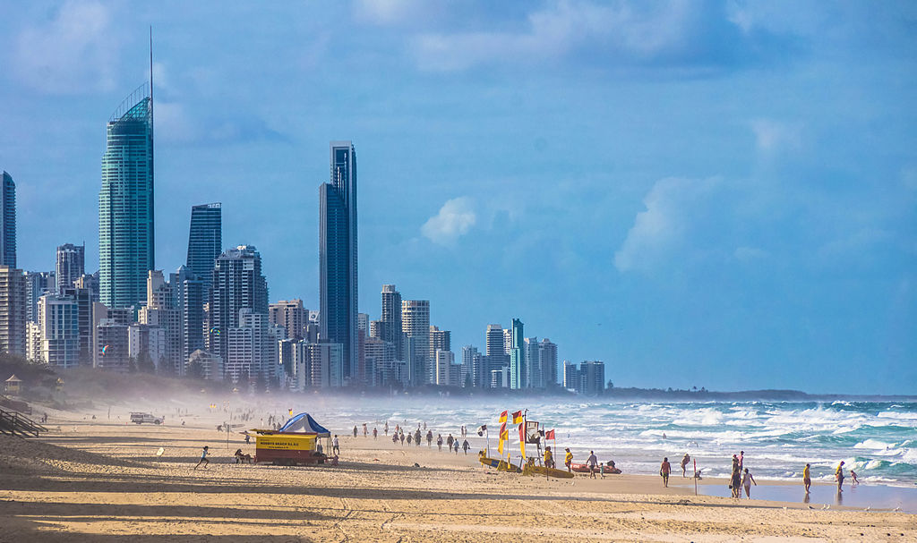
Beaches formed by Sea Waves By Petra – https://www.flickr.com/photos/chillmimi/13262015235/, CC BY 2.0, https://commons.wikimedia.org/w/index.php?curid=37728568
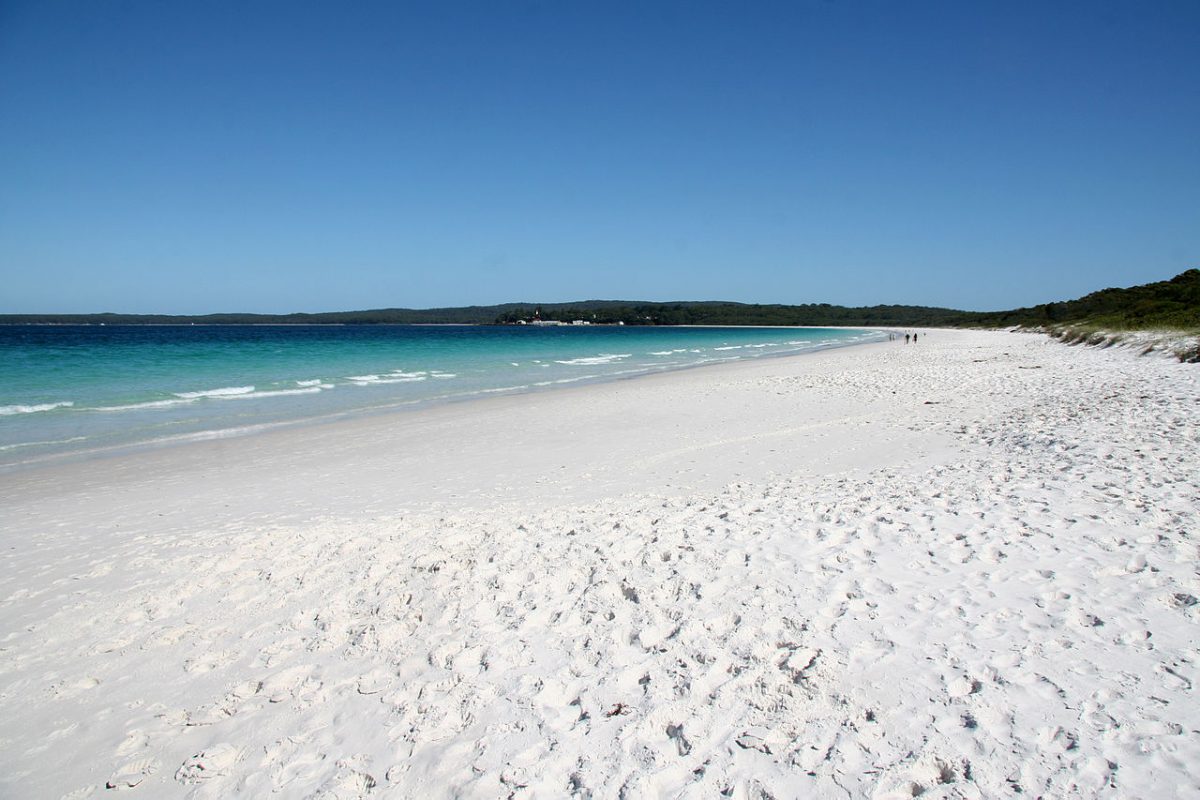
Beaches are characteristic of shorelines that are dominated by deposition but may occur as patches along even the rugged shores. Most of the sediment making up the beaches comes from land carried by the streams and rivers or from wave erosion.
Beaches are temporary features. The sandy beach which appears so permanent may be reduced to a very narrow strip of coarse pebbles in some other season. Most of the beaches are made up of sand-sized materials. Beaches are called shingle beaches that contain excessively small pebbles and even cobbles.
Dunes
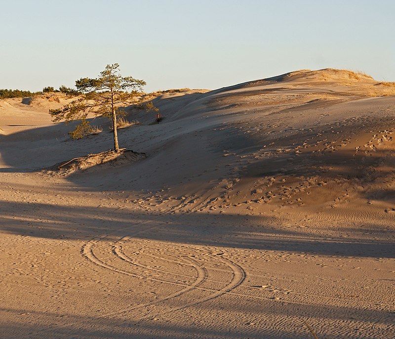
Coastal dunes formed by the deposition of sea waves at the Yyteri Beach in Pori Finland By kallerna – Own work, CC BY-SA 3.0, https://commons.wikimedia.org/w/index.php?curid=10239419
Just behind the beach, the sands lifted and winnowed from over the beach surfaces will be deposited as sand dunes. Sand dunes forming long ridges parallel to the coastline are very common along low sedimentary coasts.
Beach By Dave Naithani – Own work, CC BY-SA 3.0, https://commons.wikimedia.org/w/index.php?curid=18037324
Bars, Barriers and Spits
A ridge of sand and shingle formed in the sea in the off-shore zone (from the position of low tide waterline to seaward) lying approximately parallel to the coast is called an off-shore bar.
An off-shore bar that is exposed due to the further addition of sand is termed a barrier bar. The off-shore bars and barriers are commonly from across the mouth of a river or at the entrance of a bay. Sometimes such barrier bars get keyed up to one end of the bay when they are called spits.
Spits may also develop attached to headlands/hills. The barriers, bars, and spits at the mouth of the bay gradually extend leaving only a small opening of the bay into the sea and the bay will eventually develop into a lagoon.
The lagoons get filled up gradually by sediment coming from the land or from the beach itself (aided by wind) and abroad and wide coastal plain may develop replacing a lagoon. Do you know, the coastal off-shore bars offer the first buffer or defence against storms or tsunamis by absorbing most of their destructive force.
Then come to the barriers, beaches, beach dunes, and mangroves, if any, to absorb the destructive force of the storm and tsunami waves. So, if we do anything which disturbs the ‘sediment budget’ and the mangroves along the coast, these coastal forms will get eroded away leaving human habitations to bear the first strike of the storm and tsunami waves.
Conclusion
This article covers the topic ‘Depositional landforms of sea waves‘ for Upsc.
Coastal processes are the most dynamic and hence most destructive. Some of the changes along the coasts take place very fast. At one place, there can be erosion in one season and deposition in another. Most of the changes along the coasts are accomplished by waves.
When waves break, the water is thrown with great force onto the shore, and simultaneously, there is a great churning of sediments on the sea bottom. The constant impact of breaking waves drastically affects the coasts. Storm waves and tsunami waves can cause far-reaching changes in a short period of time than normal breaking waves.
As the wave environment changes, the intensity of the force of breaking waves changes. Other than the action of waves, the coastal landforms depend upon:
(i) the configuration of land and seafloor;
(ii) whether the coast is advancing (emerging) seaward or retreating (submerging) landward.
Assuming sea level to be constant, two types of coasts are considered to explain the concept of evolution of coastal landforms:
(i) high, rocky coasts (submerged coasts);
(ii) low, smooth, and gently sloping sedimentary coasts (emerged coasts).
HIGH ROCKY COASTS
Along the high rocky coasts, the rivers appear to have been drowned with the highly irregular coastline. The coastline appears highly indented with the extension of water into the land where glacial valleys (fjords) are present. The hillsides drop off sharply into the water. Shores do not show any depositional landforms initially.
Erosion features dominate. Along high rocky coasts, waves break with great force against the land shaping the hillsides into cliffs. With constant pounding by waves, the cliffs recede leaving a wave-cut platform in front of the sea cliff. Waves gradually minimize the irregularities along the shore.
The materials which fall off, and are removed from the sea cliffs, gradually break into smaller fragments, and roll to roundness will get deposited offshore. After a considerable period of cliff development and retreat when the coastline turns somewhat smooth, with the addition of some more material to this deposit offshore, a wave-built terrace would develop in front of the wave-cut terrace.
As the erosion along the coast takes place a good supply of material becomes available to longshore currents and waves to deposit them as beaches along the shore and as bars (long ridges of sand and/or shingle parallel to the coast) in the nearshore zone.
Bars are submerged features and when bars show up above the water, they are called barrier bars. The barrier bar which gets keyed up to the headland of a bay is called a spit. When barrier bars and spits form at the mouth of a bay and block it, a lagoon forms.
The lagoons would gradually get filled up by sediments from the land giving rise to a coastal plain.
LOW SEDIMENTARY COASTS
Along low sedimentary coasts, the rivers appear to extend their length by building coastal plains and deltas. The coastline appears smooth with occasional incursions of water in the form of lagoons and tidal creeks. The land slopes gently into the water. Marshes and swamps may abound along the coasts.
Depositional features dominate. When waves break over a gently sloping sedimentary coast, the bottom sediments get churned and move readily building bars, barrier bars, spits, and lagoons. Lagoons would eventually turn into a swamp which would subsequently turn into a coastal plain.
The maintenance of these depositional features depends upon the steady supply of materials. Storm and tsunami waves cause drastic changes irrespective of the supply of sediments. Large rivers which bring lots of sediments build deltas along low sedimentary coasts.
The west coast of our country is a high rocky retreating coast. Erosional forms dominate on the west coast. The east coast of India is a low sedimentary coast. Depositional forms dominate on the east coast.
EROSIONAL LANDFORMS
Cliffs, Terraces, Caves, and Stacks
Wave-cut cliffs and terraces are two forms usually found where erosion is the dominant shore process. Almost all sea cliffs are steep and may range from a few m to 30 m or even more. At the foot of such cliffs, there may be a flat or gently sloping platform covered by rock debris derived from the sea cliff behind.
Such platforms occurring at elevations above the average height of waves is called wave-cut terrace. The lashing of waves against the base of the cliff and the rock debris that gets smashed against the cliff along with lashing waves create hollows and these hollows get widened and deepened to form sea caves.
The roofs of caves collapse and the sea cliffs recede further inland. The retreat of the cliff may leave some remnants of rock standing isolated as small islands just off the shore. Such resistant masses of rock, originally parts of a cliff or hill are called sea stacks.
Like all other features, sea stacks are also temporary and eventually, coastal hills and cliffs will disappear because of wave erosion giving rise to narrow coastal plains, and with the onrush of deposits from over the land behind may get covered up by alluvium or may get covered up by shingle or sand to form a wide beach.
FAQ
1.Which is not an erosional feature of sea waves?
Options:
a. Cliff
b. Beach
c. Sea Caves
Answer: Beach is not an erosional feature of sea waves. It is a depositional feature of sea waves.
Glacial depositional landforms are formed from the action of glaciers. Most of the Glacial depositional landforms are formed by the movement of large ice sheets.
Most of the famous areas for such glacier landforms are Fennoscandia, Andes, etc.
Formation
The unsorted sediments, unassorted coarse and fine debris are dropped from the glacier melting. This is called Glacial till. The rock fragment in large numbers in the Till is in form of angular or subangular form.
Due to the melting of ice at the bottom, sides, lower ends of the glaciers, the streams are formed. In these streams, small rock debris is carried, washed down, and deposited. Such glacial-fluvial deposits are called Outwash deposits.
Outwash deposits are stratified and assorted. Also, the rock fragments in the outwash deposits are rounded at their edges.
Glacial depositional features
Moraines
Moraines ( Depositional landforms of Glacier ) around the lake By Edal Anton Lefterov – Own work, CC BY-SA 3.0, https://commons.wikimedia.org/w/index.php?curid=21131769
Moraine is are the left behind materials by the moving glacier. These materials are usually soil and rocks. The glacier moves all types of boulders, dirt which are built up to form moraines. Moraines are simply long ridges of deposits of glacial till.
Moraines are of four types and are Terminal Moraines, Lateral moraines, medial moraines and Lateral Moraines. Examples of Moraines are the Side Glacier of the Gorner Glacier in Zermatt Switzerland, Kettle Moraine Wisconsin USA, Harbor Hill Moraine in Long Island USA, etc.
Terminal Moraines
Terminal Moraines are found at the endpoint of the glacier. These are long ridges of deposits of glacial till are formed along the sides parallel to the glacial valleys.
In some cases, the lateral moraines and terminal moraine may join and form a horseshoe-shaped ridge.
Lateral Moraines
These moraines are found on either side of the glacier and there can be many lateral moraines. The lateral moraines partly or fully owe their origin to glacio-fluvial waters that push up the material to the sides of the glacier.
Ground Moraines
The ground moraines are rocks of different sizes and types. These are formed when different glacier’s valleys retreat rapidly. This leaves an irregular sheet of till over the valley floors. These deposits differ greatly in thickness and in surface topography.
Medial Moraines
These Moraines are found at the centre of the glacial valley / at the junction between two glaciers flanked by lateral moraines. Medial moraines are imperfectly formed compared to lateral moraines.
In some cases, the ground moraines are indistinguishable from the medial moraines.
Eskers
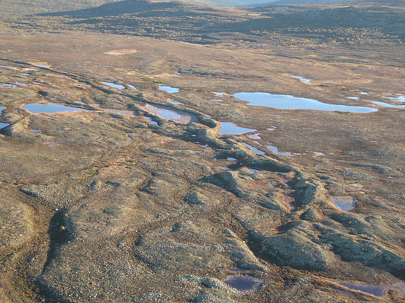
Eskers at Fulufjället, western Sweden By Hanna Lokrantz – https://www.flickr.com/photos/geologicalsurveyofsweden/6853882122/in/album-72157625612122901/, CC BY 2.0, https://commons.wikimedia.org/w/index.php?curid=42848874
Eskers are ridges that are made of stones, sands, and gravel. These are deposited by the water which is melted from the glaciers. Eskers are carried by the water through the tunnels underneath or within the glaciers.
Formation of Eskers
During the summer, the glaciers melt and the water flows over the surface of the Ice. Also, the water seeps down along the margin or through holes in the ice. This water accumulates below the glacier and flows like a stream below the glacier.
These streams also flow over the ground that forming ice in its banks. These streams carry coarse materials like boulders, blocks, and other rock debris and make them settle in the valley of ice beneath the glacier.
After the ice melts these coarse materials can be found as a sinuous ridge called Esker.
Outwash Plains
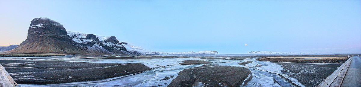
Outwash Plains By Debivort at English Wikipedia, CC BY-SA 3.0, https://commons.wikimedia.org/w/index.php?curid=6226139
Outwash plains occur in front of melting glaciers. These are deposits of sand and gravel carried by running water. The glacial mountains plain at the foot or beyond the limits of the continental ice sheet are covered with glacio-fluvial deposits.
These glacio-fluvial deposits were in the form of broad flat alluvial fans that may join to form outwash plains of gravel, silt, sand, and clay. The outwash plains are expansive, dominated by braided rivers when glaciers melt.
The outwash plain extends several miles beyond the glacier margin. The outwash plains were often used for specialized kinds of Potato cultivation. Example in Montcalm County. This plain favors plants that grow well in well-drained soil.
Drumlins
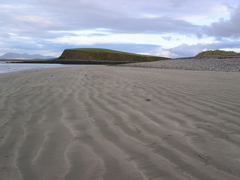
Drowned drumlin in Clew Bay Ireland By Brendanconway – Own work, Public Domain, https://commons.wikimedia.org/w/index.php?curid=54447
Drumlins are oval-shaped hills, that are composed of glacial drift that is formed under the glacier or ice sheets. These are aligned in the direction of ice flow.
Drumlins are smooth have the feature of the oval-shaped ridge. It is made of glacial till of gravel and sand. The long axes of drumlins are parallel to the direction of ice movement and measure up to 1 km in length and 30 m or so in height.
One end of the drumlins facing the glacier called the stoss end is blunter and steeper than the other end called the tail. The drumlins form due to the dumping of rock debris below heavily loaded ice through fissures in the glacier or ice sheets. The stoss end gets blunted due to pushing by moving ice.
Thereby, the Drumlins give an indication of the direction of glacier movement.
Conclusion
This is Ncert’s notes for the topic ‘Glacial depositional landforms‘ for Upsc and other state service exams. Due to the deposition actions of the Glaciers, several types of landforms are formed. They are Moraines, Eskers, Outwash Plains, and Drumlins.
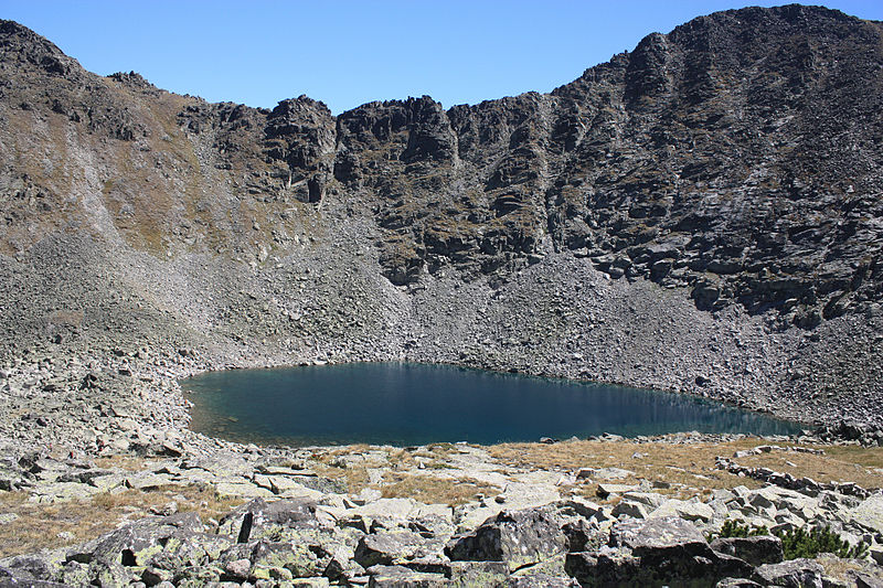
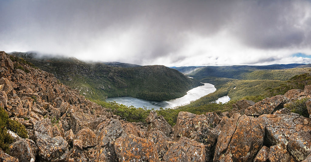
Cirque By JJ Harrison (https://www.jjharrison.com.au/) – Own work, GFDL 1.2, https://commons.wikimedia.org/w/index.php?curid=6760381
Cirques are the most common landforms in glaciated mountains. The cirques quite often are found at the heads of glacial valleys.
The accumulated ice cuts these cirques while moving down the mountain tops. They are deep, long, and wide troughs or basins with very steep concave to vertically dropping high walls at its head as well as sides.
A lake of water can be seen quite often within the cirques after the glacier disappears. Such lakes are called cirque or tarn lakes. There can be two or more cirques one leading into another down below in a stepped sequence.
Horns and Serrated Ridges
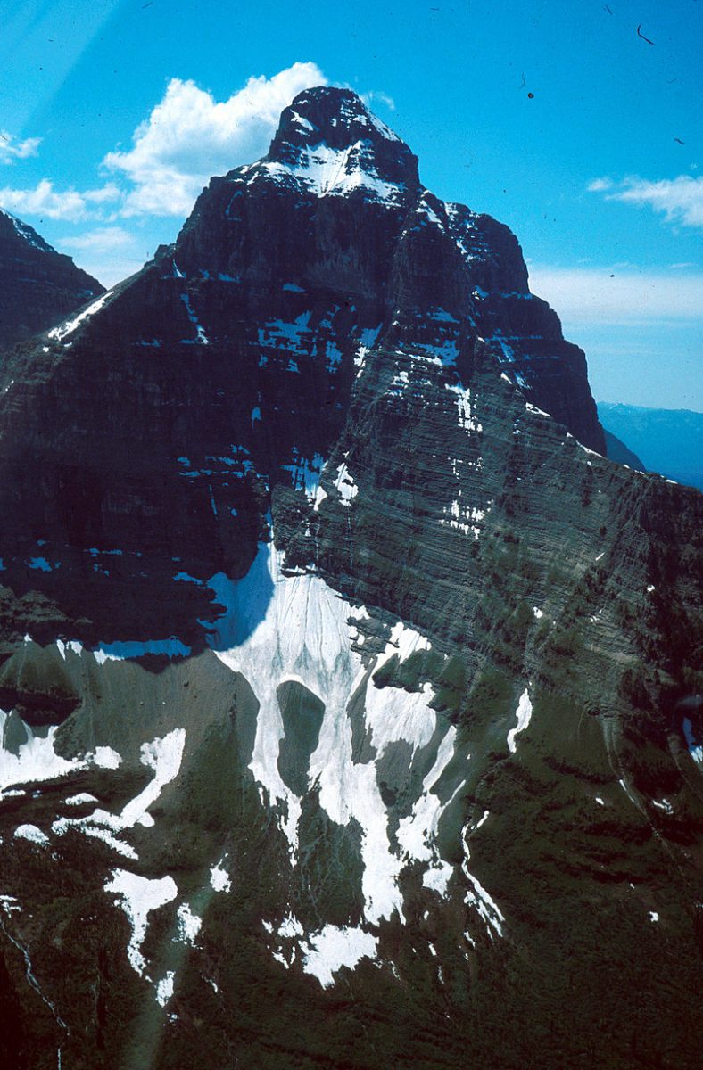
Horns form through headward erosion of the cirque walls. If three or more radiating glaciers cut headward until their cirques meet, high, sharp-pointed, and steep-sided peaks called horns form.
Horns Geology By US Geological Survey – http://libraryphoto.cr.usgs.gov/cgi-bin/show_picture.cgi?ID=ID.%20Carrara,%20P.%20348ct, Public Domain, https://commons.wikimedia.org/w/index.php?curid=22025810
The divides between the cirque side walls or headwalls get narrow because of progressive erosion and turn into serrated or saw-toothed ridges sometimes referred to as arêtes with very sharp crest and a zig-zag outline.
“The highest peak in the Alps, Matterhorn and the highest peak in the Himalayas, Everest are in fact horns formed through headward erosion of radiating cirques.“
Serrated Ridges By Alpsdake – Own work, Public Domain, https://commons.wikimedia.org/w/index.php?curid=11567654
Glacial Valleys/Troughs
Glacial Valleys/Troughs By DanHobley – Own work, CC BY-SA 3.0, https://commons.wikimedia.org/w/index.php?curid=19290010
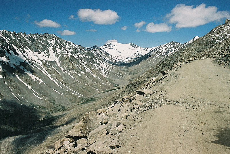
Glaciated valleys are trough-like and U-shaped with broad floors and relatively smooth, and steep sides. The valleys may contain littered debris or debris shaped as moraines with a swampy appearance. There may be lakes gouged out of the rocky floor or formed by debris within the valleys.
There can be hanging valleys at an elevation on one or both sides of the main glacial valley. The faces of divides or spurs of such hanging valleys opening into main glacial valleys are quite often truncated to give them an appearance like triangular facets.
Very deep glacial troughs filled with seawater and making up shorelines (in high latitudes) are called fjords/fiords.
Erosion is a natural process by the top layer of soil, rock or material on the surface of earth is removed by transported to another location by means of water, wind etc.
Weathering is an important process, which is part of erosion where is helps in break down of rock into small debris and it does not involve in the movement of the materials.
Erosion is the removal, or transportation process, which involves the acquisition and transportation of rock debris.
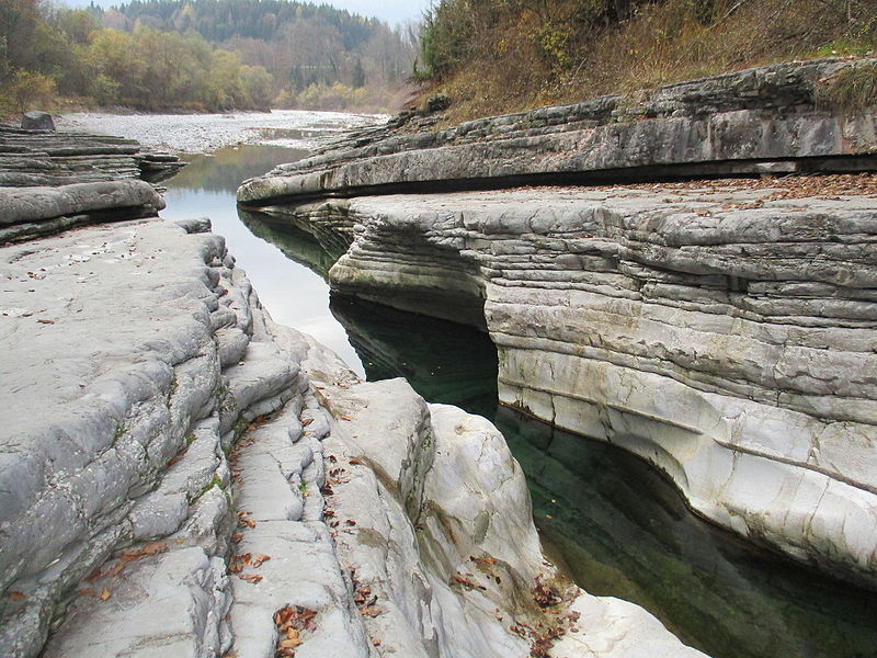
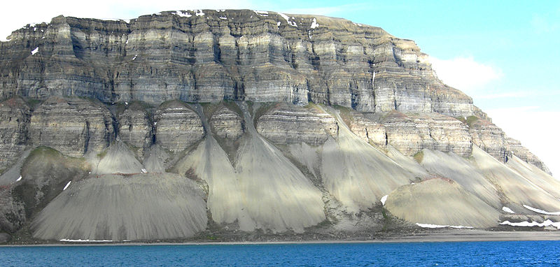
Transportation and Deposition of Rocks Upsc By Michael C. Rygel – Own work, CC BY-SA 3.0, https://commons.wikimedia.org/w/index.php?curid=12622448
Role of Geomorphic Agents in Erosion
Depending upon the dynamics of the Geomorphic Agents such as water, glacier, waves, wind, groundwater etc the massive rocks are weathered, that is break up of rocks into smaller fragments or debris.
Abrasion by the rock debris is carried by the Geomorphic agents such as water, glacier, waves, wind etc, and also helps greatly in erosion, transportation and deposition of Rocks.
The erosion degrades the Reliefs and by that, the landscapes are worn down. This makes us understand that weathering helps erosion but it is not a precondition for the erosion to takes places.
The degradational processes include Mass Wasting, Erosion and Weathering. The earth surface undergoes continuous changes and the main reason behind it is Erosion.
Kinetic Energy in Transportation and Deposition of Rocksand deposition of Rocks
Kinetic energy controls denudational processes such as transportation and erosion.
Wind, Water, Glacier, Waves etc brings the earth material by erosion and transportation.
The Geomorphic agent’s such as Wind, Running Water and Glacier are controlled by Climatic conditions. The wind represents the Gaseous form, Running represents the liquid form and glacier represents the solid forms respectively.
Erosion is defined as the application of the kinetic energy related to the agent to the surface of the land along with its moves K.E. = 1/2 m v2.
Therefore the energy is available to perform work depends on the mass of the material and the velocity with which it is moving.
Even though the Glacier move very slow, it is more effective than other agents of erosion such as wind. This is because Glacier has tremendous mass and wind is less effective at it is in a gaseous state.
The other two erosional agent such as the waves and the groundwater is not controlled by the climate.
The erosional work of the groundwater is determined much by the lithological character of the region and the work of wave is along the coastal region and it happens along with the interface of lithosphere and hydrosphere.
The Karst topography develops only when the rock is permeable and solution and also there is the availability of water.
The erosional agent’s losses its velocity and thereby the energy on the gentle slopes and material carried by the erosional agents start to settle themselves and it means that the deposition is not actually the work of any agent.
The coarser materials get deposited first and then the finer ones. The depression gets filled up by deposition.
The same erosional agents viz. running water, glaciers, wind, waves, and groundwater also act as aggradational or depositional agents.
FAQ
Which is the gaseous agent of erosion?
Wind is the Gaseous agent of Erosion.
2. why are glaciers such effective agents of erosion and deposition?
This is because Glacier spread out over the surface of land, as it grow and changes the shape of the land. Also they scrape away the surface, erode the rock and its sediment.
The glacier also carry the sediments to one place to another place. Therefore glacier are one of most effective agents of erosion and deposition.
The rocks debris is transferred down the slopes due to gravity. It also suggests that the debris is not influenced by Air, water, or Ice to move from place to place. But the debris moves the water, ice, and Air.
The mass movements also called slope movement or mass wasting are both slow and fast and it influences the shallow to deep columns of material and works creep, flows, slide and fall. The gravitational attraction applies its force to the bedrock and also the products of weathering.
The Weathering is not a basic requirement for Mass Movement but it greatly helps it. The un-weathered material is inactive for slope movements whereas weathered material is active for slope movement.
Mass Wasting does not come under Erosion as it does not have any influence due to geomorphic agents such as waves, currents, glaciers, water, wind, etc as it is only guided by gravity.
Mass Movements – Debris flows or Mudflows By Wilson44691 – Own work, Public Domain, https://commons.wikimedia.org/w/index.php?curid=7859465
Materials over the slopes have their own resistance towards the disturbing forces and will accept or allow only when the forces are greater than their shearing resistance.
The weak unconsolidated rocks, thinly bedded rocks, faults, steeply sliding beds, vertical cliffs, perpendicular slopes, plentiful rainfall or snowfall, torrential showers, lack of vegetation are the factors that positively influence mass wasting.
Factors that Precede Mass Movements
Removal of support from underneath to the rocks above by natural or artificial ways.
The rise in inclination and height of slopes.
Overloading by the increasing of material due to natural or unnatural ways.
Overloading by huge rainfall, lubricating the slopes, and fullness(saturation).
Removal of materials from the slope.
By earthquakes, explosion, etc.
Excessive Natural drainage.
Heavy drawdown of water from the lakes, rivers leads to slow outflow of water from under the slopes or river banks
Random removal of natural vegetation.
The forms of Mass Movement are Heave, flow, and slide and its types are Slow Movements and Rapid Movement.
Slow Movement
Creep
Creep is a type of slow movement which occurs on moderately steep and soil-covered slopes. This movement is extremely slow and gradual, only can be observed if viewed for a very long time.
Creep involves soil or rock debris. Due to this movement, the telephone lines lean downslope from their linear alignment, fence post lean, etc.
Types of Creep depends upon the type of material:
Soil Creep
Talus Creep
Rock Creep
Rock Glacier Creep
Creep Movement of Soil that changes the alignments of Object such as Fence and makes them lean downwards By Sb2s3 – Own work, CC BY-SA 4.0, https://commons.wikimedia.org/w/index.php?curid=44188845
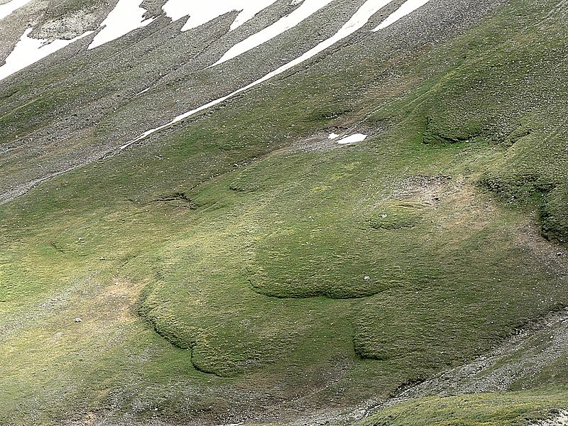
Solifluction
It includes gradual and slow, downslope flowing soil mass or fine-grained rock debris immersed or lubricated with water.
This process usually occurs in the moist temperate regions where the surface melting of deeply frozen ground and long-continued rain happens repeatedly.
When the upper parts get overfilled and while the lower parts are impenetrable to water percolation, flowing happens in the upper portions.
Solifluction – Slow Movement By Jack Flanagan – Flickr: solifluction lobes, CC BY-SA 2.0, https://commons.wikimedia.org/w/index.php?curid=52049358
Rapid Movements
Rapid movements are most common in humid climatic regions and happen over gentle to steep hills/slopes.
Earthflow
The flow of water-saturated clayey or silty materials down low-angle terraces or hillsides is known as earthflow.
Earthflow – Sheet or stream of soil and rock materials saturated with water and flowing downslope by force of gravity and it shows that it is an intermediate stage between creep and mudflow.
Usually, the materials slump creating step-like terraces and leaving curves or bow-shaped called arcuate scarps at their heads and an accumulation bulge at the toe.
If the slopes are more perpendicular, even the bedrock primarily of soft sedimentary rocks such as shale or strongly weathered igneous rock may slide downslope.
Earthflow By Unknown author – US Department of the Interior – Bureau of Land Management (http://www.blm.gov/co/st/en/BLM_Programs/areas_of_critical/visit_an_acec/acec_by_map/slumgullion_earthflow0.html), Public Domain, https://commons.wikimedia.org/w/index.php?curid=27092618
Mudflow
Another type of rapid movement is Mudflow. In the inadequacy of vegetation cover and by massive rainfall, thick layers of weathered matter get soaked with water and both slowly or rapidly flow down by certain channels.
It seems like a river of mud in a valley. If the mudflows arise out of channels over the area at the base of a mountain or mountain range such as piedmont or plains, it can become very dangerous by engulfing or covering the roads, bridges, and houses.
Mudflows happen regularly on the slopes of exploding or newly exploded volcanoes. Volcanic ash, dust, and other particles transform into the mud because of heavy Showers and flow down as tongues or streams of mud producing large destruction to humans.
Mudflow By R.W. Jibson, U.S. Geological Survey – http://www.ngdc.noaa.gov/hazardimages/picture/show/1549, Public Domain, https://commons.wikimedia.org/w/index.php?curid=1054685
Debris Avalanche
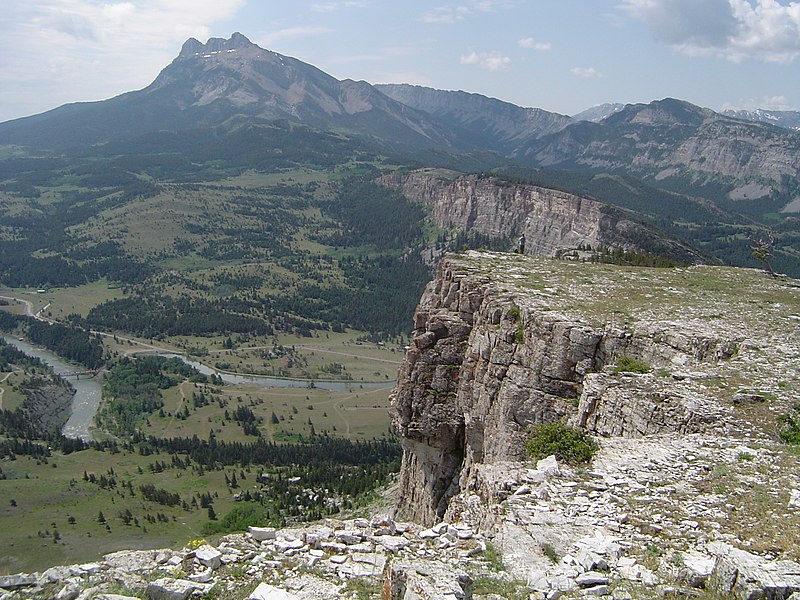
Debris avalanche is another type of rapid mass movement, which is more a feature of humid areas with or without vegetation cover and happens in narrow tracks on steep slopes. This debris avalanche can be much quicker than the mudflow.
A debris avalanche is comparable to a snow avalanche.
Debris Avalanche By DanHobley – Own work, CC BY-SA 3.0, https://commons.wikimedia.org/w/index.php?curid=19290019
Landslides
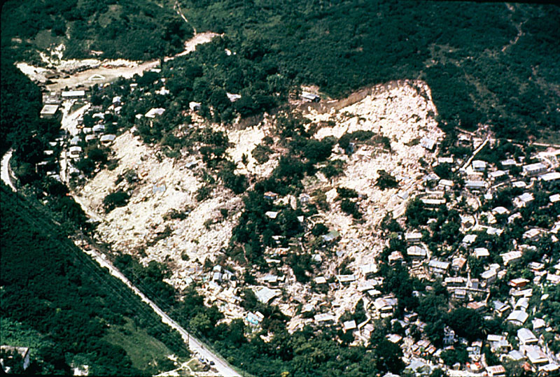
Landslides are nearly rapid movements and the material involved is relatively dry.
The size and shape of the loosened mass depend on the nature of discontinuities in the rock, the level of weathering, and the inclination of the hill.
Depending on the nature of the movement of materials different types are classified.
Slump
It is the slipping of one or several sections of rock debris with a backward rotation with regard to the slope where the movement occurs.
Debris slide
The rapid rolling or sliding of rock debris without backward rotation.
Debris fall
It is almost a free fall of rock debris from a vertical or overhanging surface.
Rock Slide
Sliding of a single rock, masses down bedding, joint or fault surfaces, and over steep slopes, is rapid and destructive. These slides happen as the planar collapses along discontinuities like bedding planes.
Rockfall
It is the free-falling of rock masses over any steep slope running off from the slope. It happens from the surface layers of the rock face, an event that separates it from the rock slide. It concerns the materials up to a certain depth.
Landslide – Rapid Movement By Eeekster – Own work, CC BY 3.0, https://commons.wikimedia.org/w/index.php?curid=3994100
Mass Movement in India
Debris avalanches and landslides are frequent in the Himalayas.
The reasons are the Himalayas are tectonically active.
They are mostly made of sedimentary rocks and unconsolidated and semi consolidated deposits.
The slopes are very steep.
Compared to the Himalayas, the Nilgiris bordering Tamil Nadu, Karnataka, Kerala, and the Western Ghats along the west coast are relatively tectonically stable and mostly made of very hard rocks. But still debris avalanches and landslides occur but not as frequently as in the Himalayas.
The earth materials such as rocks are subjected to the action of elements of weather and climate such as Ice, water, wind etc. These elements of weather act individually or together to affect earth materials such as rock and reduce them to fragments.
Altogether, It is defined as the decomposition of rocks by the natural process such as climate or weather by using water, ice, wind etc, through its action by mechanical disintegration and decomposition by chemical action.
Also, it is an in-situ or on-site process, that in is little or no motion takes place during the process of disintegration or decomposition of rocks. But sometimes little motion takes places due to the process of the transportation process.
The factor that supports weathering process is vegetation, topography, climatic, geological factors etc.
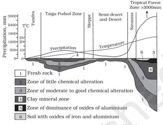
Climate plays an important part, as it affects the depth of the weathering mantle and it differs from one climate to another.
Different climate and depth of weathering of mantles
Types of Weathering
Chemical
Physical
Biological
Chemical Weathering
Weathering by chemical action such as Solution, carbonation, hydration, oxidation, and reduction.
All these chemical action acts on rocks and this decomposes the rocks and reduce them to the fine state by water, air, and other acids individually or combined.
To speed up the chemical reaction water, air which includes oxygen, carbon-di-oxide along with heat needs to be present.
The carbon-di-oxide, in the underground, is increased by the decomposition of plants and animals, also its increase carbon dioxide in the atmosphere.
Solution
When something is dissolved in water or acids the dissolved contents with water or acid are called a solution.
The process involves the removal of solids in solution and depends on the solubility of a mineral in the weak acids or water.
Many solids disintegrate when it comes into contact with water and form as a suspension in water.
Water-soluble rock-forming minerals such as Nitrates, Sulphates, and potassium, etc are affected and easily leached out in rainy climates without leaving any residue and it gets accumulated in the dry regions.
Minerals such as Calcium Carbonate and Calcium Magnesiumbicarbonate that are present in the limestone are soluble in the water containing carbonic acid.
This carbonic acid is formed when water comes in contact with Carbon dioxide. In process of Carbonic acid production is initiated by decaying organic matter along with soil is mixed in water.
Also, Sodium chloride or common salts also considered responsible for this process.
Carbonation
The reaction of carbonate and bicarbonate with minerals, that helps to break down feldspars and carbonate minerals is called Carbonation.
The water absorbs, the carbon dioxide from the atmosphere and soil to form carbonic acid.
Carbonic acid is a weak acid, which affects Calcium carbonate and Magnesium Carbonate and gets dissolved and removed in the solution.
This leaves no residue and this results in cave formation.
Hydration
The addition of water to the chemicals, minerals, etc is called Hydration.
The mineral expands after Hydration. This expansion of minerals by water increases the volume of itself inside the rock.
Gypsum is formed when water is reacted with Calcium Sulphate. This gypsum is much more unstable than Calcium Sulphate.
This process of Gypsum conversion is reversible and is continued many times and creates fatigue in the rock which leads to disintegration.
The overlying material cracks after the process of repetition of wetting and drying of clay minerals which swell and contract during the process.
Rocks are fractured by the Salts in the pores spaces which undergo rapid and repeated hydration.
The volume of salts changes during hydration which helps in physical weathering by exfoliation and granular disintegration.
Oxidation and Reduction
When a mineral is combined with oxygen to form oxides or hydroxides it is called Oxidation in Weathering.
Oxidation happens almost everywhere there is the atmosphere. And also with oxygenated water.
Iron, manganese, sulphur, etc are mineral which is commonly get involved in the oxidation process.
The rock breaks down because of disturbances caused addition of oxygen.
Iron turns to red colour when it gets oxidized as Iron oxide, also Iron oxide is further oxidized and appears as brown or yellow.
The reduction takes place when the oxidized material is placed in the absence of oxygen.
The area, where the oxygen is absent, are usually below the water table. Example stagnant water areas, waterlogged ground, etc.
The Iron oxide which is red in color turn to greenish or bluish-grey upon reduction.
The chemical weathering such as Oxidation and reduction, carbonation, and Hydration are interrelated and are responsible for weathering process.
Physical Weathering Process
Physical Weathering is also called Mechanical Weathering, and its process depends on applied forces dues gravitation forces such as pressure, load and shearing stress, expansion forces because of temperature changes, crystal growth, wetting and drying cycles by water, animal activities, etc.
The above forces are responsible for rock fracture, as when these forces are applied at the surface and within earth materials.
The Thermal expansion and pressure release are responsible for most mechanical weathering processes.
The continued fatigue caused by repeated contraction and expansion due to thermal expansion and pressure release creates great damage to rocks, even though this process is small and slow.
Unloading and Expansion
Elimination of overlying rock load because of continued erosion produces vertical (upward) pressure release with the result that the upper layers of the rock expand creating a disintegration of rock blocks.
Fractures are developed nearly parallel to the ground surface.
In the regions of the curved or arched ground surface, arched or curved fractures or cracks tend to generate massive sheets or exfoliation(peeling) slabs of rocks.
Exfoliation sheets emerging from expansion because of unloading and pressure release may average several hundreds of meters in horizontal space.
The large and smooth rounded domes are known as Exfoliation domes is end result of this process.
Exfoliation domes By Ronnie Macdonald from Chelmsford, United Kingdom – Half Dome Trek 15, CC BY 2.0, https://commons.wikimedia.org/w/index.php?curid=25809888
Temperature Changes and Expansion
Different minerals in the rocks have different limits of expansion and contraction.
The mineral expands and pushes against its neighbour when the temperature is raised, and similarly, the mineral gets contracted when the temperature falls.
Due to these diurnal changes in the temperature, this inner change between the mineral grains of the surface layers of rocks takes place frequently.
This process is most powerful in the dry climate and in the high elevations wherever the diurnal temperature variations are severe.
These variations make the rock weak due to continued fatigue, even though these changes are very small.
The outer layers of rock have higher expansion than the rocks at the depth, which leads to the creation of stress within the rock and leads to heaving and fracturing parallel to the surface.
It is because of differential heating and the following expansion and contraction of surface layers and its following exfoliation from the surface ends in the smooth rounded surface in rocks.
In granites, smooth-surfaced and rounded small to big boulders called Tors are formed due to the exfoliation.
Freezing, Thawing and Frost Wedging
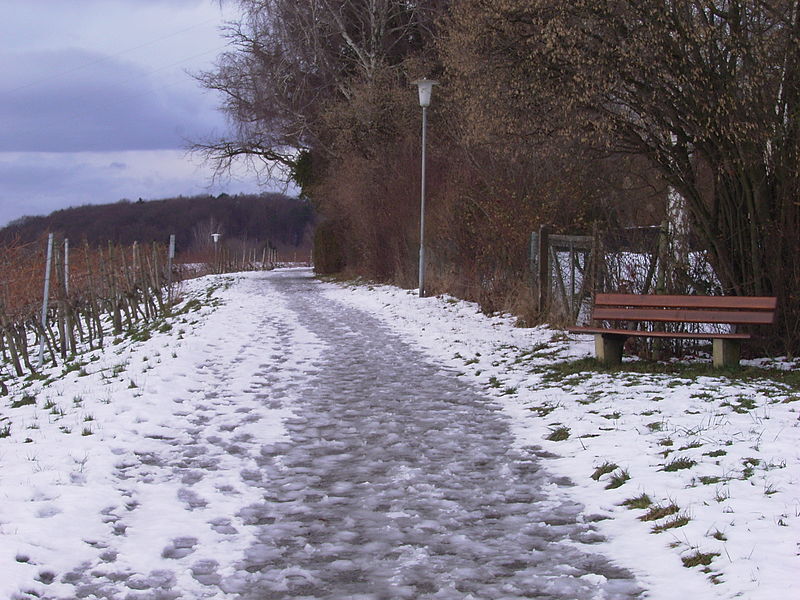
This kind of weathering happens when the Ice grows within the pores and cracks the rocks by repeated cycles of freezing and melting.
Frost Weathering has the highest impact at the higher elevations in the mid-latitudes. It is because in the mid-latitudes the freezing and melting happen repeatedly.
The Glacial areas are dominated by frost wedging daily as this process, the rate of freezing is vital.
Rapid freezing of water creates sudden expansion and high pressure.
It is the result of expansion that attacks the joints, cracks, and small intergranular fractures and makes it wider till the rocks break apart.
Thawing and Frost Wedging By Stefan-Xp – Own work, CC BY-SA 3.0, https://commons.wikimedia.org/w/index.php?curid=487569
Salt Weathering
Because of the thermal action, crystallization, and hydration, the salt in the rocks expands.
Many salts such as calcium, sodium, magnesium, potassium, barium, etc have the tendency to expand.
The thermal properties and temperature are the factor of expansion.
The salt expansion is favored in deserts as the surface temperature expands between 30 to 50° C.
The salt crystals in near-surface pores produce the splitting of single grains inside the rocks that ultimately fall off.
Granular foliation or granular disintegration is the result of the process of falling off of the individual grains.
The most effective salt weathering is Salt crystallization.
In the regions where there is wetting and drying happens repeatedly, salt crystal development is supported and the nearby grains are pushed aside.
Sodium chloride and gypsum crystal in the deserts, lift up overlying layers of the materials and the consequence is, polygonal cracks form all over the heaved surface.
With salt crystal growth, chalk cracks down readily and resulted in limestone, sandstone, shale, granite, gneiss, etc.
Biological Weathering
The weathering is caused by the physical changes because of the movement and growth of organisms.
Moisture and air are penetrated into the surface of rocks and exposing it to chemical and mechanical weathering by the Burrowing and wedging actions of the earthworms, termites, rodents, etc.
Human is also part of the biological weathering, as Human disturb the vegetation by cultivation after plowing.
The production of carbonic acids, and other such acids, humic are produced by the decaying plant and animals, which form solutions that help in chemical weathering.
Also, the roots of plants and trees put great pressure on the earth’s materials and result in mechanical weathering.
Conclusion
Weathering is responsible for the breaking of rocks, which in turn forms as soil. This also helps in erosion and mass movement. By that, vegetation is flourished.
The Landform changes are the result of erosion and mass wasting, which are aided by weathering.
It also helps concentration and enrichment of ores such as Iron, Copper, etc, which is good for the countries economy.
All the processes which move, elevate or build up portions of the earth crust comes under Diastrophism.
Orogenic
The processes involving mountain building by severe folding and affecting long and narrow belts of the earth crust. In this process, the crust is severely deformed into folds.
Epeirogenic
The process that involves uplifting or warping of large parts of the earth’s crust. In this process, there may be simple deformation.
Earthquakes
The earthquake is shaking of ground, that involves local relatively minor movements.
Plate Movements
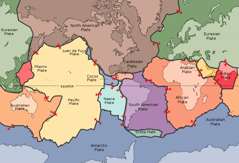
Plate tectonics involves horizontal movements of crustal plates.
The deference between the Orogenic and Epeirogenic process, is Orogeny is a mountain building process and epeirogeny is a continental building process.
The faulting and fracturing of crust is by the processes of Orogeny, epeirogeny, earthquakes and plate tectonics. All these four processes are caused by PVT changes. (PVT – Pressure, Volume, Temperature).
The post-world war -II period added new information regarding the continents. In particular, the ocean floor mapping gave new dimensions in the field of study of oceans and continents.
Convectional Current Theory
The convection currents operating in the mantle portion were discussed by Arthur Holmes in the 1930s.
These currents are caused by radioactive elements in the mantle that create Thermal Differences. Holmes suggested that this force existed throughout the Mantle that was responsible for continental drifts.
Mapping of the Ocean Floor
The ocean floor consists of not only floors or plains and consists of reliefs, mountains, etc just like what that in lands.
The survey of the ocean floor started after world war-2, which gave results such as the existence of mountains, deep trenches were mostly closer to continent margins.
The volcanic eruption is mostly active, found at the mid-oceanic ridges. From the result of dating, the result is that the rocks from the oceanic crust are much younger than the continental areas.
The age and constituent of rocks are almost the same for the rocks of two sides of the crest of oceanic ridges and equidistant from the crest location.
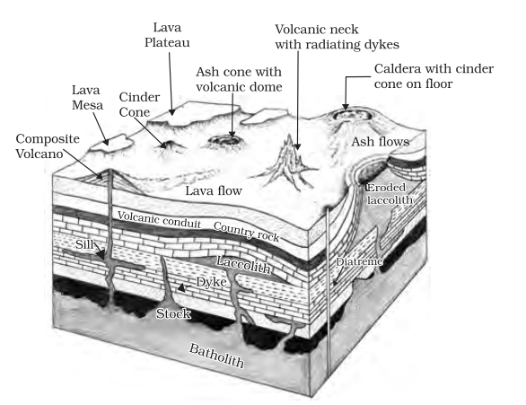
The landform formed due to volcanic eruptions is divided into extrusive and intrusive landforms. This is based on the magma, that cools within the crust or above the crust. Intrusive landforms are formed under the surface of the earth when the magma cools and gets solidified.
Extrusive landforms are formed when the magma flows out of the earth called Lava. This Lava flows and gets solidified. The landforms from the lava are called Extrusive landforms.
Intrusive Forms
The lava that is released during volcanic eruptions on cooling develops into igneous rocks. The cooling may take place either on reaching the surface or while the lava is still in the crustal portion. Depending on the location of the cooling of the lava, igneous rocks are classified as volcanic rocks (cooling at the surface) and plutonic rocks (cooling in the crust).
The lava that cools within the crustal portions assumes different forms. These forms are called intrusive forms.
Volcano Landforms
Batholiths
A large body of magmatic material that cools in the deeper depth of the crust develops in the form of large domes. They appear on the surface only after the denudational processes remove the overlying materials. They cover large areas, and at times, assume depth that may be several km. These are granitic bodies. Batholiths are the cooled portion of magma chambers.
Lacoliths
These are large dome-shaped intrusive bodies with a level base and connected by a pipe-like conduit from below. It resembles the surface volcanic domes of the composite volcano, only these are located at deeper depths. It can be regarded as the localized source of lava that finds its way to the surface.
The Karnataka plateau is spotted with domal hills of granite rocks. Most of these, now exfoliated, are examples of laccoliths or batholiths. Lapolith, Phacolith, and Sills. As and when the lava moves upwards, a portion of the same may tend to move in a horizontal direction wherever it finds a weak plane.
It may get rested in different forms. In case it develops into a saucer shape, concave to the sky body, it is called lapolith.
A wavy mass of intrusive rocks, at times, is found at the base of synclines or at the top of the anticline in the folded igneous country. Such wavy materials have a definite conduit to source beneath in the form of magma chambers (subsequently developed as batholiths).
These are called the phacoliths. The near horizontal bodies of the intrusive igneous rocks are called sill or sheet, depending on the thickness of the material. The thinner ones are called sheets while the thick horizontal deposits are called sills.
Dykes
When the lava makes its way through cracks and the fissures developed in the land, it solidifies almost perpendicular to the ground. It gets cooled in the same position to develop a wall-like structure. Such structures are called dykes. These are the most commonly found intrusive forms in the western Maharashtra area. These are considered the feeders for the eruptions that led to the development of the Deccan traps.
Extrusive Volcanic Landforms
Extrusive volcanic landforms, also known as volcanic surface features, are the result of volcanic activity that occurs on or near the Earth’s surface. Unlike their intrusive counterparts, which form beneath the surface, extrusive landforms are created when magma erupts from a volcano and solidifies into various shapes and structures upon exposure to air or water.
Key Features of Extrusive Volcanic Landforms:
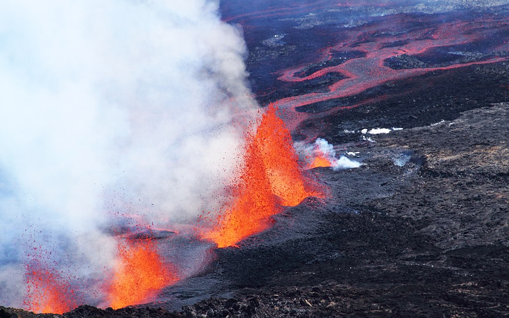
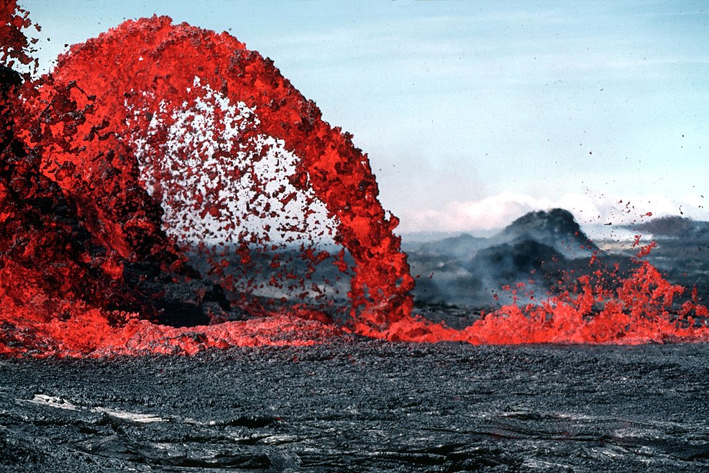
Lava Flows
One of the most recognizable features of extrusive volcanic activity is lava flows. These molten rivers of magma travel down the slopes of a volcano, leaving behind a trail of solidified lava. The composition of the lava influences the texture and appearance of the flow, ranging from smooth pahoehoe to jagged ‘a’a flows.
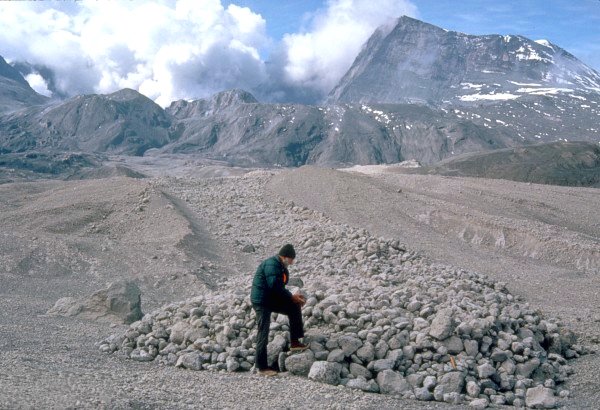
Pyroclastic Deposits
Volcanic eruptions often eject a mixture of hot gases, ash, and volcanic rocks into the air. As these materials settle, they form pyroclastic deposits, creating diverse landforms such as ash cones, volcanic tuff rings, and ignimbrite plains.
Volcanic Cones
Extrusive volcanic cones are iconic landforms shaped by the accumulation of erupted materials around a vent. These cones can take various forms, including shield volcanoes with gentle slopes and stratovolcanoes with steeper, more conical profiles.
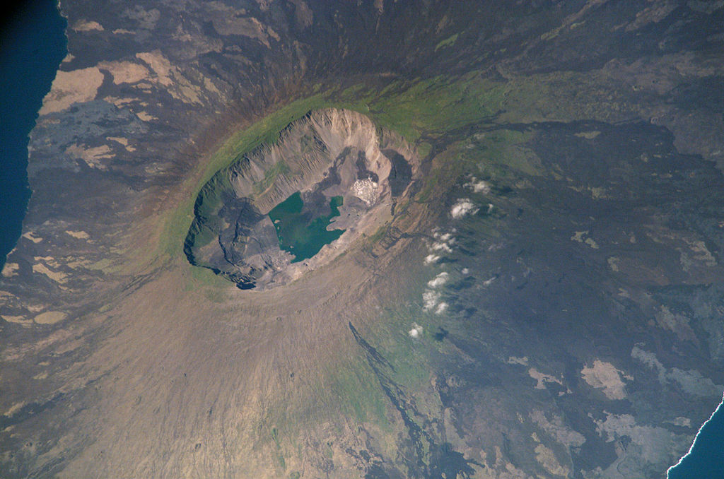
Craters and Calderas
The explosive release of volcanic gases can result in the formation of craters and calderas. Craters are typically smaller depressions around the vent, while calderas are large, collapsed features formed by the emptying of a magma chamber during a major eruption.
Calderas in Fernandina Island in the Galápagos archipelago
Geological Significance:
Extrusive volcanic landforms offer a window into the dynamic processes occurring beneath the Earth’s surface. By studying these features, geologists can gain insights into the composition of magma, the nature of volcanic eruptions, and the interactions between Earth’s lithosphere and asthenosphere. Additionally, the deposits left behind by volcanic activity contribute to the formation of fertile soils, making volcanic regions agriculturally productive.
Notable Examples of Extrusive Volcanic Landforms:
Mauna Loa, Hawaii:
As the largest shield volcano on Earth, Mauna Loa in Hawaii showcases the classic gentle slopes associated with shield volcanoes. Lava flows from Mauna Loa have extended into the ocean, creating new land and expanding the island of Hawaii over time.
Mount St. Helens, USA:
The eruption of Mount St. Helens in 1980 resulted in the formation of a horseshoe-shaped crater and the deposition of pyroclastic flows. This event provided valuable data for understanding volcanic hazards and recovery processes.
Eyjafjallajökull, Iceland:
The 2010 eruption of Eyjafjallajökull not only disrupted air travel but also left behind spectacular lava flows and ash deposits. The eruption highlighted the interconnectedness of geologic processes and global systems.
Conservation and Exploration:
While extrusive volcanic landforms offer invaluable insights into Earth’s geologic history, they also require careful conservation. Human activities in volcanic regions, including tourism and infrastructure development, must be managed sustainably to preserve these natural wonders. Responsible exploration allows us to marvel at the beauty of these landscapes without compromising their integrity.
Conclusion
In conclusion, the dynamic interplay between the Earth’s internal forces and its surface has given rise to two mesmerizing categories of volcanic landforms: intrusive and extrusive. Each of these geological wonders tells a unique story of the planet’s history, showcasing the relentless processes that have shaped our landscapes over millions of years.
Intrusive volcanic landforms, concealed beneath the Earth’s surface, whisper tales of molten magma pushing through cracks and fissures, creating awe-inspiring structures such as batholiths, dikes, and sills. These formations, often hidden from the naked eye, serve as geological time capsules, preserving a record of the Earth’s evolution and the complex movements within its crust.
On the other hand, extrusive volcanic landforms boldly announce their presence on the Earth’s surface, sculpted by the fiery dance of lava, ash, and gases. From the gentle slopes of shield volcanoes to the dramatic calderas formed by explosive eruptions, these features stand as testaments to the raw power of nature. They not only contribute to the creation of fertile soils but also provide researchers with invaluable insights into volcanic processes and hazards.
Both intrusive and extrusive volcanic landforms play integral roles in our understanding of Earth’s geology. They offer glimpses into the planet’s past, present, and future, guiding scientific exploration and contributing to our knowledge of geological processes. While intrusive landforms often remain hidden from view, their significance lies in the unseen forces that shape the Earth’s crust. Extrusive landforms, on the other hand, showcase the immediate and visually striking results of volcanic activity, leaving landscapes marked by lava flows, craters, and pyroclastic deposits.
As we marvel at the diversity and beauty of these volcanic formations, it’s crucial to recognize the importance of responsible exploration and conservation. Human activities, including tourism and development, should be approached with care to ensure the preservation of these geological wonders. By understanding and appreciating both intrusive and extrusive volcanic landforms, we deepen our connection to the Earth’s dynamic nature and gain a profound appreciation for the intricate processes that continue to shape our planet. The study of these volcanic features not only enriches our scientific knowledge but also fosters a sense of wonder and respect for the geological forces that define the ever-changing landscape of our world.
* * All the Notes in this blog, are referred from Tamil Nadu State Board Books and Samacheer Kalvi Books. Kindly check with the original Tamil Nadu state board books and Ncert Books.