Insolation Upsc: Variability of insolation at the surface of the earth and Spatial distribution

Solar Insolation

Solar Insulation is the amount of solar radiation incident upon a unit horizontal surface over a specified time for a given place. It mostly depends on the solar zenith angle and also on the ratio (d/dm) of the actual distance to the mean distance of the Earth from the Sun.

The surface of the earth receives solar radiation in form of short wavelengths. This energy received by the earth is known as Incoming Solar Radiation also called Insolation.

Insolation on Earth’s Surface

The earth gets a very small amount of solar energy. This is because the earth is a geoid that resembles a sphere. Due to this, the sun’s rays fall obliquely at the top of the atmosphere.

What time of year is insolation greatest?

The solar output received at the top of the atmosphere varies slightly in a year due to variations in the distance between the earth and the sun.

Aphelion

During its revolution around the sun, the earth is farthest from the sun (152 million km) on the 4th of July. This position of the earth is called aphelion.

Perihelion

On 3rd January, the earth is the nearest to the sun (147 million km). This position is called perihelion. Therefore, the annual insolation received by the earth on 3rd January is slightly more than the amount received on 4th July.

However, the effect of this variation in the solar output is masked by other factors like the distribution of land and sea and atmospheric circulation.

Hence, this variation in the solar output does not have a great effect on daily weather changes on the surface of the earth.

Variability of Insolation at the Surface of the Earth

The amount and the intensity of insolation vary during a day, in a season, and in a year.

The factors that cause these variations in insolation are :

  • The rotation of the earth on its axis
  • The angle of inclination of the sun’s rays
  • The length of the day
  • The transparency of the atmosphere
  • The configuration of land in terms of its aspect.

But the transparency of the atmosphere and configuration of the land has less influence.

Rotation of the Earth on its Axis

The fact that the earth’s axis makes an angle of 66 with the plane of its orbit around the sun has a greater influence on the amount of insolation received at different latitudes.

Lattitude020406090
December 2212h 00 m10h 48m9h 8m5h 33m0
June 2112h13h 12m14h 52m18h 27m6 months
Length of the Day in Hours and Minutes on Winter and Summer Solstices in the Northern Hemisphere

The angle of inclination of the sun’s rays

The second factor that determines the amount of insolation received is the angle of inclination of the rays. This depends on the latitude of a place. The higher the latitude the less the angle they make with the surface of the earth resulting in slant sun rays.

The area covered by vertical rays is always less than the slant rays. If more area is covered, the energy gets distributed and the net energy received per unit area decreases.

Moreover, the slant rays are required to pass through a greater depth of the atmosphere resulting in more absorption, scattering, and diffusion.

Transparency of the Atmosphere

The atmosphere is largely transparent to short-wave solar radiation. The incoming solar radiation passes through the atmosphere before striking the earth’s surface.

Within the troposphere water vapour, ozone, and other gases absorb much of the near-infrared radiation.

Very small-suspended particles in the troposphere scatter visible spectrum both to space and towards the earth’s surface. This process adds colour to the sky. The red colour of the rising and the setting sun and the blue

Spatial Distribution of Insolation at the Earth’s Surface

The insolation received at the surface varies from about 320 Watt/m2 in the tropics to about 70 Watt/m2 in the poles. Maximum insolation is received over the subtropical deserts, where the cloudiness is the least. The Equator receives comparatively less insolation than the tropics.

Generally, at the same latitude, the insolation is moreover the continent than over the oceans. In winter, the middle and higher latitudes receive less radiation than in summer.

FAQ

Why is less insolation received at the equator in June?

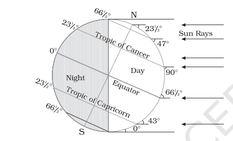
During June, especially around June 21 of the year, the position of the earth in its orbit is inclined directly towards the sun. This is called the Summer solstice in the Northern Hemisphere.

As a result during June, maximum insolation is received at the Tropic of Cancer, as Sun is directly perpendicular to the Tropic of Cancer. The Equator is below the Tropic of Cancer, and thereby receives less insolation at the equator in June.
Less insolation at equator during June month
Sunray fell more on the Tropic of Cancer in June. As a result less insolation at equator

Composition and structure of the atmosphere Upsc

Structure of atmosphere

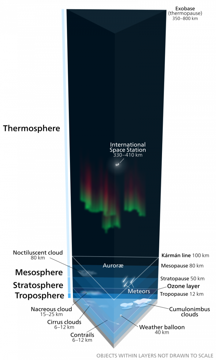
The atmosphere consists of different layers with different temperatures and densities. The density of the atmosphere is highest at the surface of the earth and as the altitude increases the density of the atmosphere decreases.

The column of the atmosphere has five different layers depending upon the condition of the temperature and they are: Troposphere, Stratosphere, Mesosphere, Thermosphere, and Exosphere

Structure of atmosphere Upsc
column of atmosphere By Kelvinsong – Own work, CC BY-SA 3.0, https://commons.wikimedia.org/w/index.php?curid=24006541

Vertical Structure of the Atmosphere

Troposphere

The lowermost layer of the atmosphere is Troposphere and its average height is 13 km it extends an average height of 8 km near the poles and extends 18 km at the equator.

The equator has the thickest Troposphere because in the equator the heat is transported to great heights by the strong convectional currents.

The troposphere contains water vapor and dust particles and all the climate, weather changes, and most biological activities take place in this layer the temperature troposphere decreases at the rate of 1°C for every 165m of height.

The zone which separates the troposphere and stratosphere is known as Tropopause.

The average air temperature at the tropopause is minus –80°C over the equator and about minus –45°Cover the poles.

The temperature in this region is near, constant and it is known as Tropopause.

Stratosphere

The stratosphere lies above the Troposphere and extends up to a height of 50km. This layer does not associate with Weather or Climate Phenomena and is almost free from the clouds.

The Stratosphere has ideal conditions for flying Aeroplanes. The most important feature of the Stratosphere is, that this atmospheric layer contains a layer of Ozone Gas, that protects humans and other living beings from the harmful effects of solar rays.

The mesosphere lies above the stratosphere, which extends up to a height of 80 km.

In this layer, once again, the temperature starts decreasing with the increase in altitude and reaches up to minus 100°C at the height of 80km.

The upper limit of the mesosphere is known as menopause. The ionosphere is located between 80 and 400 km above the mesopause. It contains electrically charged particles known as ions, and hence, it is known as the ionosphere.

Radio waves transmitted from the earth are reflected back to the earth by this layer.

The temperature here starts increasing with height. The uppermost layer of the atmosphere above the thermosphere is known as the exosphere.

This is the highest layer but very little is known about it. Whatever contents are there, these are extremely rare in this layer, and they gradually merge with outer space.

Although all layers of the atmosphere must be exercising an influence on us, geographers are concerned with the first two layers of the atmosphere.

Elements of Weather and Climate

The main elements of the atmosphere which are subject to change and which influence human life on earth are temperature, pressure, winds, humidity, clouds, and precipitation.

FAQ

1.What is the uppermost layer of the atmosphere?

The uppermost layer of Earth’s atmosphere is called the exosphere. It extends from about 600 kilometers (373 miles) to roughly 10,000 kilometers (6,213 miles) above Earth’s surface. The exosphere is a very thin and rarefied layer, with air pressure being extremely low. It is the transition zone between Earth’s atmosphere and outer space.

In the exosphere, atoms and molecules are so far apart that they rarely collide with each other. This means that the exosphere is very dynamic, with atoms and molecules constantly escaping into space and others being replaced by new ones from the lower atmosphere.

The exosphere is also where the auroras (Northern and Southern Lights) are formed. These colorful displays are caused by charged particles from the sun interacting with the Earth’s atmosphere.

2. Which is the thickest layer of the atmosphere?

This actually depends on how you define “thickest”! Let’s explore both interpretations:

By height:

  • The clear winner here is the exosphere, the outermost layer extending from about 375 miles (600 km) to a fuzzy boundary around 6,200 miles (10,000 km). It’s a vast and diffuse region, technically part of our atmosphere but with minimal density.

By density:

  • In terms of concentrated air molecules, the troposphere takes the crown. This lowest layer, hugging the Earth’s surface up to around 6 miles (10 km), packs in about 80% of the atmosphere’s total mass. It’s where we experience weather, with its denser air allowing for clouds, precipitation, and the life-sustaining conditions we know.

Chemical composition of Atmosphere Upsc

The Composition of Atmosphere are Gases, Water, Vapour and Dust Particles and the below table shows details of different gases in the air particularly in the lower atmosphere. Next, we’ll look into its chemical composition.

Chemical composition of atmosphere

In the atmosphere of the earth, the air is a mixture of gases that contains 78% Nitrogen, 21% oxygen, and 1% other gases which include Carbon dioxide, Argon, Neon, Helium, etc and also water vapour.

ConstituentVolume Percentage
Nitrogen78.08
Oxygen20.95
Argon0.93
Carbon di Oxide0.036
Neon0.002
Helium0.0005
Krypto0.001
Xenon0.00009
Hydrogen0.00005
Gases and its volume in the Atmosphere

Composition of gases in Atmosphere

The proportion of gases gets changed in higher layers of the Atmosphere, in a way that the oxygen gets almost negligible in quantity at the height of 120km.

Carbon Di Oxide

Carbon dioxide and water vapor are found only up to the height of 90km from the earth’s surface. Carbon dioxide is a very important gas in the Earth’s Atmosphere, as it is transparent to the incoming solar radiation and it is opaque to the outgoing solar radiation.

This nature of Carbon dioxide absorbs some part of terrestrial radiation and reflects it back to the earth’s surface and it is the main factor for the Green House Effect.

The volume of Carbon dioxide keep raising for the past few decades due to human activities and other gases’ volume remains constant. This increase in the volume of Carbon dioxide in the atmosphere increases the temperature of the air.

Ozone

Ozone is one of the important constituents in the atmosphere and it is found between 10 to 50 km above the earth’s surface. This gas acts as a filter and absorbs the ultraviolet ray from the sun rays and prevents it from entering the earth’s surface.

Composition of Atmosphere

Water Vapour

The water vapour is also a variable gas in the atmosphere, that decreases with altitude and it accounts for up to 4% by volume in warm and wet tropics.

But its volume is less than 1% in the cold and dry desert and also in the polar regions. It is to be noted that the Volume of the Water Vapour decreases from the Equator to towards the poles.

Another property of Water Vapour is, it acts similar to Carbon dioxide, by absorbing the parts of the insolation from the sum and preserves the earth’s radiated heat.

Just like a blanket, it neither allows the earth to become too hot or too cold. It also contributes to the stability and instability in the air.


Dust Particles

The atmosphere has enough capacity to keep the small solid particles and it originates from various sources.

Some of these small solid particles include sea salts, fine soil, smoke soot, ash, dust, pollen, and dust from meteors. These small solid particles called Dust particles are normally concentrated in the lower layers of the atmosphere.

And sometimes, convectional air currents transport the dust particles to greater heights.

The concentration of dust particles is high in the subtropical and temperate regions and it is because dry winds are higher in these regions compared to the equatorial and polar regions.

The dust and salt particles act as hygroscopic nuclei, using which the water vapor condenses to produces clouds.

Distribution of alluvial soil in India Upsc

Distribution of alluvial soil in India

Alluvial soil is distributed widely in the Northern Plains of India, also in eastern coastal plains in India such as the Mahanadi delta, Godavari delta, Krishna delta and Kaveri delta.

In Northern Plains, it is found throughout the Indo-Gangetic plain and especially along with the lower courses of India’s major rivers such as their deltas.

Alluvial soil distribution in India upsc
By Eurico Zimbres, CC BY-SA 2.5, https://commons.wikimedia.org/w/index.php?curid=1326065

Areas of Distribution

It is the highest with about 43%. The region which is rich in Alluvial soil is the Great Northern Plains such as the Plains of river Ganga. This is because of the Himalayas, the rivers from where it is originated.

The Ganga carries, transports the soils and fine sediments, by its flowing water and deposits the silt, fine sediment of soil and rocks along their banks.

By a narrow corridor in Rajasthan, they extend into the Gujarat plains.

In the peninsular regions, these are distributed along the eastern coast and river valley.

In the Upper and Middle Ganga plain, two varieties of Alluvial soils developed and they are Khadar and Bhangar. The Khadar is new alluvium, which is deposited annually and consists of fine silts soil.

Bhangar is older alluvium, and it is deposited away from the flood plains. Both these Khadar and Bhangar have calcareous concretions (Kankars). These soils are distributed along the lower and middle Ganga plains and Brahmaputra valley.

The Alluvial soil distribution in India, states are Assam, Bihar, Chandigarh, Delhi, Haryana, Himachal Pradesh, Jammu and Kashmir, Madhya Pradesh, West Bengal.

In the Peninsula, the deltas of Mahanadi, Godavari, Krishna and Kaveri rivers.

The Alluvium is very fertile has a good proportion of potash, phosphoric acid and lime which are ideal for the growth of sugarcane, paddy, wheat, and other cereals and pulses.

Depositional landforms of groundwater Upsc

Depositional landforms of groundwater

A variety of depositional forms are developed within the limestone caves.

The main chemical component in limestone is Calcium Carbonate.

The groundwater may become saturated with Calcium bicarbonate. The Calcium bicarbonate is formed by a reaction between Carbonic acid which is present in the rainwater and the calcium carbonate present in the rock.

Calcium carbonate is easily soluble in the Carbon-di-oxide absorbed rainwater, which is Carbonated Water.

When this hard water reaches the cave, Calcium Carbonate is deposited by the water carrying a solution of Calcium Carbonate evaporates by evaporation it loses its carbon dioxide, as it trickles over the rough rock surfaces.

This happens when Carbon dioxide bubbles out of the solution and goes back into the air by the process of carbonation in reverse.

With the help of evaporated Calcite or Calcium Carbonates is precipitated.

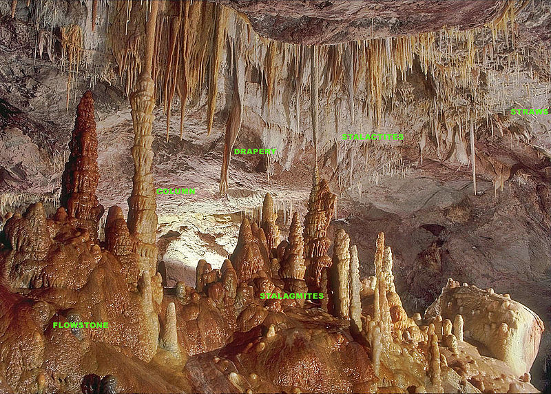
The forms of Depositional landforms of groundwater are Stalactites, Stalagmites, pillar etc

Trickle

A flow of liquid in a small stream. Also can be said as “a small flow of liquid” or drip
Depositional landforms of groundwater
Stalagmites, Stalactites and pillars By Dave Bunnell / Under Earth Images – Own work, CC BY-SA 2.5, https://commons.wikimedia.org/w/index.php?curid=22613190


Stalactites

The water dripping from the ceiling of the caves initially forms pendant soda straws and over time it may grow into icicle-shaped stalactites.

Stalactites hand as icicles of varying diameters. Normally Stalactites are broad at their bases and taper towards the free ends showing up different forms and rising up from the floor of the caves.

It has to be noted, that the Stalactites were formed by the dripping of water from the surface or via the thin pipe of the stalactite which is present immediately below it.

Stalactites grow at about 7.5 mm per year.

Stalagmites

The water drips onto the floor which further deposits the calcium carbonate and forms more rounded and cone-shaped stalagmites.

Stalagmites take the shape of a column, a disc with either a smooth, rounded bulging end or a miniature crater-like depression.

Pillars

The stalagmite and stalactites over time join together to rise to columns and pillars of varying diameters.

Erosional landforms of groundwater Upsc and features created by it

This article focuses on the work of the Erosional landforms of groundwater.

If the rocks are permeable, thinly bedded, high jointed and cracked, then the water percolates well into it. After the water goes down to some depth vertically, the water under the ground flows horizontally within the bedding places, joints or within the materials themselves.

The downward and horizontal movement of water is the reason behind the erosion of rocks. Physical or mechanical removal of rocks by running groundwater is unimportant in developing landforms.

As a result, the work of groundwater is not seen in all types of rocks. Groundwater’s work is mostly seen in rocks like limestone or dolomites, which are has the presence of Calcium Carbonate in them.

It is by the chemical process of solution and precipitation caused by the groundwater and the surface water, the deposition develops different types of landforms.

The solution process and the precipitation process are active in the limestone and dolomites. These two processes either occur exclusively or interbedded with other rocks.

Any region of limestone or dolomitic that exhibits the landforms produced by the action of groundwater by the processes of solution and deposition is called Karst topography. This is named after the Karst region in the Balkans, which is adjacent to the Adriatic sea, developed such topography, where the region consists of limestone rocks.

Also, the Karst Topography is featured by depositional and erosional landforms.

Erosional landforms of groundwater Upsc
Karst topography By Ian mckenzie at English Wikipedia – Photo by Ian McKenzie, Calgary Canada. Originally from en.wikipedia; description page is/was here., CC BY-SA 2.5, https://commons.wikimedia.org/w/index.php?curid=3130474

Erosional landforms of Groundwater

Pools, Lapies, Sinkholes and Limestone Pavement, which are medium to small-sized round to sub-rounded shallow depressions are known as Swallow Holes. The Swallow holes forms on the limestone surface through the solution.

Sinkholes

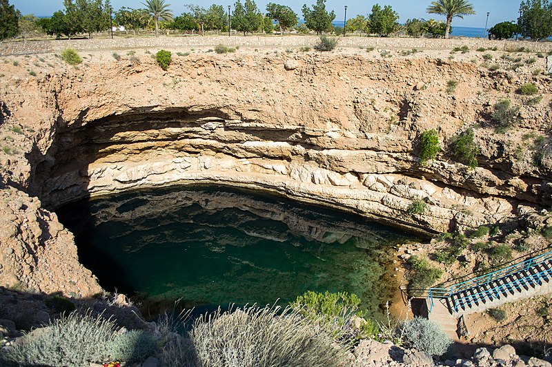
A Sinkholes are an opening which is almost circular at the top and shaped like a funnel towards the bottom with different sizes from a few square Kilometre to a size of hectares. Its depths also vary from a few metres to thirty metres or more. These Sinkholes are a common thing in Karst Areas or Limestone Areas.

Sink Hole
Sink Hole in Oman By Ajay Suresh from New York, NY, USA – Oman2-056, CC BY 2.0, https://commons.wikimedia.org/w/index.php?curid=79023807

These forms were formed solely by Solution action called Solution Sinks. Others might start as solution forms initially and then if the bottom of the sinkhole forms the roof of a void or cave under the ground, this might leads to collapse, that leaves a large hole opening into a cave or a void bellow called Collapse Sinks.

Collapse Sinks By Tihansky, A.B. – Tihansky, A.B., 1999, Sinkholes, West-Central Florida: U.S. Geological Survey Circular 1182, 121–140 p., accessed March 5, 2015, at https://pubs.er.usgs.gov/publication/cir1182., Public Domain, https://commons.wikimedia.org/w/index.php?curid=51542183

Sometimes, these Sinkholes are with soil mantle and look like shallow water pools and if some steps over them, it would go down similar to quicksands in deserts. The Collapse sinks are also termed Doline.

The solution sinks are more common than the collapse sinks. Sometimes the surface run-off simply runs underneath swallow and sinkholes and runs as underground streams and later it reemerges at distance as downstream from a cave opening.

Valley sinks or Uvalas

Valley sinks or Uvalas (Erosional landforms of groundwater)By Jelena – see author, CC BY-SA 3.0, https://commons.wikimedia.org/w/index.php?curid=33465878

Valley Sinks or Uvalas form when the sinkholes and doline merge together due to slumping of materials (rocks) along with their margins or because of the roof collapse of caves, long-narrow to wide trenches.

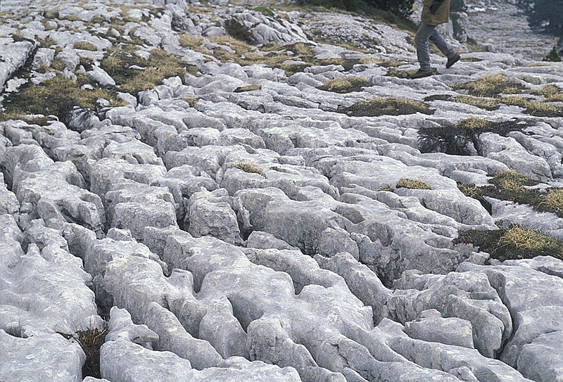
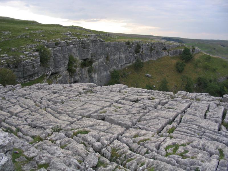
Slowly, most of the surface of the limestone is eaten away by these pits and trenches that leave extremely irregular with a maze of points, grooves and ridges or lapies.

These ridges or lapies were formed due to differential solution activity along parallel to sub-parallel joints. The lapie fields will eventually turn into something like a smooth limestone pavement.

lapies
lapies By Lupin at the English-language Wikipedia, CC BY-SA 3.0, https://commons.wikimedia.org/w/index.php?curid=12469369

Caves

Caves – Erosional landforms of groundwater By Wilson44691 – Own work, CC BY-SA 3.0, https://commons.wikimedia.org/w/index.php?curid=18792588

In places where there are alternating beds of rocks such as shales, sandstones, quartzites etc with limestone or dolomites in between or in the regions where the limestone is dense, massive and occurring as thick beds, caves formation are prominent.

Along the bedding planes, the water percolates through the cracks, joints, and moves horizontally. Along these bedding planes, where the limestone dissolves, long-narrow to wide gaps form and it is called Caves.

These caves can be a maze of caves at varying elevations. This cave formation at different elevations depends upon the limestone beds and intervening rocks. The cave has opened by which the streams are discharged.

The caves where the opening is present at both ends are called Tunnels.

FAQ

1.how is groundwater erosion differentiated from surface water erosion?

Depositional landforms of river Upsc

Depositional landforms of river

The depositional landforms that formed the running waters of the river are:

Alluvial Fans, Deltas, Floodplains, Natural Levees, and Point Bars, Meanders, Braided Channels

The main work of the river is deposition, bed building, by which it forms the flood plains. When there is a large water flow such as floods, the river cuts the bank and takes straighter, shorter, and new routes.

Alluvial Fans

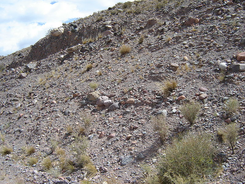
Alluvial fans are developed when streams running from higher levels break into foot slope plains of low gradients.

Usually, the very coarse load is transported by streams running over mountain slopes. This load grows too heavy for the streams to be carried over gentler gradients and gets dumped and spread as a broad low to high cone-shaped deposit called an alluvial fan.

Usually, the streams which flow over fans are not confined to their original channels for long and shift their position across the fan forming many channels called distributaries.

Alluvial fans in humid areas show normally low cones with a gentle slope from head to toe and they appear as high cones with a steep slope in arid and semi-arid climates.

Also, their Alluvial cone. The alluvial cone is a steep, narrow, cone-shaped alluvial fan. This is where a swift stream rapidly slows down due to an upland stream emerging abruptly into a level plain.

Depositional landforms of river Upsc
Alluvial Fans By en:user:Mikenorton – http://en.wikipedia.org/wiki/Image:Alluvial_fan_01.JPG, CC BY-SA 3.0, https://commons.wikimedia.org/w/index.php?curid=4782727

Deltas

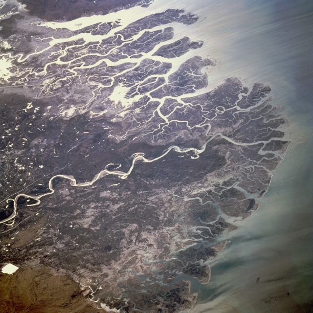
Indus River Delta
Indus River Delta By NASA, Public Domain, https://commons.wikimedia.org/w/index.php?curid=5989926

Deltas are like alluvial fans but develop at a different location. The load carried by the rivers is dumped and spread into the sea. If this load is not carried away far into the sea or distributed along the coast, it spreads and accumulates as a low cone.

Unlike in alluvial fans, the deposits making up deltas are very well sorted with clear stratification. The coarsest materials settle out first and the finer fractions like silts and clays are carried out into the sea.

As the delta grows, the river distributaries continue to increase in length and the delta continues to build up into the sea.

Floodplains

Floodplains
Flood Plains By Oikos-team – en:wikipedia [1], CC BY-SA 3.0, https://commons.wikimedia.org/w/index.php?curid=3772385

Deposition develops a floodplain just as erosion makes valleys. Floodplain is a major landform of river deposition. Large-sized materials are deposited first when the stream channel breaks into a gentle slope.

Thus, normally, fine-sized materials like sand, silt, and clay are carried by relatively slow-moving waters in gentler channels usually found in the plains and deposited over the bed and when the waters spill over the banks during flooding above the bed.

A river bed made of river deposits is an active floodplain. The floodplain above the bank is an inactive floodplain. Inactive floodplain above the banks basically contains two types of deposits — flood deposits and channel deposits.

In plains, channels shift laterally and change their courses occasionally leaving cut-off courses that get filled up gradually.

Such areas over flood plains built up by abandoned or cut-off channels contain coarse deposits. The flood deposits of spilled waters carry relatively finer materials like silt and clay. The flood plains in a delta are called delta plains.

Natural Levees

Natural Levees
Natural Levees By NOAA Restoration Center, Erik Zobrist – http://www.photolib.noaa.gov/habrest/r0004205.htm, Public Domain, https://commons.wikimedia.org/w/index.php?curid=866078

Natural levees and point bars are some of the important landforms found associated with floodplains. Natural levees are found along the banks of large rivers. They are low, linear, and parallel ridges of coarse deposits along the banks of rivers quite often cut into individual mounds.

During flooding as the water spills over the bank, the velocity of the water comes down and large-sized and high specific gravity materials get dumped in the immediate vicinity of the bank as ridges.

They are high nearer the banks and slope gently away from the river. The levee deposits are coarser than the deposits spread by floodwaters away from the river. When rivers shift laterally, a series of natural levees can form.

Point Bars

Point Bar By Jean-Christophe BENOIST – Own work, CC BY 2.5, https://commons.wikimedia.org/w/index.php?curid=2081218

Point bars are also known as meander bars. They are found on the convex side of meanders of large rivers and are sediments deposited in a linear fashion by flowing waters along the bank.

They are almost uniform in profile and in width and contain mixed sizes of sediments. If they’re more than one ridge, narrow and elongated depressions are found in between the point bars.

Rivers build a series of them depending upon the water flow and supply of sediment. As the rivers build the point bars on the convex side, the bank on the concave side will erode actively.

Meanders

Meaders By Thomas Nugent, CC BY-SA 2.0, https://commons.wikimedia.org/w/index.php?curid=66434005

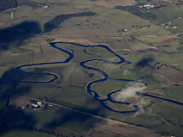
In large flood and delta plains, rivers rarely flow in straight courses. Loop-like channel patterns called meanders develop over flood and delta plains. Meander is not a landform but is only a type of channel pattern.

This is because of the propensity of water flowing over very gentle gradients to work laterally on the banks, unconsolidated nature of alluvial deposits making up the banks with many irregularities which can be used by water exerting pressure laterally and Coriolis force acting on the fluid water deflecting it like it deflects the wind.

When the gradient of the channel becomes extremely low, water flows leisurely and starts working laterally.

Slight irregularities along the banks slowly get transformed into a small curvature in the banks; the curvature deepens due to deposition on the inside of the curve and erosion along the bank on the outside.

If there is no deposition and no erosion or undercutting, the tendency to meander is reduced. Normally, in meanders of large rivers, there is active deposition along the convex bank and undercutting along the concave bank.

The concave bank is known as a cut-off bank which shows up as a steep scarp and the convex bank presents a long, gentle profile and is known as a slip-off bank.

As meanders grow into deep loops, the same may get cut-off due to erosion at the inflection points and are left as ox-bow lakes.

Braided Channels

Braided Channels
Braided Channels By I, Gobeirne, CC BY 2.5, https://commons.wikimedia.org/w/index.php?curid=2437562

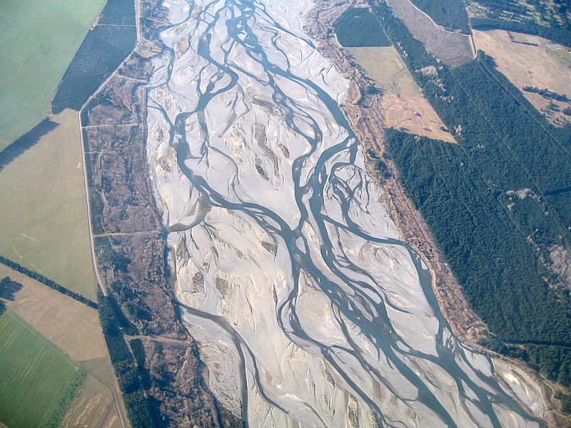
When rivers carry coarse material, there can be selective deposition of coarser materials causing the formation of a central bar which diverts the flow towards the banks; and this flow increases lateral erosion on the banks.

As the valley widens, the water column is reduced and more and more materials get deposited as islands and lateral bars developing a number of separate channels of water flow.

Deposition and lateral erosion of banks are essential for the formation of the braided pattern.

Or, alternatively, when discharge is less and load is more in the valley, channel bars and islands of sand, gravel, and pebbles develop on the floor of the channel and the water flow is divided into multiple threads.

These thread-like streams of water rejoin and subdivide repeatedly to give a typical braided pattern.

Conclusion

This is Ncert’s notes for the topic ‘Depositional landforms of the river’, written Upsc Exam. This article is also useful for Tnpsc and other state service exams. This covers the landforms formed by the deposition of rivers such as natural levees, point bars, braided channels, meanders, etc.

Erosional landforms of River Upsc

The erosional landforms of the river are River Valley Formation, Potholes and Plunge Pools, Incised or Entrenched Meanders, River Terraces, etc.

Valleys

The valley begins as small and narrow rills. The rills then slowly develop into long and wide gullies. Then the gullies get deepened, widened, and rise on becoming valleys.

Based on the dimensions and shape, the Valleys are classified as V-Shaped Valleys, Gorges, Canyons, etc.

V-Shaped Valleys

The V-Shaped Valley is formed by the river erosion over time and its shape is similar to the letter “V“.

V- Shaped Valley - Erosional landforms of river Upsc
V- Shapped Valley – By BorisFromStockdale at the English-language Wikipedia, CC BY-SA 3.0, https://commons.wikimedia.org/w/index.php?curid=18215841

Gorge

A Gorge is a narrow, deep valley running between the mountains or hills with very steep to straight sides. It is typically with steep rocky walls and rivers or streams running through it. Also, the canyon is characterized by steep step-like side slopes and might be as deep as the gorge.

It is almost equal in width at the top and as well the bottom. On the other hand, the Canyon is wide at the top than its bottom. Also, the fact, is that Canyon is a type of Gorge.

Gorge – Canyon By chadh – Snake River Canyon, CC BY 2.0, https://commons.wikimedia.org/w/index.php?curid=46852845

The valley depends on the structure and types of rock on which they form due to the erosion by running water.

For Example – Gorges are formed in Hard rocks and Canyons are formed in the horizontal bedded sedimentary rocks.

Potholes and Plunge Pools

Over the rocky beds of hill-streams, circular depressions called potholes form because of stream erosion aided by the abrasion of rock fragments. Once a small and shallow depression forms, pebbles and boulders get collected in those depressions and get rotated by flowing water and consequently the depressions grow in dimensions.

A series of such depressions eventually join and the stream valley gets deepened. At the foot of waterfalls also, large potholes, quite deep and wide, form because of the sheer impact of water and rotation of boulders.

Such large and deep holes at the base of waterfalls are called plunge pools. These pools also help in the deepening of valleys. Waterfalls are also transitory like any other landform and will recede gradually and bring the floor of the valley above waterfalls to the level below.

Incised or Entrenched Meanders

In streams that flow rapidly over steep gradients, normally erosion is concentrated on the bottom of the stream channel. Also, in the case of steep gradient streams, lateral erosion on the sides of the valleys is not much when compared to the streams flowing on low and gentle slopes.

Because of active lateral erosion, streams flowing over gentle slopes, develop sinuous or meandering courses. It is common to find meandering courses over floodplains and delta plains where stream gradients are very gentle.

But very deep and wide meanders can also be found cut in hard rocks. Such meanders are called incised or entrenched meanders.

Meander loops develop over original gentle surfaces in the initial stages of development of streams and the same loops get entrenched into the rocks normally due to erosion or slow, continued uplift of the land over which they start.

They widen and deepen over time and can be found as deep gorges and canyons in hard rock areas. They give an indication of the status of the original land surfaces over which streams have developed.

River Terraces

River terraces are surfaces marking old valley floor or floodplain levels. They may be bedrock surfaces without any alluvial cover or alluvial terraces consisting of stream deposits.

River terraces are basically products of erosion as they result due to vertical erosion by the stream into its own depositional floodplain.

There can be a number of such terraces at different heights indicating former river bed levels. The river terraces may occur at the same elevation on either side of the rivers in which case they are called paired terraces. When a terrace is present only on one side of the stream and with none on the other side or one at quite a different elevation on the other side, the terraces are called unpaired terraces.

Unpaired terraces are typical in areas of slow uplift of land or where the water column changes are not uniform along both the banks.

The terraces may result due to:

(i) receding water after a peak flow

(ii) change in hydrological regime due to climatic changes;

(iii) tectonic uplift of land;

(iv) sea-level changes in the case of rivers closer to the sea.

Depositional landform of Wind Upsc

Plain formed by Wind Deposition

The two features that are formed by wind deposition are Sand dunes and loess deposits. The dunes are also called Aeolian Landforms. The wind is a good sorting agent. Based on the velocity of the wind, varying sizes of grains are moved along the floor by saltation, or by rolling, carried in suspension.

During this process of transportation, the material gets sorted. The lighter material is carried long, and heavy materials stay grounded.

When the wind slows or begins to die down, based on the sizes of grains and their critical velocities, the grains will begin to settle.

So, in depositional landforms made by wind, good sorting of grains can be found. Since wind is there everywhere and wherever there is a good source of sand and with constant wind directions, depositional features in arid regions can develop anywhere.

Sand Dunes

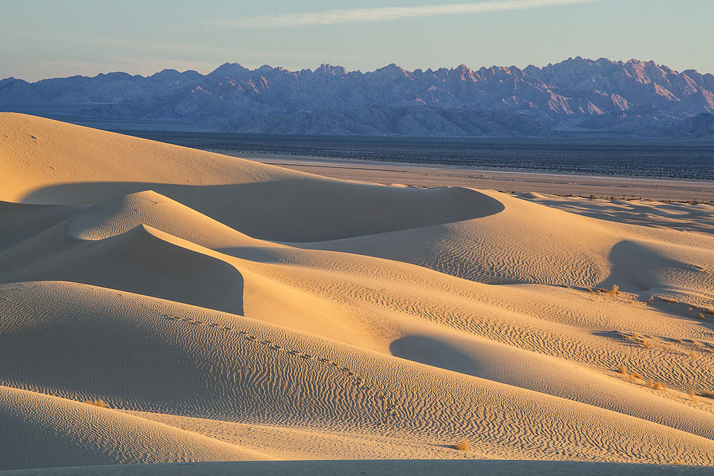
Sand Dunes
Sand Dunes By Bureau of Land Management – My Public Lands Roadtrip: Cadiz Dunes Wilderness in California, Public Domain, https://commons.wikimedia.org/w/index.php?curid=42086871

Dry hot deserts are good places for sand dune formation. Obstacles to initiating dune formation are equally important. There can be a great variety of dune forms.

Crescent-shaped dunes called barchans with the points or wings directed away from wind direction i.e., downwind, form where the wind direction is constant and moderate and where the original surface over which sand is moving is almost uniform.

Parabolic dunes form when sandy surfaces are partially covered with vegetation. That means parabolic dunes are reversed barchans with wind direction being the same.

Seif is similar to barchan with a small difference. Seif has only one wing or point. This happens when there is a shift in wind conditions.

The lone wings of seifs can grow very long and high. Longitudinal dunes form when the supply of sand is poor and wind direction is constant. They appear as long ridges of considerable length but are low in height.

Transverse dunes are aligned perpendicular to the wind direction. These dunes form when the wind direction is constant and the source of sand is an elongated feature at right angles to the wind direction. They may be very long and low in height.

When sand is plenty, quite often, the regular shaped dunes coalesce and lose their individual characteristics. Most of the dunes in the deserts shift and a few of them will get stabilised especially near human habitations.

Conclusion

Deposition landforms of Wind such as a Sand Dune is a mound of sand that is deposited by wind. The landforms vary in size and shape. The Layers of sand and silt which are deposited in the same area are called Loess, it is very fertile.

Erosional landforms of wind :Deflation hollows and caves Upsc

The wind is one of the two dominant agents in hot deserts. The desert floors get heated up too much and too quickly because of are dry and barren.

The heated floors heat up the air directly above them and result in upward movements in the hot lighter air with turbulence, and any obstructions in its path set up eddies, whirlwinds, updrafts, and downdrafts.

Winds also move along the desert floors with great speed and the obstructions in their path create turbulence. Of course, there are storm winds that are very destructive.

Winds cause deflation, abrasion, and impact. Deflation includes lifting and removal of dust and smaller particles from the surface of rocks.

In the transportation process sand and silt act as effective tools to abrade the land surface. The impact is simply the sheer force of momentum which occurs when sand is blown into or against a rock surface. It is similar to sandblasting operation.

The wind action creates a number of interesting erosional and depositional features in the deserts.

In fact, many features of deserts owe their formation to mass wasting and running water as sheet floods. Though rain is scarce in deserts, it comes down torrentially in a short period of time.

The desert rocks devoid of vegetation, exposed to mechanical and chemical weathering processes due to drastic diurnal temperature changes, decay faster and the torrential rains help in removing the weathered materials easily.

That means the weathered debris in deserts is moved by not only wind but also by rain/sheet wash.

The wind moves fine materials and general mass erosion is accomplished mainly through sheet floods or sheet wash. Stream channels in desert areas are broad, smooth, and indefinite and flow for a brief time after rains.

Erosional landforms of wind

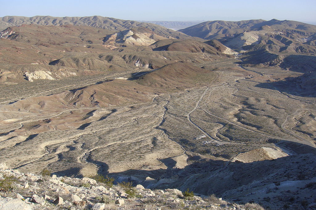
Pediments and Pediplains Landscape evolution in deserts are primarily concerned with the formation and extension of pediments. Gently inclined rocky floors close to the mountains at their foot with or without a thin cover of debris are called pediments.

Such rocky floors form through the erosion of the mountain front through a combination of lateral erosion by streams and sheet flooding.

Erosion starts along the steep margins of the landmass or the steep sides of the tectonically controlled steep incision feature over the landmass.

Once, pediments are formed with a steep wash slope followed by a cliff or free face above it, the steep wash slope and free face retreat backward.

This method of erosion is termed a parallel retreat of slopes through backwashing. So, through parallel retreat of slopes, the pediments extend backward at the expense of the mountain front, and gradually, the mountain gets reduced leaving an inselberg which is a remnant of the mountain.

That’s how the high relief in desert areas is reduced to low featureless plains called pediplains.

Playas

Plains are by far the most prominent landforms in the deserts. In basins with mountains and hills around and along, the drainage is towards the centre of the basin, and due to gradual deposition of sediment from basin margins, a nearly level plain forms at the centre of the basin.

In times of sufficient water, this plain is covered up by a shallow water body. Such types of shallow lakes are called playas where water is retained only for a short duration due to evaporation and quite often the playas contain good deposition of salts.

The playa plain covered up by salts is called alkali flats.

Deflation Hollows and Caves Weathered mantle from over the rocks or bare soil, gets blown out by the persistent movement of wind currents in one direction.

This process may create shallow depressions called deflation hollows. Deflation also creates numerous small pits or cavities over rock surfaces.

The rock faces suffer impact and abrasion of wind-borne sand and the first shallow depressions called blowouts are created, and some of the blowouts become deeper and wider fit to be called caves.

Mushroom, Table, and Pedestal Rock Many rock-outcrops in the deserts easily susceptible to wind deflation and abrasion are worn out quickly leaving some remnants of resistant rocks polished beautifully in the shape of mushroom with a slender stalk and a broad and rounded pear-shaped cap above.

Sometimes, the top surface is broad like a tabletop and quite often, the remnants stand out like pedestals.

* * All the Notes in this blog, are referred from Tamil Nadu State Board Books and Samacheer Kalvi Books. Kindly check with the original Tamil Nadu state board books and Ncert Books.