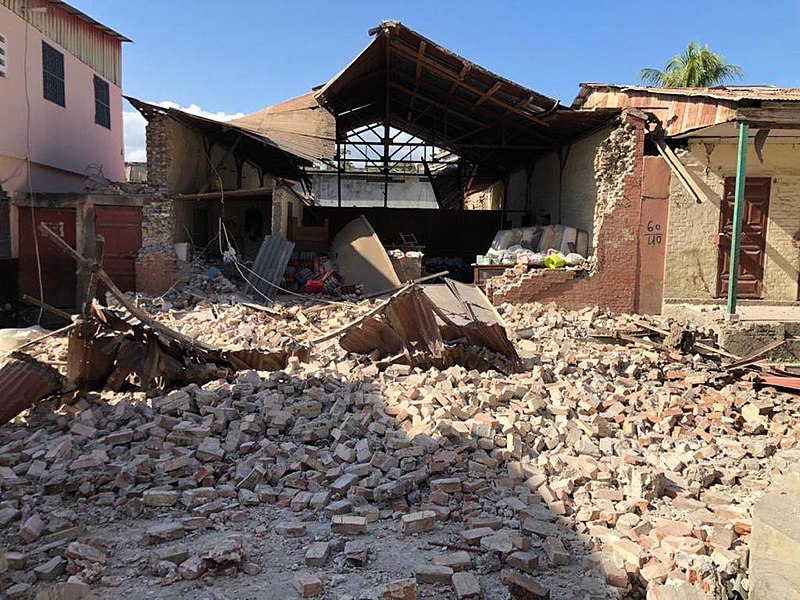
A landslide is defined as the movement of a mass of rock debris down a slope. Landslides are caused by the direct influence of gravity. Landslides can be caused by rainfall, snowmelt, stream erosion, flood, earthquakes, volcanic activity, disturbance by human activities, or any combination of these factors.
Landslides cause property damage, injury, and death and adversely affect a variety of resources. For example, water supplies, fisheries, sewage disposal systems, forests, dams, and roadways can be affected.
Landslide meaning in Hindi is ‘bhooskhalan‘ (भूस्खलन).
Cause of Landslide
Landslide occurs when the gravitational and other shear stresses within a slope exceed the shear strength of the things that form the slope. This is caused naturally and is man-made. The cause of landslides in India are:
Deforestation – Cutting and clearing of trees from the forest, slopes, mountains, hills etc are said to be one of the main causes of Landslides in India.
Shifting Cultivation – Shifting cultivation is mostly practised in India, especially in the North and North Eastern states. This involves the clearing of trees and plants in hills. It is also an important reason behind landslides in India.
Mining Activities – Mining involves different operations which produce large amounts of vibrations. Activities such as blasting, and grinding of underground rocks create huge vibrations that reach several hundred and beyond and pose a threat and cause the risk of landslides.
Urbanisation – As per the latest studies, the urbanized areas are more prone to landslides caused by precipitation than the rural areas.
Types of Landslide
Landslide is classified into four types:
Falls and Toppling
Slides
Flows
Earthflow
During a Landslide
Listen for any unusual sounds that might indicate moving debris, such as trees cracking or boulders knocking together.
If you are near a river, be alert for any sudden increase or decrease in water flow and for a change from clear to muddy water. Such changes may indicate landslide activity upstream, so be prepared to move quickly.
Be alert especially when driving. Embankments along roadsides are particularly susceptible to landslides.
Disconnect the power supply in the areas of the landslide.
After the Landslide
Stay away from the slide area. There may be a danger of additional slides, Check for injured and trapped persons near the slide, without entering the direct slide area.
Direct rescuers to their locations.
Listen to local radio or television for the latest emergency information Watch for flooding, which may occur after a landslide or debris flow.
An earthquake is sudden, rapid shaking of the ground caused by the shifting of rocks beneath the earth’s surface.
Earthquakes strike suddenly without warning and can occur at any time. The impacts of earthquakes include deaths, injuries, and damage to property.
Induced Seismicity
Induced seismicity are earthquakes that are due to human activities such as extraction or injection of fluids in the subsurface(Suckale, 2010).
The causes of induced seismic activity include dam building, geothermal energy extraction, mining, hydraulic fracturing, etc.
MEASURES FOR EARTHQUAKE RISK REDUCTION
The most important measure of the reduction of risk is pre-disaster mitigation, preventive measures, preparedness will reduce the vulnerability.
This also helps in rescue and relief action rapidly after the occurrence of the earthquake.
Steps
Stay calm, do not panic.
In most cases, one can protect themselves and others by Dropping, Covering, and Hold On.
If you are in a building, sit down on the floor under a table or any other furniture, and firmly hold on to it until the earthquake has stopped.
If there is no table nearby, cover your face and head with your hands and sit on the floor in a corner of the room. Keep away from glass windows, glass doors, and things that can fall down.
Do not try to leave the building quickly; during earthquakes, people mostly die because they try to run out of the building and become trapped under ruins if the building is destroyed.
Do not go to the staircase, a balcony, or an elevator. If you are in the street, keep away from buildings; try to get into an open space and avoid power transmission lines.
If you are at home, turn off electrical equipment and gas quickly. If you are in a chemistry class or a laboratory where chemicals are stored, try to leave the room because chemicals may cause injuries.
After earthquake
First, check if you have any injuries, and then check the condition of the surrounding people. If you cannot do this, wait for the rescue team. After the earthquake when you leave the shelter, do not return for 2-3 hours because the quakes may repeat (an aftershock).
Check if there is fire; in case of a mild one try to extinguish it. Be cautious about the possibility of gas leakage and damage caused to electrical wiring.
Be careful while opening wardrobe doors to take necessary items. Use only lanterns; do not use an oil lamp or a candle. Listen to the radio to receive information about the earthquake.
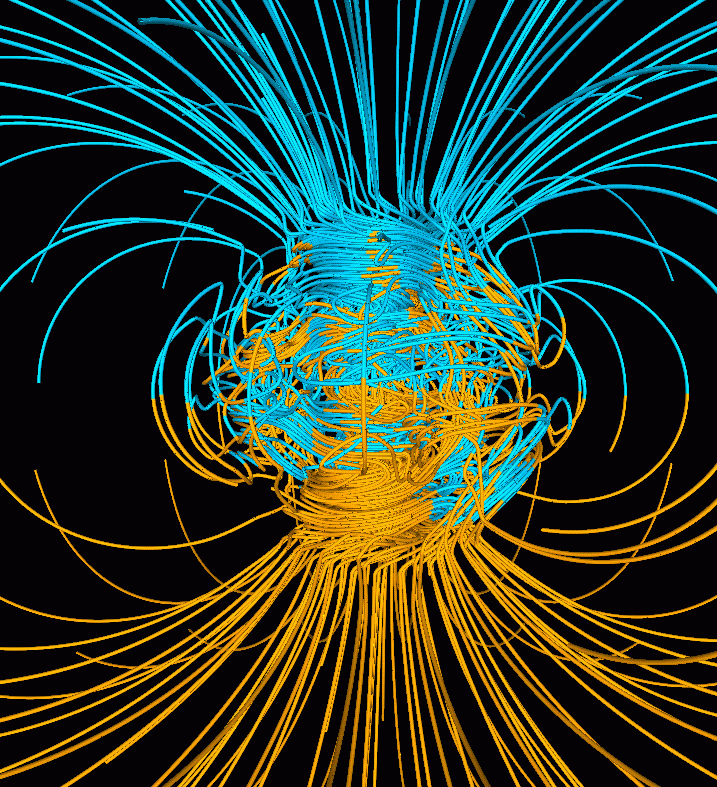
The Magnetic field of the earth is also called Geomagnetism. The strength of the Earth’s magnetic field changes from place to place and its value is in order of 10-5 T.
The scientific reason for the earth magnetic field is still not satisfactory. Earlier is was the large bar magnet is present along the axis of rotation of earth deep inside the earth. But it is scientifically correct.
Also by theory of Dynamo effect, it was though that magnetic field is arised by the electrical current generated by convective motion of metallic fluids consisting of iron and nickel in molten form.
The magnetic field of lines shows that the magnetic dipole located at the centre of the earth. But the axis of the dipole does not coincide with the axis of rotation of earth as it is tilted to 11.3°.
The place of the north magnetic pole is at a latitude of 79.74° N and a longitude of 71.8° W, a location in northern Canada. The magnetic south pole is at 79.74° S, 108.22° E in Antarctica.
The pole near the geographic north of the earth is the North Magnetic Pole and similarly the pole near the geographic south pole is called South Magnetic Pole.
There is some confusion in the nomenclature of the poles this is because if one looks at the magnetic field lines of the earth, the field lines go into the earth at the north magnetic pole (Nm) and come out from the south magnetic pole (Sm).
This convention comes as the magnetic north was the direction to which the north pole of a magnetic needle-pointed and the north pole of a magnet was so named as it was the north-seeking pole and practically, the north magnetic pole behaves like the south pole of a bar magnet inside the earth and vice versa.
Magnetic declination in surveying
When a point is taken into account on the earth’s surface. At such a point, the direction of the line of the longitude circle judges the geographical north-south direction.
The line of longitude towards the pole being the direction of true north. The vertical plane containing the line of the longitude circle and also the axis of rotation of the earth is termed the Geographic Meridian.
Similarly, the Magnetic meridian of an area is the vertical place which passes through the imaginary line connecting the magnetic north and the south poles and this plane would cross the surface of the earth in a longitude sort of a circle.
A magnetic needle, which is free to swing horizontally, would then lie in the magnetic meridian and also the north pole of the needle would point towards the magnetic north pole.
Since the line joining the magnetic poles is titled with relevance to the geographic axis of the earth, the magnetic meridian at a point makes angle with the geographic meridian.
This, then, is the angle between the true geographic north and the north shown by a compass needle. This angle is called the magnetic declination or simply declination.
The declination is larger at higher latitudes and smaller close to the equator. The declination in India is little, it is at Delhi with 0°41′ E and 0°58′ W at Mumbai. Thus, in each of these places, a magnetic needle shows the true north quite accurately.
There is an added amount of interest. If a magnetic needle is perfectly balanced about a horizontal axis so that it can swing in a plane of the magnetic meridian, the needle would make an angle with the horizontal and is known as the angle of dip or inclination.
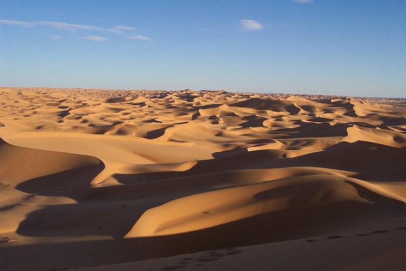
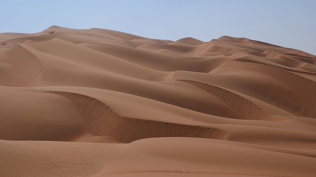
The Great Indian Desert lies to the Northwest of the Aravali hills and is a land of undulating topography dotted with longitudinal dunes and barchans.
Region of the Great Indian Desert that the Thar Desert receives low rainfall below 150mm per year.
Due to the low rainfall, this region has an arid climate with low vegetation cover.
It is because of these Physical characteristics, that this is also called Marusthali, which is a region in the west that is a very dry part.
This region extends over 62,000 sq. km, north of the Luni river.
It is believed that this region during the Mesozoic era, was under the sea and this belief is made strong by the pieces of evidence found at the wood fossils park at Aakal, marine deposits around Brahmsar, near Jaisalmer.
These wood fossils were as old as 180 million years.
Marusthali – Great Indian Desert By Nepenthes – Own work, CC BY-SA 3.0, https://commons.wikimedia.org/w/index.php?curid=5623273
Marusthali desert
The great Indian desert is called Marusthali.
The underlying rock structure of the desert is an extension of the Peninsular plateau but still because of the extremely arid conditions, its surface features have been carved by physical weathering and wind action.
The desert lands feature found here are mushroom rocks, shifting dunes, and an oasis which is mostly in its southern part.
Based on the orientation, the desert can be divided into the northern part is sloping towards Sindh, and the south towards the Rann of Kachchh.
The south half of Marusthali forms a never-ending bowl, framed by flat-topped hills of sand, rocks, and limestone.
The north part has ridden closely packed with coarse sand.
The rivers mostly in this region are ephemeral(lasting for a very short time). The Luni river flowing in the southern part of the desert has some importance.
The Low precipitation and high evaporation make this region a water deficit.
There are some streams that suddenly disappear after some distance and which show the existence of inland drainage by joining a lake or playa.
The lakes and the playas have brackish water which is an important source of obtaining salt.
In this region, the soil is mostly loamy.
The crops grown in this region were attacked frequently by locust invasion.
Occupation in Marusthali
Livestock raising and irrigated farming. The crops grown here are Cereal grains, chickpeas, cotton, sugarcane, groundnuts, and oilseeds. Also, Lignite and gypsum are mined here.
The volcanoes are classified based on the nature of the eruption and the form is developed at the surface. The major types of volcanoes are:
Shield Volcanoes
Composite Volcanoes
Caldera
Flood Basalt Provinces
Mid Ocean Ridge Volcanoes
Shield Volcanoes
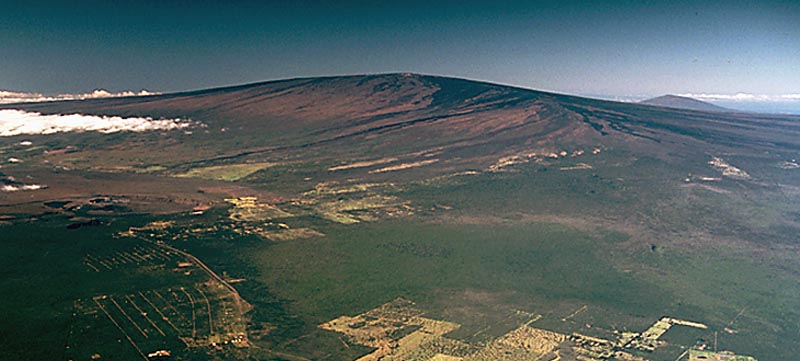
Shield Volcanoes By J.D. Griggs – U.S. Geological Survey, Public Domain, https://commons.wikimedia.org/w/index.php?curid=835932
These volcanoes are the largest of all the volcanoes on the earth and the most famous examples are Hawaiian Volcanoes.
Shield Volcanoes are made of Basalt, which is a type of lava and it is very fluid when erupted.
Due to such a type of lava, these volcanoes are not steep and they become explosive in case water gets into its vent.
Otherwise, the Shield volcanoes are characterized by low explosivity.
The upcoming lava throws out in form of a fountain out the cone at the top of the vent and forms into Cinder Cone.
Composite Volcanoes
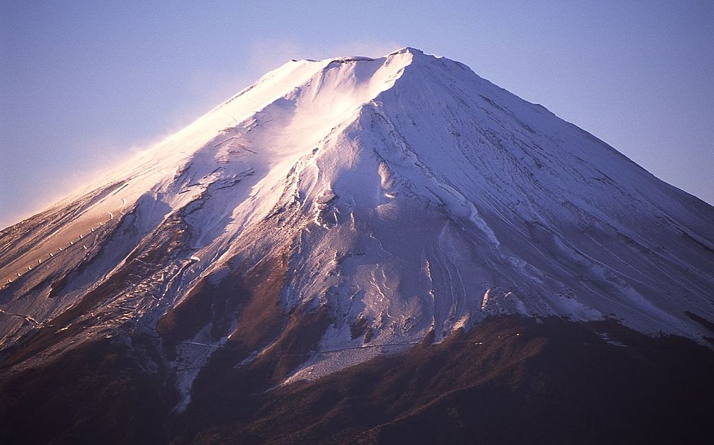
Composite Volcanoes By hogeasdf – https://www.flickr.com/photos/9177053@N05/4071658790/, CC BY 3.0, https://commons.wikimedia.org/w/index.php?curid=9100465
These Volcanoes are featured by eruptions that are cooler and more viscous lava than the basalts.
The composite volcanoes result in explosive eruption and also along with the lava, large quantities of pyroclastic material and ashes were thrown out of the vents.
These materials accumulate in the vicinity of the vent openings leading to the formation of layers which makes these mounts look like composite volcanoes.
Caldera
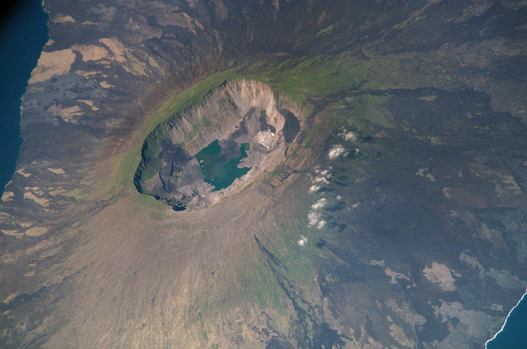
Caldera By unnamed NASA astronaut – This file is in the public domain in the United States because it was created by the Image Science & Analysis Laboratory, of the NASA Johnson Space Center. NASA copyright policy states that “NASA material is not protected by copyright unless noted”. (NASA media use guidelines or Conditions of Use of Astronaut Photographs).Photo source: ISS005-E-6997., Public Domain, https://commons.wikimedia.org/w/index.php?curid=1162697
Calderas is the most explosive of all the volcanoes and they are generally so explosive that they collapse themselves and do not build any structures.
These collapsed depressions are called Calderas.
As the explosiveness of Caldera volcanoes shows that the magma chamber that supplies the Lava is not only big but it is also in close vicinity.
Flood Basalt Provinces
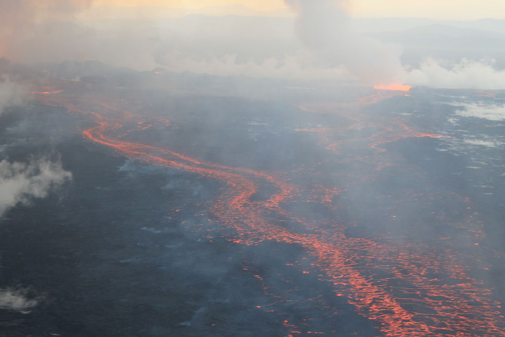
Flood Basalt Provinces By peterhartree – https://www.flickr.com/photos/41812768@N07/15145875322/, CC BY-SA 2.0, https://commons.wikimedia.org/w/index.php?curid=35165591
Flood Basalt Province volcanoes outpour highly fluid lava, which flows for long distances. Some area is covered by thousands of square kilometers of thick basalt lava flows.
Due to a series of flows with some flows attaining a thickness of more than 50m. Also, some flows may extend a few hundred kilometers.
The Deccan Traps from India, presently covering most of the Maharashtra plateau, are a much larger flood basalt province.
Mid-Ocean Ridge Volcanoes
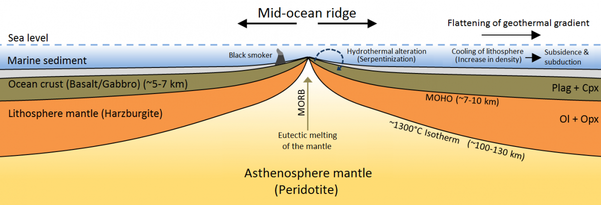
Mid-Ocean Ridge Volcanoes By 37ophiuchi BrucePL – Based on diagram File:Mittelozeanischer Ruecken – Schema.png. I translated it from German to English and revised outlines of rock units., CC BY-SA 4.0, https://commons.wikimedia.org/w/index.php?curid=79658206
It occurs in the oceanic regions and there is such a system of Mid-Ocean Ridges more than 70,000 km long that extends through all the ocean basins. In these ridges, the central portion experiences frequent eruptions.
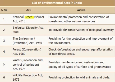
Environmental acts in India Source by Tamil Nadu Samacheer Kalvi book
Wildlife Protection Act 1972
This law provides protection to wild animals and birds. This is an Act of the Parliament. By this law, protection is provided to wild animals, birds, and plants.
This law extends to the whole of India. Its features are the establishment of Wildlife Sanctuaries, National Parts, etc. The next feature is to prohibit the hunting of endangered species.
It also provides the license for the sale, transfer, and possession of wildlife species.
The significance of the Wildlife Protection Act 1972 is, it regulates the sanctuaries, national parks, zoos, and other protected regions. Also, it protects the illegal trade of wildlife.
Water (Prevention and control of Pollution) Act, 1974
Provides maintenance and restoration and quality of all types of surface and groundwater.
Forest (Conservation) Act,1980
Check deforestation and encourage afforestation of non-forest areas.
The Environment(Protection) Act, 1986
Providing for the protection and improvement of the Environment.
Biological Diversity Act, 2002
To provide for the conservation of biological diversity
National Green Tribunal Act, 2010
Environmental protection and conservation of forests and other natural resources.
India is a tropical country and it has high opportunities for harvesting solar energy using Photovoltaic technology. Photovoltaic is a technology that converts sunlight directly into electricity.
Recently Solar energy became very cheap and many houses in rural and urban areas use them as part of their Primary power consumption. Also, many big power plants are established all over the country by the Union Government, State Government, Private and also through PPP (Public Private Partnership).
Photovoltaic or solar produces a very litter voltage of 0.5–1 V when exposed to sunlight, this is very little. But when these cells are combined in an arrangement that will produce sufficient Current which will be utilized for various applications.
The main advantages of solar cell are they do have any moving parts, as a result, it requires only little maintenance and it has a long life.
The periodical rise and fall of the sea level, once or twice a day, mainly due to the attraction of the sun and the moon, is called a tide. The movement of water caused by meteorological effects (winds and atmospheric pressure changes) are called surges. Surges are not regular like tides. The study of tides … Continue reading “Types of tides Upsc”
The periodical rise and fall of the sea level, once or twice a day, mainly due to the attraction of the sun and the moon, is called a tide.
The movement of water caused by meteorological effects (winds and atmospheric pressure changes) are called surges. Surges are not regular like tides. The study of tides is very complex, spatially and temporally, as it has great variations in frequency, magnitude, and height.
The moon’s gravitational pull to a great extent and to a lesser extent the sun’s gravitational pull, are the major causes for the occurrence of tides.
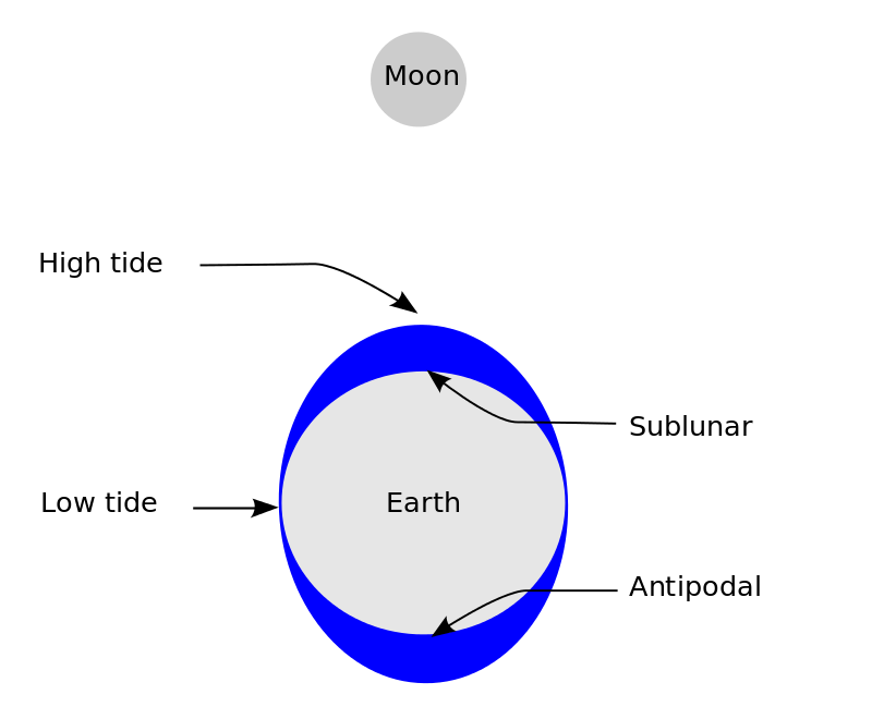
the lunar portion of Earth’s tides By The SVG code is valid. This vector image was created with Inkscape-default – Own work, CC BY-SA 3.0, https://commons.wikimedia.org/w/index.php?curid=15500578
Another factor is centrifugal force, which is the force that acts to counterbalance gravity. Together, the gravitational pull and the centrifugal force are responsible for creating the two major tidal bulges on the earth.
On the side of the earth facing the moon, a tidal bulge occurs while on the opposite side through the gravitational attraction of the moon is less as it is farther away, the centrifugal force causes a tidal bulge on the other side.
The ‘tide generating force is the difference between these two forces; i.e. the gravitational attraction of the moon and the centrifugal force.
On the surface of the earth, nearest the moon, pull or the attractive force of the moon is greater than the centrifugal force, and so there is a net force causing a bulge towards the moon. On the opposite side of the earth, the attractive force is less, as it is farther away from the moon, the centrifugal force is dominant.
Hence, there is a net force away from the moon. It creates the second bulge away from the moon. On the surface of the earth, the horizontal tide generating forces are more important than the vertical forces in generating the tidal bulges.
The tidal bulges on wide continental shelves have greater height. When tidal bulges hit the mid-oceanic islands they become low.
The shape of bays and estuaries along a coastline can also magnify the intensity of tides. Funnel-shaped bays greatly change tidal magnitudes. When the tide is channeled between islands or into bays and estuaries they are called tidal currents.
Types of Tides
Tides vary in frequency, direction, and movement from place to place and also from time to time. Tides may be grouped into various types based on their frequency of occurrence in one day or 24 hours or based on their height.
Tides based on Frequency
Semi-diurnal tide
The most common tidal pattern, featuring two high tides and two low tides each day. The successive high or low tides are approximately the same height.
Diurnal tide
There is only one high tide and one low tide during each day. The successive high and low tides are approximately the same height.
Mixed tide
Tides having variations in height are known as mixed tides. These tides generally occur along the west coast of North America and on many islands of the Pacific Ocean. Tides based on the Sun, Moon, and the Earth Positions.
The height of rising water (high tide) varies appreciably depending upon the position of the sun and moon with respect to the earth. Spring tides and neap tides come under this category.
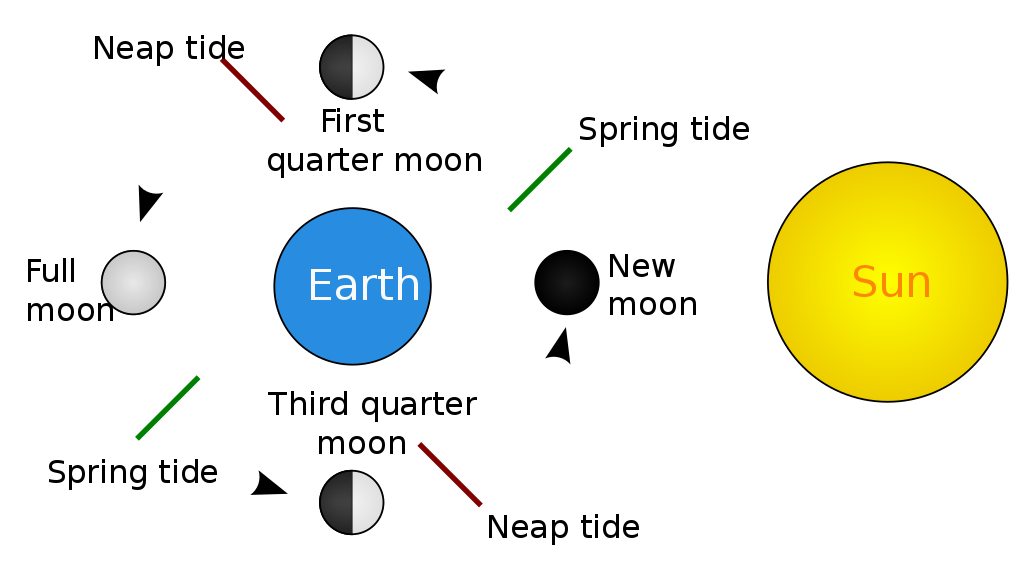
Tides based on Frequency By User:KVDP, SVG conversion by Surachit – Public domain image: File:Tides schematic.JPG which was based on an image in “Leidraad voor het Stuurbrevet” by Richard Vooren, Paul Van den Keybus, Public Domain, https://commons.wikimedia.org/w/index.php?curid=8752107
Spring tides
The position of both the sun and the moon in relation to the earth has a direct bearing on tide height. When the sun, the moon, and the earth are in a straight line, the height of the tide will be higher.
These are called spring tides and they occur twice a month, one on the full moon period and another during the new moon period.
Neap tides
Normally, there is a seven-day interval between the spring tides and neap tides. At this time the sun and moon are at right angles to each other and the forces of the sun and moon tend to counteract one another.
The Moon’s attraction, though more than twice as strong as the sun’s, is diminished by the counteracting force of the sun’s gravitational pull.
Once in a month, when the moon’s orbit is closest to the earth (perigee), unusually high and low tides occur. During this time the tidal range is greater than normal.
Two weeks later, when the moon is farthest from Earth (apogee), the moon’s gravitational force is limited and the tidal ranges are less than their average heights.
When the earth is closest to the sun (perihelion), around 3rd January each year, tidal ranges are also much greater, with unusually high and unusually low tides. When the earth is farthest from the sun (aphelion), around 4th July each year, tidal ranges are much less than average.
The time between the high tide and low tide, when the water level is falling, is called the ebb. The time between the low tide and high tide, when the tide is rising, is called the flow or flood.
Importance of Tides
Since tides are caused by the earth-moon-sun positions which are known accurately, the tides can be predicted well in advance. This helps the navigators and fishermen plan their activities.
Tidal flows are of great importance in navigation. Tidal heights are very important, especially harbours near rivers and within estuaries having shallow ‘bars’ at the entrance, which prevent ships and boats from entering into the harbour.
Tides are also helpful in desilting the sediments and in removing polluted water from river estuaries. Tides are used to generate electrical power (in Canada, France, Russia, and China). A 3 MW tidal power project at Durgaduani in Sunderbans of West Bengal is underway.
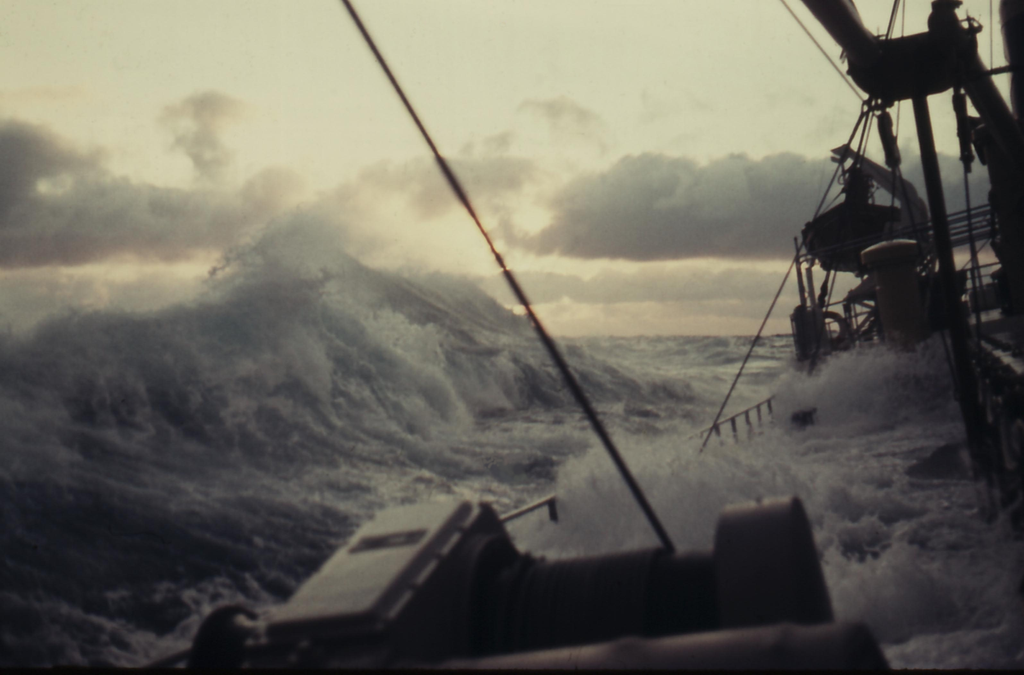
Sea Waves are mostly caused by wind. The wind drive waves are called the surface and are formed by the friction between wind and surface water. When the wind blows across the surface of the ocean, the continuous disturbance forms a wave crest.
These other types of sea waves also are discussed below.
Waves
A wave is a disturbance or change, that transfers the energy progressively from one point in the medium to another point. This disturbance in a medium (sea) carries energy without a net movement of particles. This may take the form of elastic deformation, change in pressure, etc.
In this article, we are going to discuss ‘sea waves, their formation, origin, types etc.
Types of Sea Waves
There are three types of Sea waves. They are distinguished as Wind Waves and Swell, Wind Surges, and Tsunamis (Sea Waves due to Earthquake, volcanic eruption, etc)
Sea waves are further classified based on their wavelength into Capillary Wave, Wind Wave, Seiche, Seismic Sea Wave.
Capillary Wave
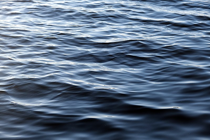
Capillary Wave By kallerna – Own work, CC BY-SA 4.0, https://commons.wikimedia.org/w/index.php?curid=88899901
Capillary Wave has a wavelength less than 2 Cm. Its disturbing force is Wind.
Wind Wave
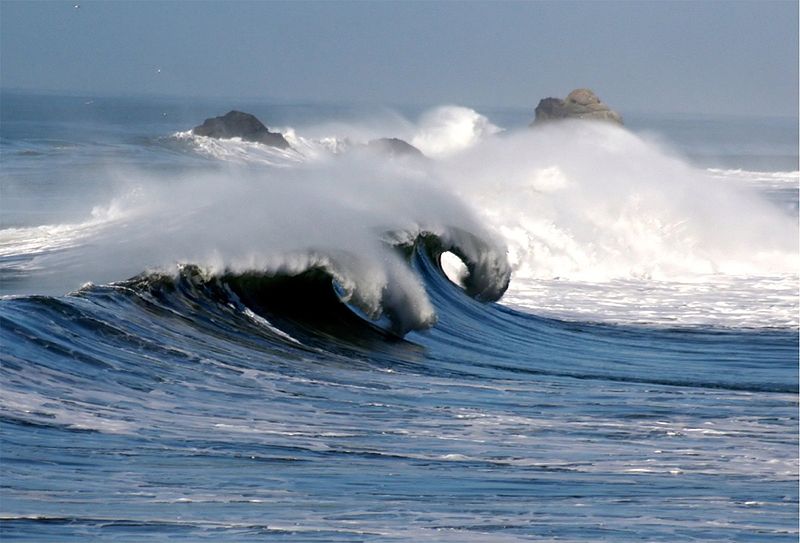
Wind Wave By Brocken Inaglory – Own work, CC BY-SA 4.0, https://commons.wikimedia.org/w/index.php?curid=3379848
Wind Wave has a wavelength between 60 to 150m. This is caused by the wind over the sea.
Seiche Wave
Seiche Wave By Buonasera – Rechteinhaber und eigenes Foto, CC BY-SA 3.0, https://commons.wikimedia.org/w/index.php?curid=17820532
Seiche Wave has a Wavelength that is large than Wind Wave, it changes to a great extent and is in order of the basin size. This is caused by disturbing forces such as Storm surge, Change in atmospheric pressure, etc.
Tsunami or Seismic Wave
Tsunami or Seismic Wave By David Rydevik (email: david.rydevikgmail.com), Stockholm, Sweden. – Originally at Bild:Davidsvågfoto.JPG., Public Domain, https://commons.wikimedia.org/w/index.php?curid=177627
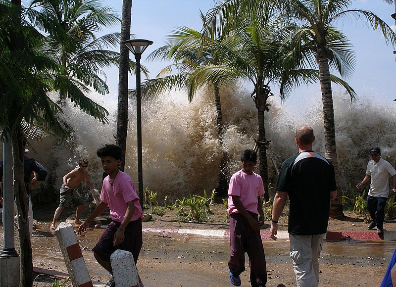
Tsunami Wave has a typical wavelength of about 200 Km. This type of wave is caused by a volcanic eruption, landslide, earthquake. faulting of the seafloor.
Sea Waves
The waves are energy that moves across the ocean’s surface. The water particles travel in a small circle when the wave passes by.
Mostly, this energy is triggered by the wind and makes the waves travel, making this energy released on the seashores. The Waves on the surface of the ocean and their motion affects the deepwater of oceans that are stagnant.
The waves get slow down when reaching the beach. This is due to friction between the seafloor and the dynamic water. The wave breaks when the depth of the water is less than half of the wavelength of the wave.
Open oceans are home to the largest waves. The waves grow in size as they move and absorb energy from the wind.
Wind Wave Formation
Most of the waves are formed due to wind driving against the water. When a breeze of two knots or fewer blows over the calm water, small ripples were created and grow as the speed of the breeze increased. This wave grows until the white caps appear in the breaking waves.
The sea wave travels thousand of miles before rolling ashore, breaking and dissolving as surf.
Wave Size and Origin
The origin of a wave can be determined by the size of the wave. Steep waves are young waves that are probably formed due to the local wings.
But the steady and slow waves may have formed from far away places, maybe or even from another Hemisphere.
Height of Wave
The maximum wave height is determined by the strength of the wind. But how long the wind blows and the area over which the wind blows in a single direction determines the wave height.
Waves travel because the wind pushes the water body in its course. But gravity pulls the crests of the waves downward. The falling water pushes the former troughs upward, and the wave moves to a new position.
The actual motion of the water below the waves is circular. This indicates that things are carried up and forward as the wave approaches, and down and back as it passes.
Characteristics of Waves
Wave crest and trough
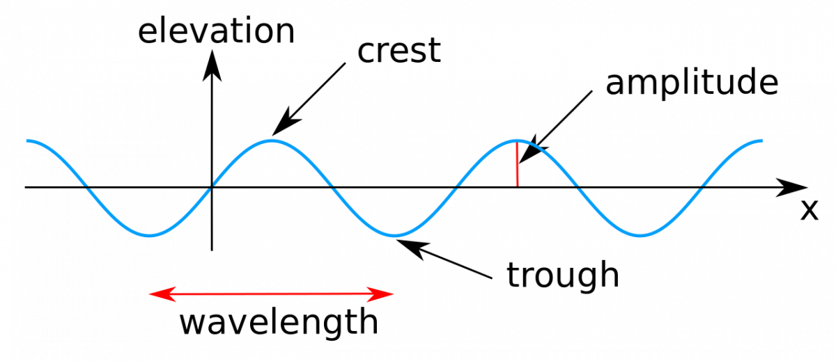
The highest and lowest points of a wave are called the crest and trough respectively.
Wave height
It is the vertical distance from the bottom of a trough to the top of a crest of a wave.
Wave amplitude
It is one-half of the wave height.
Wave period
It is merely the time interval between two successive wave crests or troughs as they pass a fixed point.
Characteristics of Waves – Height, Crest, Wavelength, amplitude, trough By Kraaiennest – Own work, CC BY-SA 3.0, https://commons.wikimedia.org/w/index.php?curid=4038226
Wavelength
It is the horizontal distance between two successive crests.
Wave speed
It is the rate at which the wave moves through the water, and is measured in knots.
Wave frequency
It is the number of waves passing a given point during a second time interval.
Conclusion
The waves are basically of four types. The winds are the main cause of the sea waves. The other causes are earthquakes, volcano eruptions, landslides, etc. Also based on the size of the wave its origin can be determined.
The ocean water is dynamic. Its movements are influenced by Physical characteristics and external forces.
Causes of ocean water movement such as Waves, Tides, and Ocean Currents are Temperature, salinity, density, and external forces such as sun, moon, and winds.
Difference between waves tides and ocean currents
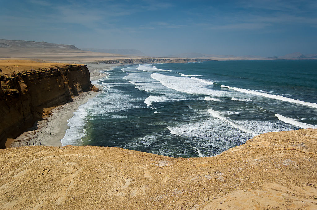
Difference between waves tides and ocean currents By World Wide Gifts – Peru – Paracas National ReserveUploaded by snowmanradio, CC BY-SA 2.0, https://commons.wikimedia.org/w/index.php?curid=28224008
There are two types of movement in Ocean water are Horizontal and Vertical motion. Ocean current and waves are Horizontal movements and Tides are vertical motion.
The ocean currents are the continuous flow of a large amount of water in a particular direction. The water moves ahead from one place to another in case of ocean currents.
On the other hand, Waves are a horizontal movement of water, where the water does not move. But in the case of wave train the moves ahead. The vertical motion refers to the rise and fall of the ocean and seawater due to the attraction of the moon and sun.
This vertical motion will happen twice a day. Another type of vertical movement is caused by the upwelling of cold water from subsurface and surface water sinking.
Waves Tides and Ocean Currents are the types of movement of ocean water.
This article topic ‘Difference between waves, tides and currents’ for Upsc, Tnpsc and other state service exams.
* * All the Notes in this blog, are referred from Tamil Nadu State Board Books and Samacheer Kalvi Books. Kindly check with the original Tamil Nadu state board books and Ncert Books.