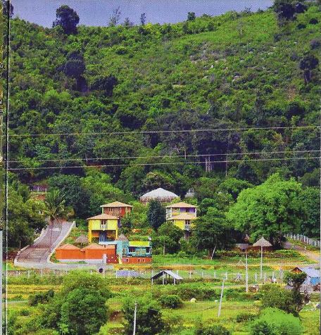
Major tribes of India and their locations Upsc

Adivasi: Indigenous People of India

India is one of the large homes for the Indigenous people, who haven’t been touched by the modern world. Also, this country has the largest tribal population in the World with 84.4 Million tribal people.

Indigenous people or Tribal people In India are called Adivasis. Adivasis happens to be the poorest in the country. Adivasis still rely on Hunting, agriculture, fishing, etc for their life.

In this country, there are more than 50 tribal groups, most of them belonging to Negrito, Australoid, and Mongoloid stocks.

Major Tribes of India

Tribes of India
Lepcha. Toda, Rava, Khasi, Limbu, Garo, Naga, Chakma are major Mongoloid stocks in India
  • Major Tribes of India are:
    • Gonds
    • Santhals
    • Khasis
    • Angamis
    • Bhils
    • Bhutias
    • Great Andamanese

Gonds

Found mostly in the Gond forest of central India. Gonds are one of the largest tribal groups in the world. They are highly influenced by Hindu culture and traditions.

Santhals

They are the third-largest tribe in India. Found mostly in West Bengal, Bihar, Odisha, Jharkhand, and Assam.

Santhals belong to the pre-Aryan period. They are great fighters from the British times.

Bhils

They are famously called the bow men of Rajasthan.Bhils are a widely distributed tribe in the nation.

They form the largest tribe in the whole of South Asia. Bhils are divided into central or pure bills and eastern or Rajput Bhils.

Munda

They are mainly found in Jharkhand. They are mostly found in West Bengal, Bihar, Odisha, Jharkhand, and Chattisgarh. Munda refers to the headman of a village.

Their main occupation is Hunting.

Khasi

They are found in the Khasi Jaintia hills in Meghalaya. Also, found in Punjab, UP, Manipur, West Bengal, and J&K.

A large population is found in Meghalaya.

Angami

They belong to the extreme northeastern part of the nation in Nagaland. Their population is 12 million.

They are famous for Woodcraft and artwork. Angami main festival is Sekrenyi.

Bhutia

They are of Tibetian origin. They have migrated to Sikkim around the 16th century. They are known as Lachenpas and Lachungpas in the Northern part of Sikkim.

They occupy 14% of Sikkim’s population. Their main festivals are Losar and Losoong.

Chenchu

They inhabit the Nallamalai hills, which is part of Nagarjuna Sagar Tiger Sanctuary in Andra Pradesh.

They are mainly found in Mahabubnagar, Nalgonda, Praksham, Guntur, and Kurnool.

Great Andamanese

They are Negrito tribe inhabitants in the Andaman Islands. They form the largest population in these Islands.

As per census, their population is limited to very few individuals.

Major Human races of the world and their characteristics Upsc

Human races in the world

Human races in the world
Different Racial Groups in the World

A Race is a group of people with similar, permanent distinguishing characteristics. People belonging to a particular race, skin and Hair colour have certain interpretations.

The classification of racial groups should be done based on characteristics, and physical features inherited from a common ancestor.

The important features based on race are:

  • skin colour
  • stature
  • The shape of the head, face, nose, eye
  • Type of hair
  • Blood Group

4 Major Races in the World

  • Negroid
  • Caucasoid
  • Mongoloid
  • Australoid

Negroid

negroid race
Negroid

Negroid is commonly called as “Black Race“. Negroid, have the darkest skin tone of other human races in the world. Their other striking characteristics are:

  • Slopped Forehead
  • Thick Lips
  • Wide Nose
  • Dark Hairs

Their skin colour is brown to black-brown yellow-brown. Also, their stature is Tall to very short. Their face is medium broad to narrow and tends to have medium-high strong prognathism. The head form is Predominantly long and low in height.

The hair colour is Brown blacklight curl and woolly. The body build is linear and muscular. The nose is low, medium to very broad. Their blood group is high in Rh(D). The eye colour is brown to brown block, vertical eye folds are common.

Blacks live in Sub-Sahara Africa.

Mongoloid

MONGOLOID
mongoloid face

Mongoloid live in East Asia. These people have folding eyelids, almond-shaped eyes, Yellowish skin tone and V-shaped cheeks. Their skin colour is Saffron to Yellow Brown and reddish brown.

The body stature is Medium Tall to Medium Short. The face is Medium broad to very broad malars high and flat tends to medium-high. The head is medium height, predominantly broad. The hair colour is brown to brown-black straight.

The body build tends to be lateral, with some linearity evident. The nose is low to medium form, medium broad. They have a high number of blood Group B.

The eye is brown to dark brown, medial epicanthic fold is very common. Native Americans and Eskimos are also Mongoloid. They have the least body hairs, the least body odour, and the smallest limb ratio. Mongoloid facial structure is likely to adapt to cold mild wind.

Caucasoid

The Caucasoid is also known as “White People”. They have a pointy nose, vertical forehead, pinkish/orange skin tone, Visible brow ridge and colourful eyes/hair. The skin colour is Pale reddish white to olive brown. Their stature is Medium to tall. The face is Narrow to medium broad and tends to have high no prognathism.

The Head form is Long broad short-medium, high very high. The hair colour is Light blonde to Dark brown, straight to wavy. Their body is linear to Lateral slender to refuge. The nose is usually high, narrow to medium board. The number of Blood Group A is more than Blood Group B. The eye colour is light blue to dark brown, with lateral eyes and folds occasionally.

It is believed that their light skin tone is meant to receive more sunlight due to Europe’s cold climate. It is also believed that Caucasoid nose structure is used to keep the nose moisture from getting dried by the wind.

Caucasoid people are living in Europe and the Middle East.

Caucasoid
Caucasoid

Australoid Race

Australoid Race have visible eye ridges, wide noses, curly hair, dark skin tone, and are short in height. It is believed that the visible eye ridge helps them to eat stiff foods.

Australoid people live in Australia Continent and Papua New Guinea.

australoid people
Australoid race

Ethnicity

Ethnicity and Race are almost similar, it is a grouping of people. It is a concept that refers to a shared culture and a way of life.

Ethnicity can be reflected in language, religion, and material cultures such as clothing, cuisine, music and art. It is a major source of social conflict. Han Chinese is the largest ethnic group in the world.

There are several thousand ethnic groups in the world, that possess a shared history, language, religion, and culture, that provides a common identity between members.

Ethnicity vs Race

  • But Ethnicity is the grouping of people based on cultural characteristics.
  • Race is a grouping of people based on physical qualities.

Racial Diversity in India

India is a unique country with great diversity in ethnicity. It has many races, religions, languages, cultures, cuisines etc. Indian civilization is one of the oldest in the world.

The Indian civilization primarily consists of the Indo-Aryan of North India the Dravidians of South India and the people of the Indus Valley Civilization. Indo-Aryan migrated to this at about 1800 BC.

Dravidians

Dravidian people are native speakers of the Dravidian languages in the Indian Subcontinent. Almost all Dravidians live in South India. Five Major Dravidian Ethnic groups in India are:

  • Tamil
  • Telugu
  • Kannada
  • Malayalam
  • Tulu

The Indus Valley People are believed to be the Dravidian People, pushed down to South India due to the arrival of Indo-Aryans and the rise of the Kuru Kingdom. Major Dravidian kingdoms are Cheras, Cholas and the Pandyas.

These three kingdoms were also tolerant of Buddhism, Jainism and Hinduism. Major Dravidian languages are Tamil, Telugu, Kannada, Malayalam and Brahui.

Brahui

Arabic Script Brahui is the only Dravidian Language that is not known to have been written in a Brahmi Based Script. Instead, it has been written in the Arabic Script since the second half of the 20th Century in Iran, Pakistan and Afghanistan.

Major rivers in Tamilnadu Tnpsc and its Origin

Major rivers in Tamilnadu

The rivers of Tamil Nadu are its lifeline. Tamilnadu has many rivers. However, the notable ones are Cauvery, Palar, Ponnaiyar, Vaigai, and Thamirabarani.

Most of the rivers of Tamil Nadu originate from the Western Ghats flow towards the east and drain into the Bay of Bengal. Thamirabarani River is the only perennial river in the country.

Thamirabarani River is perennial because it is fed by both the southwest and northeast monsoons.

Cauvery

Cauvery originates at Talacauvery in the Brahmagiri hills of Kodagu (Coorg). Coorg is a district in Karnataka in the Western Ghats. About 416 Km of its course falls in Tamil Nadu. It serves as a boundary between Karnataka and Tamil Nadu for a distance of 64 Km.

Cauvery River forms Hogenakkal waterfalls in Dharmapuri district. Stanley Reservoir also called Mettur Dam is located across the Cauvery River in the Salem district.

A tributary called Bhavani joins Cauvery on the right bank about 45 km from the Mettur Reservoir. Thereafter, it takes an easterly course to enter into the plains of Tamil Nadu.

Two more tributaries, Noyyal and Amaravati confluence the river on the right bank at Thirumukkudal 10 km from Karur. The river is wider in this region, where it is called ‘Agandra Cauvery’.

In the Tiruchirappalli district, the river branches into two parts. The northern branch is called Kollidam or Coleroon. The southern branch remains Cauvery. From here, the Cauvery delta starts.

After flowing for about 16 km, the two branches join again to form ‘Srirangam Island‘. The Grand Anaicut, also called Kallanai was built across the river Cauvery. After Kallanai, the river breaks into a large number of distributaries and forms a network all over the delta.

The network of distributaries within the delta of Cauvery on the coast is called the ‘Garden of Southern India‘. It merges into the Bay of Bengal to the south of Cuddalore.

Palar

Palar river near vayalur, Kalpakkam is one of major rivers in tamilnadu
Palar river

The Palar River rises beyond Talagavara village in the Kolar district of Karnataka. The Palar drains an area of 17,871 sq. km, out of which nearly 57% lies in Tamil Nadu and the rest in the states of Karnataka and Andra Pradesh.

Ponnai, Goundinya Nadhi, Malattar, Cheyyar, and Kiliyar are its major tributaries. Its total length is 348 km, out of which 222 km of its course falls in Tamilnadu.

Palar flows through the districts of Vellore and Kancheepuram. Finally, it enters the Bay of Bengal near Kuvattur.

Then Pennaiyar/Then Ponnaiyar

Then Pennaiyar originates from the eastern slope of Nandi Durga hills in eastern Karnataka and drains an area of 16,019 sq. km, of which nearly 77% lies in Tamil Nadu.

This river flows for a distance of 247 km in the southeasterly direction in the districts of Krishnagiri, Dharmapuri, Vellore, Tiruvannamalai, Cuddalore, and Villupuram.

Then Pennaiyar branches into two viz. Gadilam and the Ponnaiyar near Tirukoilur Anaicut. Gadilam joins the Bay of Bengal near Cuddalore and Ponnaiyar near Puducherry. Chinnar, Markandanadhi, Vaniar, and Pambar are its tributaries.

Heavy rain at the river’s source causes sudden but short-lived floods. The river is extensively dammed for irrigation, in Tamil Nadu.

There are reservoirs at Krishnagiri and Sathanur across this river. The Ponnaiyar is considered sacred by Hindus and festivals are held during the Tamil month of Thai (January-February).

Vaigai

Vaigai River rises from the eastern slopes of the Varusanadu hills of the Western Ghats of Tamil Nadu. It drains an area of 7741 sq. km, which lies entirely in the state of Tamil Nadu.

It flows through the districts of Madurai, Sivaganga, and Ramanathapuram. Its length is 258 km. It discharges its water into the Ramnad big Tank and some other small tanks. The tank surplus water is finally released into Palk Strait near Ramanathapuram.

Thamirabarani

Thamirabarani is named from Thamiram (copper) and Varuni (streams of rivers). The water of this river gives a copper-like appearance due to the presence of red soil suspended in it.

Thamirabarani originates from a peak in Pothigai Hills on the Western Ghats above Papanasan in the Ambasamudram Taluk. The origin of the river is associated with Sage Agasthiyar.

This river travels through the districts of Tirunelveli and Thoothukudi and finally flows into the Bay of Bengal near Punnaikayal in the Thoothukudi district. Karaiyar, Servalar, Manimuthar, Gadananathi, Pachaiyar, chittar, and Ramanathi are its main tributaries.

FAQ

a.How many rivers are in Tamilnadu?

There are 115 big and small rivers in Tamil Nadu. Of which there are Major 17 river basins in Tamil Nadu. Of the 17, Cauvery is the only major river basin, 13 others are medium basins and 3 are minor basins, which other rivers constitute.

b.Name some important rivers in Tamilnadu.

Cauvery, Palar, Vaigai, Noyyal, Cheyyar, Moyar, Bhavani, Thamirabarani, etc are major rivers of Tamil Nadu.

c.State river of Tamil Nadu?

There is no official state river for Tamil Nadu. But the Cauvery is its main river. It flows into Tamil Nadu from Karnataka and it flows one-third of the state.

d.Top 10 rivers in Tamilnadu?

Based on the length, the top 10 rivers in Tamilnadu are:

  1. Kaveri – 765 Km
  2. Ponnaiyar – 500 Km
  3. Palar – 348 Km
  4. Amaravati – 282 Km
  5. Vaigai -258 Km
  6. Bhavani – 215 Km
  7. Noyyal – 180 Km
  8. Tamirabarani -125 km
  9. Thirumanimutharu -120 km
  10. Arani – 108 Km

References

https://kids.britannica.com/students/article/Tamil-Nadu/337962

Types of soil classification india and its Distribution Upsc

Soil Percentage in India

  • Alluvial Soil – 22.16%
  • Red Soil- 28%
  • Black Soil-29.69%
  • Saline & Alkaline Soil- 1.29%
  • Peaty & Marshy Soil-2.17%
  • Laterite Soil -2.62%
  • Arid & Desert Soil – 6.13%
  • Forest & Mountain Soil – 7.94%
Types and Percentage of soil types in India with respect to agriculture
Soil Percentage in India

Soil distribution in India

Agriculture mainly depends on the soil. It is composed of various minerals, air, organic matter, and water. These are present on the topmost layer of the land. Soil grains are of three types namely Sand, Clay, and Silt.

The soils are formed by weathering of rocks and deposition of denudation.

Types of soil in India

There are eight types of soil identified by the Indian Council of Agriculture (ICAR), which is established in 1953.

Soil distribution in India and its Nature, Crops Grown

Alluvial soil

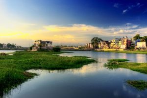
Alluvial Plain
Alluvial Plain By Matt Affolter, CC BY-SA 3.0, https://commons.wikimedia.org/w/index.php?curid=14715873
Characteristics of Alluvial Soil

It is light-colored, much more siliceous in Khadar type Alluvial soil. In the case of Bhanger, it is dark, clayey, lime nodules in older alluvium soil.

Formation of Alluvial Soil

Alluvial soil is formed by streams and rivers carry deposits from hills.

Chemical properties of Alluvial Soil

Alluvial soil composition – It is rich in carbon compounds, lime, phosphoric acid, potash, but poor in nitrogen.

Nature of Alluvial Soil

All the grains, such as sand, loam, silt, and clay, show a similar profile.

Distribution of Alluvial Soil in India

Ganga and Brahmaputra river valleys and the Plains of Haryana, Uttar Pradesh, Punjab, Uttaranchal, West Bengal, and Bihar.

Crops that grow in Alluvial Soil

Oilseeds, Wheat, Sugarcane, and Rice

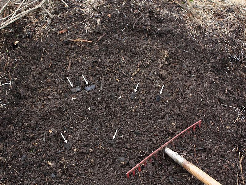
Black soils

Black Soil
Black Soil By Holger Casselmann – Own work, CC BY-SA 3.0, https://commons.wikimedia.org/w/index.php?curid=18915280
Formation of Black Soil

Black is from the Deccan Trap Basalt. It is black due to its Iron and Titanium presence. The black soil percentage in India is 29.69%

Chemical properties of Black Soil

It consists of high quantities of iron, calcium, lime, aluminium, magnesia, magnesium carbonates, potash lime, Aluminum calcium, and magnesium, poor in Nitrogen Phosphoric acid and humus.

Nature of Black Soil

Black soil has a very high degree of moisture retentivity and becomes sticky when wet.

Distribution of Black Soil

The northern part of Karnataka, Maharashtra and Malwa plateaus, Telangana and the Rayalaseema region of Andhra Pradesh and the Kathiawar peninsula.

Crops that grow in Black Soil

Sugarcane, Cotton, Tobacco, and Millet.

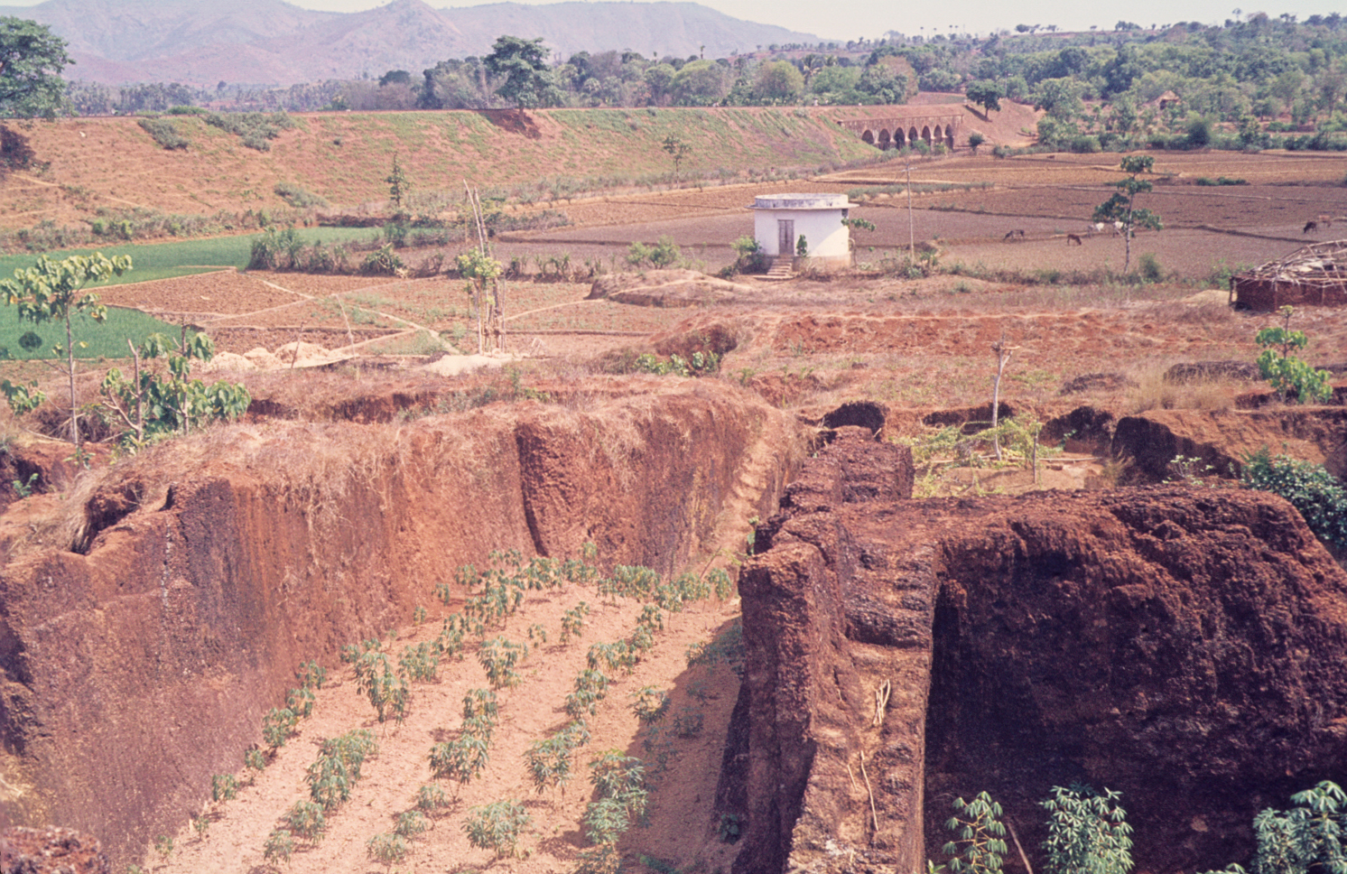
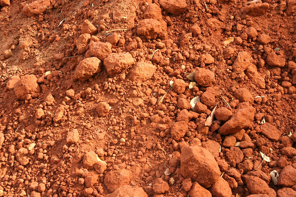
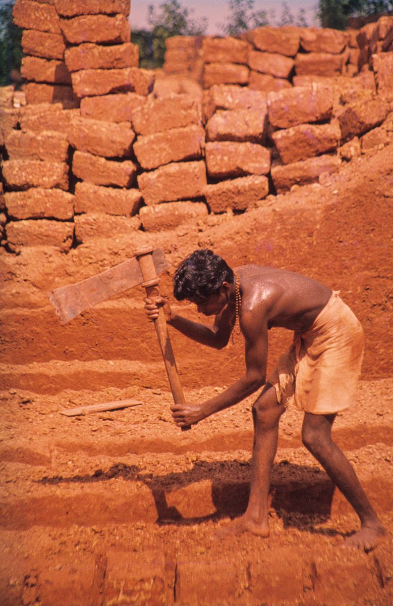
Red Soil

Red Soil
Red Soil By Carla Antonini – Own work, CC BY-SA 3.0, https://commons.wikimedia.org/w/index.php?curid=20164061
Formation of Red soil

Red soil is formed by the decomposition of ancient crystalline rocks such as granite and gneisses. The red soil percentage in India is 28%.

Chemical Properties of Red Soil

It is rich in iron and magnesium but deficient in phosphoric acid, lime, hummus, and Nitrogen.

Nature of Red Soil

It is red, clay fraction of soil consists of Kaolinitic mineral, porous, light texture.

Distribution of Red Soil

Southern states of Kerala, Tamil Nadu, Karnataka, and Eastern parts of Deccan plateau, Chota Nagpur plateau (Jharkhand).

Crops that grow in Red Soil

Cotton, Wheat, Rice, Sugarcane, and Pulses.

Laterite soils

Laterite Soil
Laterite Soil By Werner Schellmann – Own work, CC BY-SA 2.5, https://commons.wikimedia.org/w/index.php?curid=772332
Formation of Laterite soil

Laterite soil is formed in the region where both hot, dry and wet condition exists alternately and is formed by the process of leaching. The laterite soil percentage in India is 2.62%.

Chemical properties of Laterite Soil

This type of soil is mainly made of aluminium and iron hydrated oxides. Laterite soils are more acidic in higher areas, and they cannot maintain moisture. But in the plain regions, Laterite soils can maintain moisture and consist of clay and heavy loam.

Distribution of Laterite Soil

Odisha region, Karnataka, the eastern Ghats, Assam hills, and the hilly regions of Kerala.

Crops That Grow in Laterite Soil

Laterite soil crops that provide good commercial value are Rubber, Cashew Nut, Tapioca, and Coffee.

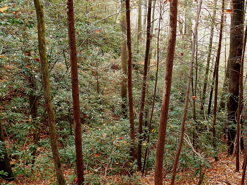
Forest and mountain soils

Forest and mountain soils
Forest and mountain soils By Ken Thomas – KenThomas.us(personal website of photographer), Public Domain, https://commons.wikimedia.org/w/index.php?curid=7269136

Based on climate and region, the property of this kind of soil differs.

Formation of Forest and Mountain Soil

This soil is formed from the mechanical forces caused by the act of temperature variations, snowfall, and rainfall.

Chemical properties of Forest and Mountain Soil

These soils lack lime, potash, and Phosphorus.

Nature of Forest and Mountain Soil

It is acidic due to slow decomposition, humus-rich, thin, light, and sandy with pieces of rock. Their character is based on their parent rocks.

Distribution of Forest and Mountain Soil

Eastern and Western Ghats, Sikkim, Jammu, and Kashmir, Coniferous belts, Himachal Pradesh, Uttarakhand.

Crops that grow in Forest and Mountain Soil

Coffee, tea, rice, maize, potato, barley, tropical fruits, and various types of spices

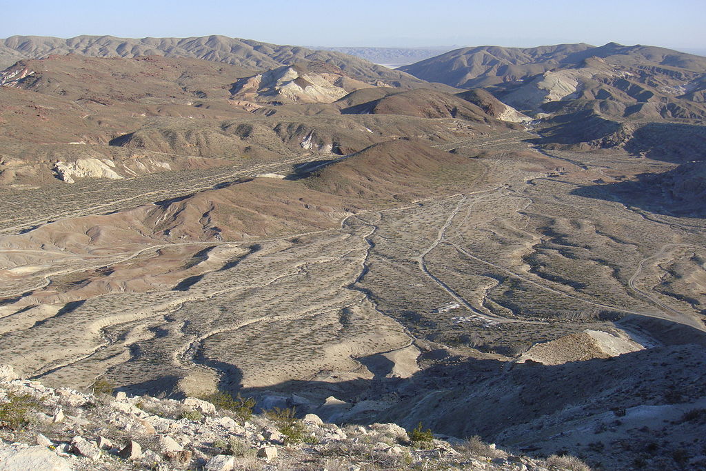
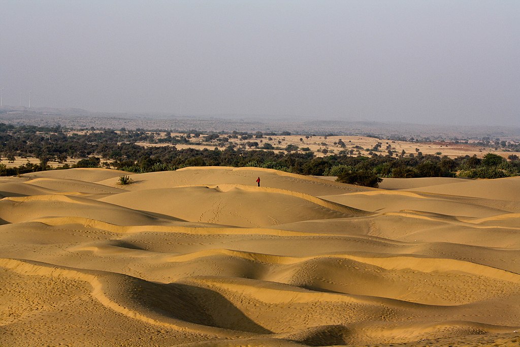
Arid and desert soils

Arid and desert soils
Arid and desert soils By sushmita balasubramani – Flickr: the vast expanse of the Thar desert, CC BY 2.0, https://commons.wikimedia.org/w/index.php?curid=18570997
Formation of Arid and Desert Soils

Due to the continued dry climate, high temperature, and fast evaporation, the soil is dry. This type of soil lack humus due to the absence of vegetative cover.

Chemical Properties of Arid and Desert Soils

It contains phosphate even though it is poor in nitrogen, a high percentage of soluble salts, alkaline with calcium carbonate in varying degrees, and poor in organic matter.

Nature of Arid and Desert Soil

It is light-coloured with low humus and moisture, and friable.

Distribution of Arid and Desert Soil

Southern Punjab, Gujarat, and Rajasthan.

Crops that grow in Arid and Desert Soil

Maize and pulse, barley, cotton, and Millet when irrigated.

Saline and Alkaline Soils

Saline and Alkaline Soils
Saline and Alkaline Soils By USDA Employee – https://www.nrcs.usda.gov/news/archive/2004newsroom.html, Public Domain, https://commons.wikimedia.org/w/index.php?curid=3468850
Formation of Saline and Alkaline Soil

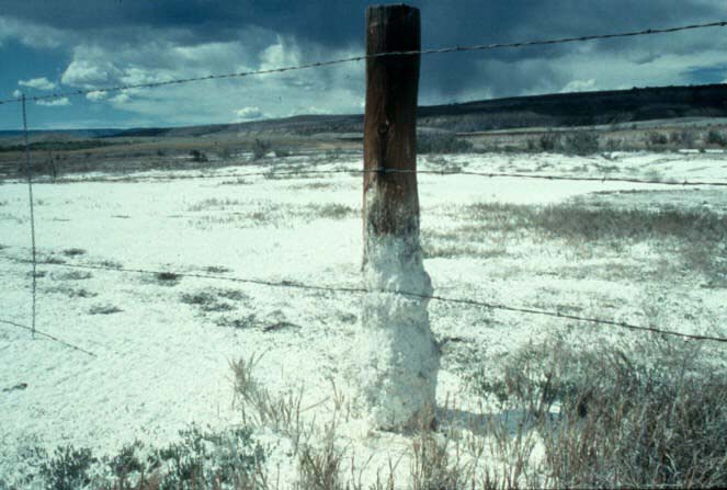
This is formed by poor drainage that makes waterlogging and injurious salts are taken to the topmost layer by capillary action.

This causes salinity in the soil.

Chemical Properties of Saline and Alkaline Soil

It liberates sodium, calcium salts, magnesium, and sulfurous acid.

Nature of Saline and Alkaline Soil

It consists of the mineral fragment as a result of poorly, not fully decomposed rocks.

Distribution of Saline and Alkaline Soil

Maharashtra, Haryana, Uttar Pradesh, Karnataka, Andhra Pradesh, and the drier parts of Bihar.

Peaty and marshy soils

Peaty and marshy soils
Peaty and marshy soils By Gary Rogers, CC BY-SA 2.0, https://commons.wikimedia.org/w/index.php?curid=9296735
Formation of Peaty and marshy soils

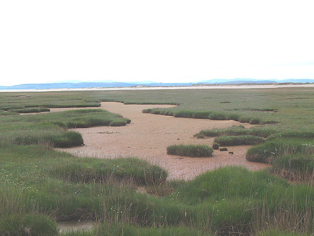
This is formed by organic matter in humid regions where there is high humidity and heavy rainfall.

Nature of Peaty and Marshy Soils

It is highly acidic, heavy, and black in color.

Chemical properties of Peaty and Marshy soils

Organic matter content is 10 to 40%, high vegetable matter proportion, and contains a considerable amount of soluble salts; it is deficient in potash and phosphate.

Distribution of Peaty and Marshy Soils

Almora district of Uttarakhand, Bihar, Kottayam, and Alapurra districts of Kerala, coastal regions of Tamil Nadu and Odisha, Sundarbans of West Bengal.

Crops that grow in Peaty and Marshy Soil

Paddy, Jute.

Soil types of India and its region with respect to agriculture
Soil Types India Map

Soil degradation

The India Institute of Remote Sensing (IIRS) estimated that the soil degradation is about 147 million hectares in India in its report in 2015.

Soil degradation is caused by Soil erosion, like sheet erosion, Rill Erosion, Gully erosion, Ravine, and Badlands.

Also, due to Saline and Alkaline, Salt flats.

Conservation and Management of Soil Methods

  • Growing up with plants and trees- Afforestation.

  • Constructing Dams

  • Construction Barrages.

  • Overgrazing Prevention.

  • Good agricultural practices such as Contour method, Rotation of crops, Contour bunding, shelterbelt planting, strip cropping.

  • Sustainable agricultural practices.

Conclusion

This article is written for the topic ‘soil distribution in India’ for the Upsc Exam and other state service exams. This post covers soil percentage, soil types, nature and characteristics, and the crops cultivated in it.

Geography of Tamil Nadu and its impact on economic growth Tnpsc

Physical determinants of agriculture

The geographical determinants of Agriculture are Landform, climate, soil, and Irrigation.

The landform of Tamil Nadu

Tamil Nadu has a diverse landscape with hills, plateaus, and plains. The plains are mostly suitable for agriculture. The alluvial soil enhances agricultural productivity.

Example – Plains of Cauvery. Agriculture on the Plateau is moderate and very poor on the Hills.

Climate

Tamil Nadu is situated near the equator and it is a tropical zone. As a result, the state experiences a tropical climate. Hence the Tamil Nadu climate is hot throughout the year. As a result, only tropical crops are cultivated.

The Northeast Monsoon is the Major source of water for irrigation and other purposes in Tamil Nadu. The major cropping season starts during this season. This seasonal rainfall affects agriculture to a large extent.

Soil

It is the most important element of agriculture. Most agriculture-productive regions in-state are covered with alluvial soil.

Regions of Agriculture

Tamil Nadu practices subsistence-intensive farming all over, there are only a few exceptions. In the hilly regions of the Eastern and Western Ghats, Plantation Agriculture is practised. Mixed farming is practised on the Banks of Cauvery and Thenpennai.

Irrigation

Monsoon Rainfall in Tamil Nadu is highly irregular and seasonal. Therefore irrigation becomes necessary for agriculture. Tamil Nadu Rice Research Institute (TRRI), working under the Tamil Nadu Agriculture University (TNAU), does Rice Research for the State.

It is situated at Aduthurai in Thanjavur district, suggesting rice variety for cultivation based on the agricultural pattern.

Crop calendar of Tamil Nadu

The farmers select crops based on seasons for cultivation. Cultivation is based on Rainfall and the availability of moisture in the soil. Accordingly, Tamil Nadu has the following cropping seasons.

Major crops of Tamil Nadu

Paddy, Millets, Pulses, Oil Seeds, Sugarcane, Cotton, Plantation crops

Livestock and Animal Husbandry in Tamilnadu

Livestock remained the lifeline of rural people. The cattle numbers of Tamil Nadu are 88,92,473. There are 47,86,680 sheep, 81,43,341 goats and 11,73,48,894 poultry animals.

Goat

The goat is called ‘Poor Mans Cow’. It is important in dryland farming. Goat is the best alternative for undulating lands which unsuitable for the rearing of cows, buffalo etc. The rearing of goats is highly profitable for small and marginal farmers.

Sheep

Sheep are used for multiple purposes, such as wool, meat, milk, skin, and manure. It is an important part of the rural economy where the land area is particularly arid, semi-arid, and mountainous. It is a dependable source of income through the sale of wool and meat.

Poultry

Poultry rearing of Hen, Quil, etc for eggs, meat, manure, etc. The poultry hub of Tamil Nadu is Namakkal, Salem, Erode, and Coimbatore districts.

Deep-sea fishing in Tamilnadu

Fishing is one of the major occupations in Tamil Nadu as lies along the Bay of Bengal, the Indian Ocean, and also the Arabian Sea. Also, Tamil Nadu has a lot of reservoirs and rivers that support inland fishing.

There are about 2500 species of fish in Tamil Nadu.

Marine Fishing

Tamil Nadu’s coastline is 1076 km which is 13% of India’s coastline. It covers an area of 0.19 million sq. km. Tamil Nadu has a continental shelf of 41,412 sq. km which gives an advantage of fishing. Marine fishing is also called Inshore or neritic fishing carried in Deep seas/Oceans.

Large mechanized boats are used for fishing in Oceans. There are two types of Marine fishing. They are

  • Inshore fishing
  • Offshore fishing

Inshore Fishing – Fishing a few kilometres from the shoreline.

Offshore Fishing– Fishing away from the shoreline such as 20-30 miles and thousands of feet deep is called Offshore Fishing.

Common varieties caught are Sharks, flying fish, conch fish, catfish, silver, bellies, crabs, etc. 40% of fish are produced from the districts of Chennai, Kanyakumari, Tirunelveli, Nagapattinam, Thanjavur, and Ramanathapuram districts.

Tamil Nadu has three major fishing harbours, three medium fishing harbours, and 363 fish landing centres. The export of Marine products is 72644 metric tons in the year 2007-2008.

Inland Fishing

It is a type of fishing that is carried out in lakes, rivers, ponds, estuaries, backwaters, and swamps. Oysters and prawns are cultured in Nurseries. Floating nets, boats, and Catamaran are used for fishing. Tamil Nadu Fisheries Department has introduced several programmes for fishing betterment.

It also established the Fish Farmer Development Agency. It develops programmes such as aquaculture in farm ponds, irrigation tanks, fish seed banks, fish seed rearing, ornamental fish culture, etc. Inland fish production is topped by the Vellore district with 10% of the state produce.

Cuddalore, Sivagangai, and Virudhunagar districts stand second with 9% production in the state each. Fishing contributes 1.25% of the state’s economy.

Second Green Revolution (Eco-Farming or Organic Farming)

Inorganic farming, Chemicals such as Synthetic fertilizers, pesticides, growth regulators, and livestock feed additives are not used. Organic farming relies on crop rotation, crop residues, animal manure, off-farm organic wastes, and biological pest control to maintain the productivity of the soil.

Farmers involved in organic farming in the state are very less.

Water Resource

Tamil Nadu constitutes 4% of India’s land but it habitats 6% of India’s population. But it has only 2.5% of India’s freshwater resources. More than 95% of the surface water and 80% of groundwater is already put to use.

The state heavily depends on monsoon rains. The annual average rainfall is about 930mm. Tamil Nadu gets 47% of rainfall during the Northwest monsoon, 35% during the southwest monsoon, 14% in summer, and 4% in winter.

Major dams in Tamilnadu

Multipurpose river valley projects are developed for irrigation for agriculture and Hydropower generation.

  • Mettur Dam
  • Bhavani Sagar Dam
  • Amaravathi Dam
  • Krishnagiri Dam
  • Sathanur Dam
  • Mullaiperiyar Dam
  • Vaigai Dam
  • Manimuthar Dam
  • The Papanasam Dam
  • Parampikulam Aliyar Project

Surface Water Resources of Tamil Nadu

The total surface water potential of Tamil Nadu is about 24,864 mcm (million cubic metres). There are 17 major river basins in the state with 81 reservoirs and about 41,262 tanks.

Most surface water is tapped, mainly for irrigation. Irrigation uses maximum water. An area of 24 lakh hectares of the land is irrigated by surface water by major, medium, and minor schemes.

Ground Water Resources

In Tamil Nadu, the utilizable groundwater resource of the state is 22,423 mcm. The current utilization level is 13558 mcm which is 60% of available recharge, while about 8875 mcm (40%) is the balance available for use.

Tamil Nadu Water Resource Management

Water resource management is planning, developing, distributing, and managing water resources such as dams, lakes, rivers, etc. The water demand increases due to an increase in population and economic activities.

The per capita availability of water resources is just 900 cubic metres when compared to the national average of 2,200 cubic metres. The largest of water usage in the State is agriculture, it consumes over 75% of the water resources. The other domestic industries have also grown significantly.

Tamil Nadu is heavily dependent upon the monsoon rains and depends on rain to recharge its water resources. This is the reason, that leads to acute water scarcity and severe droughts due to monsoon failures.

Mineral Resources

Tamil Nadu is the leading producer of vermiculite, magnetite, dunite, rutile, garnet, molybdenum, and ilmenite. 55.3% of lignite, 75% of vermiculite, 69% of dunite, 59% of garnet, 52% of molybdenum, and 30% of titanium in the country are produced in Tamil Nadu.

Important minerals found in the country are:

  • Lignite is largely available in Neyveli.
  • Coal is available in Ramanathapuram.
  • The Cauvery Basin has rich deposits of Oil and Gas.
  • Kanjamalai in Salem district and Kalrayan Malai region of Tiruvannamalai district have rich deposits of Iron.
  • Salem has Magnesite ores.
  • Bauxite is found in Servarayan Hills, Kotagiri, Udagamandalam, Palani and Kollimalai areas.
  • Gypsum is found in Tiruchirappalli, Tirunelveli, Thoothukudi and Virudhunagar districts.
  • Ilmenite and rutile are found in the sands of Kanyakumari Beach.
  • Limestone is found in Coimbatore, Cuddalore, Dindigul, Kancheepuram, Karur, Madurai, Nagapattinam, Namakkal, Perambalur, Ramanathapuram, Salem and Tiruvallur districts.
  • Magnesite is found in Coimbatore, Dharmapuri, Karur, Namakkal, Nilgiris, Salem, Tiruchirapalli, Tirunelveli and Vellore districts.
  • The other mineral found in the state is Feldspar, quartz, copper and lead.

Industries

Industries use raw materials and convert them into usable products or goods. Textiles, sugar, paper, leather, cement, electrical equipment, automobiles, information technology, and tourism are the major industries of Tamil Nadu.

Textile Industry

The textile industry is one of the traditionally well-developed industries in Tamil Nadu. The textile mills are concentrated in Coimbatore, Tirupur, Salem, Palladam, Karur, Dindigul, Virudhunagar, Tirunelveli, Thoothukudi, Madurai, and Erode.

Tamil Nadu has about 3,50,000 power looms manufacturing cotton fabrics and accounts for 30% of India’s exports of textiles products. Erode in Tamil Nadu is well known for marketing handloom, power loom, and readymade garments.

Coimbatore is also known as the ‘Manchester of Tamil Nadu’. Coimbatore, Tirupur, and Erode contribute a major share to the state’s economy through textiles.

So, this region is referred to as the ‘Textile Valley of Tamil Nadu’. Karur is known as ‘The Textile capital of Tamil Nadu’.

Silk Textiles

Tamil Nadu occupies the fourth position in the country in silk production. Kancheepuram silk is unique in its quality and is known for its traditional value all over the world.

The annual silk production in Tamil Nadu is around 1200 metric tons. Kancheepuram, Arani, Kumbakonam, Salem, Coimbatore, Madurai, and Tirunelveli are the important silk-weaving centres in Tamil Nadu.

Ramanathapuram has some specialized areas for the manufacturing of synthetic silk clothes.

Leather Industry

Tamil Nadu accounts for 60% of leather tanning processes in India and 38% of all leather footwear, garments, and components. Hundreds of leather, tanneries are located around Vellore and nearby towns, such as Ranipet, Ambur, and Vaniyambadi.

The Vellore district is the top exporter of finished leather goods in the country. Vellore leather accounts for more than 37% of the country’s exports of leather and leather-related products (such as finished leathers, shoes, garments, and gloves).

Central Leather Research Institute (CLRI), a CSIR research laboratory, is located in Chennai.

Paper Industry

Many paper industries are located in the state. Tamil Nadu Newsprint and Papers Limited (TNPL) is a government of Tamil Nadu enterprise producing newsprint and printing and writing paper at its mill located at Kagithapuram in Karur district.

It was started in 1979 with an installed capacity of 2.45 lakh MT of production per annum. TNPL is one of the most accomplished mills in the world, producing different varieties of paper of acceptable quality primarily from bagasse and pulpwood.

Other paper mills of the state are found in Pukkathurai of Kancheepuram district, Bhavanisagar, Pallipalayam, Paramathi Vellore, Coimbatore, Udamalaipet, Thoppampatti, Nilakkotai, and Cheranmahadevi.

Cement Industry

Cement production and consumption continue to grow despite the general recession in the economy. India is one of the largest cement producers and ranked second in the world with an annual production capacity of 181 million tons.

Tamil Nadu Cements Corporation Limited (TANCEM) is one of the major cement producers in Tamil Nadu operating two cement units: one at Ariyalur and another at Alangulam.

The asbestos cement sheet plant at Alangulam and the stoneware pipe unit at Virudhachalam are the other units of TANCEM. Sankar Cement, Zuari Cement, Ultratech Cement, Madras Cement, and Dalmia Cement are the major private cement brands produced in Tamil Nadu.

Information Technology

According to the National Association of Software and Services Companies (NASSCOM), the southern states continue to account for more than half of the country’s total exports of software. Tamil Nadu and Andhra Pradesh together account for 59.6% of India’s total software exports.

Tamil Nadu is the second-largest software exporter in the country next to Karnataka. A special economic zone (SEZ) is an area in which the business and trade laws are different from the rest of the country.

SEZs are located within a country’s national borders, and their aims include increased trade balance, employment, increased investment, job creation, and effective administration.

Special Economic Zones

Special economic zones (SEZs) provide an internationally competitive and hassle-free environment for exports. Units in SEZ manufacture goods and provide a range of services.

SEZs are located in Nanguneri, Ennore, Hosur and Perambalur. IT & ITES SEZ named TIDEL-II and TIDEL-III and Bio-Pharmaceuticals SEZ are located in Chennai and Coimbatore SEZ called the TIDEL Park–IV is located in the city.

The list of IT parks in Tamil Nadu

  • Tidel Park
  • Ascendas
  • Mahindra world city
  • 4 IT & ITES SEZ TIDEL-II, IT & ITES
  • SEZ TIDEL-III, Coimbatore SEZ – Tidel Park.

Manufacturing & Engineering Industry

The manufacturing industry is one of the vibrant sectors of the state economy and contributes significantly to the industrial output.

The manufacturing industry broadly covers the manufacture of machinery and equipment, motor vehicles, basic metal and alloy industries, metal products, and repair of capital goods.

Tamil Nadu’s share of the industrial output is around 11–12% of the country’s output and 15% of the country’s exports excluding software. Tamil Nadu accounts for about 17% of India’s software exports.

Automobile Industries

The share of Tamil Nadu in the all-India production of automobiles and heavy vehicles is rather significant. The automobile industry plays a crucial role in the state’s economy and has been one of the key driving factors. contributing 8 per cent to state GDP and giving direct employment to 2,20,000 people.

Tamil Nadu accounts for about 21% of passenger cars, 33% of commercial vehicles, and 35% of automobile components produced in India. Major automobile manufacturers like Ford, Hyundai, HM Mitsubishi, Ashok Leyland, and TAFE have manufacturing bases in Tamil Nadu.

Chemical & Plastic Industry

The chemical industry is one of the fastest-growing sectors of industry and the economy. The sector contributes 13% to the state’s GDP and constitutes 8% of the total exports of the country.


Handlooms and Powerlooms

The handloom sector in the state is the single largest cottage industry providing livelihood to a large number of rural people and promoting export earnings.

The handloom sector and its related economic activities generate gainful employment for more than 4.29 lakh weaver households and 11.64 lakh weavers in the state.

These societies mainly produce the cloth required for the scheme of ‘Free Supply of Uniforms to School Children and Free Distribution of Sarees and Dhotis Scheme’.

Sugar Industry

The sugar industry in Tamil Nadu is an important agro-based industry. It plays a vital role in the economic development of the state, particularly in rural areas.

The sugar industry provides large-scale direct employment to several thousand and indirect employment to several lakhs of farmers and agricultural labourers in rural areas who are involved in the cultivation of sugarcane, harvesting, transporting, and other services.

There are 34 sugar mills in Tamil Nadu, of which 16 are in the cooperative sector and 18 in the private sector.

Tourism Industry

Tourism is considered an industry because of its enormous potential to create employment for a large number of people. In recent years, the state has emerged as one of the leading tourist destinations for both domestic and foreign tourists.

Tourism in Tamil Nadu is promoted by Tamil Nadu Tourism Development Corporation (TTDC). The state currently ranks the highest among Indian states with about 25 crore arrivals (in 2013).

The annual growth rate of this industry stood at 16%. Approximately 28 lakh foreign and 11 crore domestic tourists visit our state annually.

The presence of ancient monuments, pilgrim centres, hill stations, a variety of natural landscapes, long coastline, along with rich culture and heritage make Tamil Nadu the best destination for tourists.

Download

Geography of Tamil Nadu and its impact on economic growth Tnpsc Pdf

Physical features of Tamil Nadu and Geography of Tamil Nadu Tnpsc
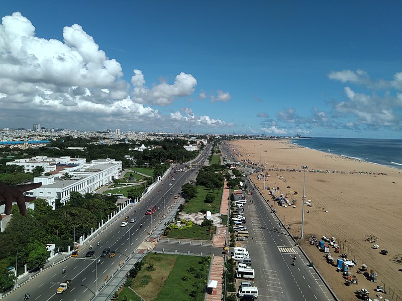
Tamil Nadu geography for Tnpsc and Upsc exams. This includes features such as mountains, plateaus, plains and coastal regions.

This region has different traditional and cultural practices. It has exquisite Physiography and climate of Tamil Nadu, which makes it distinct from other Indian states.

Tamil Nadu has a rich diversity of flora and fauna, including various plant and animal species. Several exotic hill stations, a huge forest, beautiful waterfalls and long beaches and coastline, which is the lifeline of millions. This region experiences distinct seasons, including Summer, monsoon and winter.

Location and size of Tamil Nadu

Tamil Nadu is located in the southernmost part of the Indian Peninsula. Its location is 8°4’N to 13°35’N latitudes and from 76°18’E to 80°20’E longitudes.

Its eastern boundary is Point Calimere and its western Boundary is Anaimalai Hills. Similarly, its northern boundary is marked by Pulicat Lake, and its southernmost point is Cape Comorin.

Compared to India, Tamil Nadu has 4% of its total size.

  • Latitudes: 8°4’N to 13°35’N
  • Longitudes: 76°18’E to 80°20’E

Neighbouring States and Boundaries

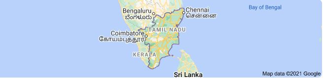
Tamil Nadu has the Bay of Bengal in the east and the Indian Ocean in the South. Her neighbouring states are Kerala in the West and Andra Pradesh in the north, and Karnataka in the Northeast.

Also, she has the second-longest coastline in India after Gujarat, which is 1076 Km.

Since Tamil Nadu is present in the southernmost tip of the Indian Mainland, it shares its border with another country called Sri Lanka.

Neighbouring States, and Countries, Its Coastline

KeralaWest
KarnatakaNorth-West
Andra PradeshNorth
Coastline Length1076 Km (India’s Second Longest)
It lies close to Sri Lanka

Tamil Nadu Boundaries

EastBay of Bengal
WestKerala & Western Ghats
NorthAndhra Pradesh & Karnataka
SouthIndian Ocean
Tamil Nadu has 4% of India’s total areaCape Comorin (Kanyakumari)
Tamil Nadu has 4% of total India’s Area
  • East: Bay of Bengal
  • West: Kerala & Western Ghats
  • North: Andhra Pradesh & Karnataka
  • South: Indian Ocean
  • Southernmost point: Cape Comorin (Kanyakumari)
  • Tamil Nadu covers about 4% of India’s total area

Administrative divisions of Tamil Nadu

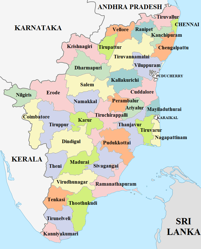
Just after Independence, Tamil Nadu had only 13 districts. The state administrative divisions were reorganised many times. As of now, Tamil Nadu has 38 districts. The newly formed districts are Kallakurichi, Tenkasi and Chengalpet.

Dindigul is the largest district in Tamil Nadu, followed by Tiruvannamalai.

Tamil Nadu Districts Map 2021
Tamil Nadu Districts Map 2021 – By Jaishink – Own work, CC BY-SA 4.0, https://commons.wikimedia.org/w/index.php?curid=88746502

Physical features of Tamil Nadu

The physical features of Tamil Nadu include:

  • Western Ghats
  • Eastern Ghats
  • Plateaus
  • Plains
  • Coastal Regions

Tamil Nadu is located on the Indian Peninsular plateau will is also called the Deccan Plateau. It was part of the ancient Gondwana land, which broke away 135 million years ago during the Cretaceous Period. The physical features of Tamil Nadu influence its Climate of Tamil Nadu, rainfall patterns, and vegetation.

Tamil Nadu’s physical features include high eroded mountains, shallow deep valleys and plains. Overall its slopes towards the east.

Tamil Nadu Physiography is divided into the Western Ghats, Eastern Ghats, the Plateaus, the Coastal and Inland Plains. Let us see the description of East Physiography.

Western Ghats

West Ghats By Mdmadhu – Own work, CC BY-SA 4.0, https://commons.wikimedia.org/w/index.php?curid=58433202

The Western Ghats is present on the Western border of Tamil Nadu alongside Kerala. It extends from Nilgiris in the North to Maruthuvazh Malai at Swamithope in the Kanyakumari district in the South.

Its height ranges from 2000 to 3000 metres and covers an area of about 2500 sq Km. The Western Ghats are a continuous range, but it also has some passes.

Passes in Geography

Passes are generally a gap or break in a continuous range of hills, terrains, mountains etc.

The Passes found in the Western Ghats are Palghat, Shencottah, Aralvaimozhi and Achankoil, and the Major hills of Western Ghats are Nilgiris, Anaimalai, Palani Hills, Cardamom Hills, Varusanadu, Andipatti and Agasthiyar Hills.

Nilgiri Hills

Nilgiri Hills By Enchant me – https://www.flickr.com/photos/enchant_me/144986171/sizes/o/, CC BY 2.0, https://commons.wikimedia.org/w/index.php?curid=5745781

The Nilgiri Hills are part of the Western Ghats, which are located in the northwestern part of Tamil Nadu. It consists of 24 peaks of a height of more than 2000 metres.

Its highest peak is Doddabetta with a height of 2637 metres, and it is followed by Mukkuruthi peak with a height of 2554 metres.

Nilgiri Hills is famous for being a hill station that attracts millions of tourists worldwide. The major hill stations located in the Nilgiris are Coonoor and Ooty.

Nilgiris is a natural wonder; it is home to more than 2700 species of flowering plants. The Tamil Nadu state animal is the Nilgiri Tahr, which is found on these hills.

For several years, its natural montane grasslands and shrublands have been damaged or disturbed by cattle grazing and tea plantations.

Anaimalai

Anaimalai Hills in Western Ghats
Anaimalai By Jaseem Hamza, CC BY 3.0, https://commons.wikimedia.org/w/index.php?curid=56537279

Anaimalai or Elephant Mountains is a range of mountains that forms the southern portion of the Western Ghats. It is located on Palghat Gap, the border of Tamil Nadu and Kerala.

Important places of Anaimalai are Anaimalai Tiger Reserve, Aliyar Reserved Forest, Valparai Hill Station, and Kadamparai Hydroelectric Power Plant.

Two dams, namely Aliyar and Tirumurthy, are located in the foothills of this range.

Palani Hills

palani hills on western ghats
Palani Hills in Western Ghats By DRUID1962 – Own work, CC BY-SA 4.0, https://commons.wikimedia.org/w/index.php?curid=49824205

The Palani Hills are the eastern extension of the Western Ghats. These hills are located in the Dindigul district, except for its western side.

Its highest peak is Vandarav,u which is of the height of 2533 metres, and its second-highest peak is Vembadi Shola, which is ofthe height of 2505.

Kodaikanal is a famous hill station located in these hills. Its height is 2150 metres, and it lies in the south-central portion of this range.

Cardamom Hills

Cardamom Hills in the western ghats
Cardamom Hills By Anand2202 – Own work, CC BY-SA 4.0, https://commons.wikimedia.org/w/index.php?curid=49746713

The Cardamom Hills is also Yela Malai. It is located in the south-western part of Tamil Nadu.

Yela Malai gets its name from the spice named Cardamom, which is commonly grown here, Also Pepper and Coffee are cultivated here.

Cardamom hills meet the Anaimalai Hills in the northwest, the Palani Hills in the northeast, and Varusanadu and Andipatti hills in the southeast.

Varusanadu and Andipatti Hills

Varusanadu
Varusanadu

Varusanadu and Andipatti Hills are the other eastward extensions of the Western Ghats. Megamalai (highway mountain), Kalugumalai, Kurangani Hill station, and Suruli and Kumbakarai waterfalls are found on these hills.

Srivilliputhur Grizzled Squirrel Wildlife Sanctuary is located on the southern slope of these hills in Virudhunagar district.

The Vaigai River and its tributaries originate from this region.

Pothigai Hills

Pothigai Hills By Rakesh – Own work, CC BY-SA 3.0, https://commons.wikimedia.org/w/index.php?curid=242144

The most part of Pothigai Hills lies in the Tirunelveli district, with its southern slope lying in the Kanyakumari district. Pothigai Hills are called by different names such as Shiva Jothi Parvath, Agasthiyar Hills, and Southern Kailash.

Pothigai area is known for its evergreen forest, ancient temples and waterfalls. Kalakkad Mundanthurai Tiger Reserve is located in this region.

Mahendragiri Hills

Mahendragiri Hills are a continuous range, which is situated along the border of the Kanyakumari and Tirunelveli districts. Mahendragiri Hills are part of the southern range of the Western Ghats, and their average height is 1645 metres.

The ISRO Propulsion Complex is a test facility for the ISRO to launch space vehicles that are situated on the lower slopes of this mountain.

The Eastern Ghats

The Eastern Ghats By Wikipedia

The Eastern Ghats are discontinuous and irregular. It is dissected at many places by rivers, and these rivers drain into the Bay of Bengal.

The height of these ranges is 1,100 to 1,600 metres. These hills separate the plains from the plateaus.

The major hills of the Eastern Ghats of Tamil Nadu are Javadhu, Servarayan, Kalrayan, Kollimalai and Pachaimalai. These are located in the northern districts of Tamil Nadu.

Javadhu Hills

Javadhu Hills By Karthik Easvur – Own work, CC BY-SA 4.0, https://commons.wikimedia.org/w/index.php?curid=45316803

Javadhu Hill are an extension of the eastern ghats, which are spread over the parts of Vellore and Tiruvannamalai Districts. These hills separate these two districts as well.

The average height of these peaks ranges from 1100 to 1150 metres. Its highest peak is Melpattu. The Vainu Bappu Observatory (VBO) Kavalur is located on these hills. This observatory started its observations in 1967.

Bluish-Grey Granites cover many parts of this range. These hills are covered with fruit-bearing trees, Medicinal herbs and Sandalwoods.

The illegal logging of trees such as Sandalwood is a major concern here.

Kalvarayan Hills

Kalvarayan Hills
Kalvarayan Hills By Thamizhpparithi Maari – Own work, CC BY-SA 4.0, https://commons.wikimedia.org/w/index.php?curid=76403112

It got its name from ancient tribes called Karalar. It is one of the major ranges of the Eastern Ghats in Tamil Nadu. This range, along with Pachaimalai, Aralvaimalai, Javadhu and Servarayan hills, separates the river basins of Cauvery and Palar.

The height of these Hills ranges from 600 to 1220 metres. Kalvarayan Hill has two sections. They are Chinna Kalvarayan in the northern section and the Periya Kalvarayan in the southern section.

The average height of Chinna Kalvarayan is 825 metres, and the Periya Kalvarayan is 1,220 metres.

Servarayan Hills

Servarayan Hills By Wikipedia: Parvathisri

It is located near Salem City, and its height ranges from 1200 to 1620 metres. It gets its name from a local deity known as Servarayan. The highest peak, Solaikaradu, in the southern part ofthe Eastern Ghats is located in this range.

Its height is 1620 metres. The hill station named Yercaud is located on this range. Yercaud is also known as Poor Man’s Ooty. Servarayan temple is its highest point (1623 metres).

Kolli Hills

kolli hills
Kolli Hills By Chinchu.c – Own work, CC BY 4.0, https://commons.wikimedia.org/w/index.php?curid=83680247

Kolli Hills is a small mountain range located in the Namakkal district. It covers an area of about 2800 sq.km. Its average height is up to 1300 metres.

This mountain range runs almost parallel to the east coast of South India. An important Pilgrim Centre in this range is the Arpaleeswarar temple.

Kolli Hills has the largest cover of evergreen or shola forest compared to other parts of the Eastern Ghats. On the commercial side, many coffee plantations, fruits, flowers and silver Oak estates are found in this region.

Pachaimalai

Pachaimalai
Pachaimalai

Pachaimalai is the lowest hill range and is spread over the Perambalur, Tiruchirapalli and Salem districts. In the Tamil language, Pachai means Green colour.

The vegetative cover of this region is greener than other vegetative covers of this region, and hence it is named ‘Pachai Malai‘. Jackfruit is a popular seasonal agricultural product of these hills.

Plateau of Tamil Nadu

Plateaus of Tamil Nadu are located between the Western and Eastern Ghats. It is roughly triangular in shape and covers an area of about 60000 sq.km.

It height increases from east to west, and its height ranges between 150 to 600 metres. This plateau is broader in the north and very narrow in the south. It has many subdivisions.

List of plateaus in Tamil Nadu

1. Bharamahal Plateau

Bharamahal plateau is a part of the Mysore plateau and is situated in the northwestern part of Tamil Nadu. Its height ranges from 350 to 710 metres. Dharmapuri and Krishnagiri districts are located in this region.

2 . Coimbatore Plateau

It lies between Nilgiris and Dharmapuri District, and its height ranges from 150 to 450 metres. Salem, Coimbatore and Erode districts are located in this region. This area spans about 2560 sq. km.

3 . Sigur PlateauThe

Moyar River separates this plateau from the Mysore plateau. Rivers like Bhavani, Noyyal and Amaravathi, which originate from the Western Ghats, flow through valleys in this region.

Its height varies from 353 to 710 metres. Many intermontane plateaus are found in the region of the Nilgiris.

4.Madurai Plateau

This plateau found in the Madurai district extends up to the foothills of the Western Ghats. The Vaigai and Thamirabarani basins are located in this zone.

Plains

The plains in Tamil Nadu are divided into two they are inland plains and the coastal plains. Inland plains are drained by rivers Palar, Ponnaiyar, Cauvery and Thamirabarani.

The Cauvery plains are the most fertile plains of the state. The plains of Cauvery are found in Salem, Erode, Karur, Tiruchirapalli, Pudukottai, Thanjavur, Tiruvarur and Nagapattinam districts.

The coastal plains of Tamil Nadu are also called the Coromandel or Cholamandalam plain. It extends from Chennai to Kanyakumari.

These coastal plains are formed by rivers that flow towards the east and drain into the Bay of Bengal, and in some places, it is more than 80 km wide.

Tamil Nadu coastal plains are an emerging coast; still, some parts are submerged into the sea.

The sand dunes formed along the coast of Ramanathapuram and Thoothukudi districts are called Teri. Coral rocks are found at the head of the Gulf of Mannar in the eastern coastal plain.

Beaches

Beaches in Tamil Nadu

The Coromandel coast along the Bay of Bengal consists of beautiful and exotic beaches. The golden sands of Tamil Nadu beaches are scattered with palm and casuarina groves. Marina and Elliot beaches of Chennai, Kovalam and Silver beaches of Kanyakumari are some of the famous beaches in Tamil Nadu.

Rivers in Tamil Nadu

Tamil Nadu has several improtant rive like Cauvery, Vaigai and Thamirabarani that play a crucial role in agriculture.

Natural Vegetation

The total forest cover of Tamil Nadu is lower than the National Forest Policy, 1988, that say a minimum of one-third of the total geographical area should be under forest cover.

Tamil Nadu’s forest cover is 2.99, and its types vary from wet evergreen to scrub forest.

The Western Ghats, the longest hill range in the state, is one of the 25 global hotspots of biodiversity and one of the three mega centres of endemism in India.

Conclusion

In this article, we have discussed the Geography of Tamil Nadu, including its physiography, hills, plateaus, plains, beaches and Natural vegetation of Tamil Nadu.

Non Conventional Sources of Energy Upsc

Non-conventional sources of energy

Non Conventional sources of energy are the ones which are renewable, eco-friendly, pollution-free and they are alternative to conventional energy sources such as Coal, Petroleum etc. Examples are Wind, Solar, Hydro, Tidal-Wave, Biomass Energy etc.

Use of Non-conventional Sources of Energy

India heavily depends on Thermal Power, which uses Fossil fuels as its energy source. This creates huge environmental and as well as health effects to all the living beings.

The gases released by thermal power plant are Sulphur Dioxide (SO ), Carbon Monoxide (CO), Oxides of Nitrogen (NOx) and Ozone (O) and also Suspended Particulate Matter (SPM), Lead and Non-Methane Hydrocarbons.

Also, Hydropower Power, even though its Non-conventional energy sources, still its largely affects the environment as Huge forest were destroyed for the construction of dams.

Due to such environmental effects, the need of hour is Non-Convention Sources of Energy.

Solar Power

Solar Panel producing solar energy: Non-Conventional Sources of energy Upsc
Solar Panels for producing electricity By Abengoa Solar – Abengoa Solar, CC BY 1.0, https://commons.wikimedia.org/w/index.php?curid=12030638

Solar Power is produced by using solar panel, which is a large number of Photovoltaic cell or solar cell which are arranged in a particular manner to yield maximum power.

The Terrace of homes and offices can be effectively used to produce Solar energy using Solar Panels and Solar inverters. These systems designed to reduce the electricity bills and also one could earn money by giving the excess electricity produced at Home or Office to the Local Power Distribution Centre or EB.

Solar Power is the fast-growing sector in India as India has a huge advantage over it. Tamil Nadu state has the highest installed solar capacity in India. (Kindly Check the Latest One)

Tamil Nadu’s total installed solar energy is 1697 MW.

The Solar thermal energy programme is being implemented by the Ministry of Non-Conventional Energy Source (MNES) and its main objective is market development, commercialisation and utilisation of heat energy in Industries, Institutions and domestic applications.

Andhra Pradesh, Gujarat, Rajasthan, Maharashtra and Madhya Pradesh are the major solar power producers.

Hydro power

Dams Producing Hydro Electricity By allen watkin, CC BY-SA 2.0, https://commons.wikimedia.org/w/index.php?curid=32039098

Hydro Power is one, where the power is generated using the free-flowing water from the Hills, Dams etc. This is regarded as one of the most economical and environmentally friendly methods of power generation. Still it has its own disadvantages, as the construction of dams needs a large area and mostly forest is cleared build such reservoirs and also Hydropower is seasonal as most of the rivers in India are non-perennial.

This method contributes 7% of global power production and the cost of production is also relatively low which makes it a good renewable energy method.

In India, the nodal agency for Hydro Power production is NHPC Limited which is an Indian government hydropower board under the ownership of the Ministry of Power, Government of India that was incorporated in the year 1975 and the first hydroelectric power station in India is established in 1987 at Darjeeling.

Distribution of Hydro Electric Power

  • River of Assam, Arunachal Pradesh, Manipur, Nagaland and Tripura accounts for 30.4%
  • Eastward flowing rivers of peninsular India – 20.9%,
  • Westward flowing rivers of the Western Ghats (South of the Tapti) – 10.5%
  • The Ganga Basin – 11.7%
  • Indus Basin – 16%
  • The rivers of central India – 10.5%

Wind Energy

Will Mill Producing Electricity By Matthew T Rader, https://matthewtrader.com, CC BY-SA 4.0, https://commons.wikimedia.org/w/index.php?curid=101799395

Wind Mills are erected, to harvest the energy from the natural Air Flow using the Wind Turbines. It is a cheap source of power, plentiful, renewable, clean, eco-friendly and does not give out any unwanted gases such as greenhouse gas during its operation.

Apart from producing electricity, wind energy is used for pumping water and Sail propel ships.

As these Winds Mill occupy less space, a number of Wind Mill unit can be built in a small area. In India, Tamil Nadu has the largest installation, Muppandal-Perungudi area, near Kanniyakumari has the largest concentration of wind farm capacity in a single location in the world.

In 1986, development of wind power in India began. The first wind farm was set up in the coastal areas of Okha, Gujarat, Ratnagiri in Maharashtra and Thoothukudi in Tamil Nadu with 55 KW Vestas Wind Turbines.

The wind energy production capacity has increased greatly in the past few years and currently, India is the fourth-largest producer of Wind Energy in the World. The National Institute of Wind Energy (NIWE), Chennai was established in Tamil Nadu in 1998 as an autonomous institution under the administrative control of the Ministry of New and Renewable Energy.

CIWE main activities include resource assessment and testing & certification.

d) Biomass Energy

The Bioenergy are obtained by the bio-degradable materials such as Animal dung, Kitchen waste, Water Hyacinth, agricultural residue and other wastes etc. Biomass energy is a clean and cheap source of energy.

At the moment India has a high potential to obtain energy from biomass and it is estimated about 18 GW of power can be obtained from biomass in India. And Currently, 32% of the total primary energy used in India is obtained from Biomass.

Currently the energy derived from the biomass is mostly used for domestic purposes.

e) Tidal and wave Energy

Tidal Power Plant By Kches16414 – Own work, CC BY-SA 4.0, https://commons.wikimedia.org/w/index.php?curid=95341987

Ocean tides and Ocean waves are the two main sources of Ocean energy and it is estimated that India has 8,000-9,000 MW potential on its coasts. The gulf of Cambay or Gulf of Khambhat in the Arabian Sea in Gujarat is the most suited area for tidal energy with a potential 7,000 MW.

And Followed by by the Gulf of Kachch with potential of 1,000MW and Sunderbans with the potential of 100MW.

At present, a 900mw tidal power plant is proposed to be set up in the Gulf of Kachch region. Also, Wave energy potential in India is estimated to be 40,000 MW. A wave energy power plant of 150 KW(maximum) has been installed at V-izhinjam near Thiruvananthapuram.

Information communication revolution Upsc

Information communication revolution

Evolution of communication technology

Production of and trade in commodities are the basis of the economy of any country. For these to go on, smoothly and with efficiency, the most basic need is information exchange.

The amount of information exchange depends very much on economic development. With the increase in demand for more information and exchange, the means of exchange also develop.

Letters are a vital element in the exchange of information for a long. The means of transport of letters depends on the distances to which they are transported. For short distances, they are sent through the roads. For distant places, they are sent by the railways. And for still farther distances, they are sent either by sea or by air.

Speed posts and the letters that should reach in a short while are being sent through the air. Until now, letters were carried in India by the Government Department alone.

Now, there are private courier services, too. The Government Postal Services have introduced ‘speed post’ to facilitate quick delivery of letters to distant places.

Information exchange is not only through letters but also through various other means such as the telephones, electronic equipment such as telefaxes. In sum, people, products, and information are transferred through roads, postal services, sea routes, and airways. The transfer is done through one or more of the transport modes.

Therefore, there is a competition between the carriers or interdependence among them. As such, development in one leads to developments in another. This is because there are merits and demerits to each of these transport modes and vehicles.

Information Explosion: Information explosion is very much like the population explosion of recent times. Several geographical information systems have been developed to store the data from the information explosion, index, and analyze them for development purposes.

It has become possible to handle different types of data easily through computers. Thus, there is no doubt now that the communication techniques and information revolution have acted in the union to prove the idea that ‘knowledge is power.

What are their impacts? How did they make for a change in geography? What developments occurred in geography as a result of these changes?

Technological, Technical Development: The world around us is changing fast. This change has made transformations on the earth possible. Methods have been devised in geographical science which analyses this change towards an understanding of the earth phenomena.

These have ushered in new perspectives and paradigmatic understanding of geography. In the 1950s, for example, number and quantity brought in a scientific revolution in geography.

Measurements and gathering of statistical data for understanding the world and to resolve problems that face the earth had become day-to-day activities. In course of time, mapping, cartographic research, and mathematical methods have come into use.

At the beginning of the 1960s, there were several descriptions and explanations which have now become established geographical ideas.

Continuous developments in information technologies increased field-based activities, voluminous data collected at the local and regional levels, the use of computers, and mathematical algorithms – all have impacted to increase the information manifold.

Information has multiplied ten times, hundreds of times, and million-fold. In order to take advantage of the exploding information, there came other, forward-looking developments during the 1970s and 1980s.

Although remotely sensed data have been received from the aerial photographs even before, satellite images have now supplemented even better information.

The traditional tool of cartography has now provided support in integrating human skills with the computing skills of computers and this has developed into modern geographical information systems.

Computers have now turned into devices, directly storing data from the fieldwork. They have now become not only the instant processors of arithmetic solutions and maps but also print them out as hard copies.

Space and satellite telecommunications, manual and computer mapping technology, and analytical mathematical algorithms have all been pooled to provide us with the Geographical Information Systems (GIS) that could accommodate and meet the challenges of information explosion in the world in the 1990s.

In several western countries, hundreds of the GISs have come into use. It is estimated that there is now a total of 2,000 such GISs in use in the world.

They have already been in intensive use in the departments of development and management. They have come into use, in our own country as well. The wings of the Survey of India and in the Departments of Universities, have now been used to the extent we could cope with the information explosion.

Importance of Information Technology: The developments in information technology have now paved the way for the new axiom ‘New scales, new worlds’.

Relations between data need, provision and handling have risen as a reflection of technological development. Nevertheless, the technology and the techniques are within certain limits, in operational terms.

Particularly, there is still a limit to the quantum of data that can be handled. The value of information technology depends upon the following is beginning to dawn in our midst:

Nature and type of sensing of information. Its spatial and temporal resolution. Our capability for processing data into information, storing and handling them in terms of computer facility.

The analytical capability with us and the corresponding interpretative capability amongst us. Classifying the conclusions and solutions from the information obtained by us and bringing them into use in a beneficial manner.

The five above, there is no doubt, will give us clarity of what we know of the world.

It is always a question in the area of communication as to how to deliver the news and ideas that arise from these to a majority. In today’s world, there are several communication types of equipment in daily use.

It is also true that some of them are still beyond the reach of a majority of people in this country because of their prices. For example, it is humanly impossible to make available newspapers to every citizen of India.

Similarly, radios and televisions cannot be made available to all of them, either. But there is no doubt that the impact of these media is widespread, throughout the world.

According to one source, radios provide vital information to 90 percent of the Indian population. Television acts in a way useful to 70 percent of the Indians.

They play a vital role in entertainment. Telephones have started functioning in remote villages, besides the towns and cities.

But in western countries, telecommunications have already become a basic need. The day is not far off for it to happen in India, as well. Let us now turn to learn the developments that have come about in the fields
of telecommunication and its technologies.

Communication Revolution: The world is under the grip of a ‘communication revolution’ that is seen in many ways. This revolution is considered the ‘third wave’ of global revolution. The ‘first wave’ of revolution is the ‘green revolution’ while the ‘second wave of revolution is that of the ‘industrial revolution.

The two revolutions (agricultural, industrial) have made a revolutionary change in the development of humankind.

It is expected that the third revolution of communication would bring about changes in the world that would surpass all changes that occurred in the earlier revolutions.

It has made possible the belief that it is ‘One World’.

It would also integrate people of all world, in all directions, is talked about throughout.

As the first impact of the appropriate activities of information technology, the world has begun to shrink. It has now become possible to send the information contained in ten books in a few seconds to a distant place: broadcasting has given way to narrow-casting.

How has this been possible? Let us now look at the historical developments in information and telecommunications, as they are useful to us.

Never before in human history has knowledge been so enormous. Also, we have never possessed such communication abilities as we do now.

We may consider these information and telecommunications technologies as problem-solving strategies and facilities.

It is even possible to integrate the wealthy North countries with the poverty-stricken South countries in the good cause of amenity expansion, catalyzing development, increasing literacy, alleviation of poverty through altruism, nature restoration, world management, promoting peace, and humanizing the world through these technologies.

Language and New Technologies: In human history, the languages were split and developed as the populations spread and multiplied.

Some cultures have gifted their cultures and languages to the outsiders and brought to themselves laurels.

Language has alone become the vehicle of communication. Some of these languages have now become the languages of law, administration, and official use through speech, writing, and printing.

Telecommunication Technologies

In some cultures, languages have been identified as ‘human identities’. English, French, Spanish, Russian, Chinese, and Arabic is being used by the multitude. Similarly, some of the regional and local dialects are being used as the languages of communication among the peoples.

All of these languages offer information through newspapers, radios, and television. All new innovations in technology use languages as the interfaces in the information exchange.

Some signal languages are used in communication with computers.

Ancient Telecommunications:

In telecommunications, all information is conveyed through symbols. The African drummers communicated messages through sound. Smoke signals were in use among some tribes as a means of telecommunications.

Flags and pictorials were used as auxiliaries to telecommunications.

Printing Revolution:

Then came printing techniques. The machine-published books became the primary sources of information besides reaching most of the world population.

The 19th-century steam-driven printing press gave way to the machines which operated with electricity and depended on composing. Next came litho press.

Photocopying created a revolution in copying. This is even now in use. In this computer age, printing has become simple through desktop publication.

The book in your hands has been published using computer publishing.

Telegraph and Telephones

The first-ever electrically operated telegraphic equipment came into use in the year 1837. Subsequently, in 1867, the telephone was born.

These have served humankind for more than a century in the exchange of information. Joining with the computers and satellites in telecommunications, the telephones have revolutionized the internal and international information exchanges.

As a ‘two-way communication’ and a ‘communication without codes’, telephones have become a communication link with no match to its versatility.

Radio: Radio broadcasting –

Especially continuous one – came into vogue in the year 1922. Radio has acquired the epithet ‘the vehicle of social change’ in a few years’ time. It had a very distinctive role in the green revolution of the developing countries.

It is also being used as the primary communication link in population control. It is not only useful to the educated but even more so to the uneducated. But this is under Government control. In some western countries, it is also being used as the communication medium in the private sector radio broadcasting.

With the telephone, this has made history in individual-related communication, too.

Television

Sound and light-based communication was first begun in 1936. This is the television era, which has made possible a ‘reception room revolution’, using cinematographic techniques.

Yet, in some countries, it has earned the name ‘the idiot box, which it does not deserve. This is now an instrument changing the perception of the world population.

However, television has coverage of a mere 15 percent of the population in the poor South countries which hold 75 percent of the world population. In northern countries, it is rare to see a place or a home without television. In some countries, the telecast is through more than 100 channels.

The necessary information they provide, recreational and entertainment fares they offer, and the knowledge-based telecasts are numerous. Yet, where the cinema impacts more readily on the population as in the developing countries, the hold of the television on the population is minimal.

Deep-Sea Telegraphic Lines: These are a communication link among the many countries which have developed quite fast in both telegraphic and telephonic communication.

A deep-sea line in 1980 carried some 5,000 telephonic links. Now there have been several developments. Many countries are not only connected by the deep sea telegraphic lines but they use them in an important way, too.

The Satellite Power

The first-ever satellite is Sputnik 1. This was launched in 1957. It is estimated that over 15,000 satellites have orbited the earth in space. Some have burnt themselves while returning to the earth, in the atmosphere.

The 180 satellites sent up by the United States of America are all in use. The 100 satellites sent up by the former Soviet Union are still in operation. Among the 16 satellites launched by India, none failed.

They have completed successfully their mission, besides helping with the resources appraisal and in international communication. As for geography, the images received from these satellites play a vital role in the assessment of resources.

They form the spatial database for mapping through the GIS. It is not only easy to analyze the problems that the country faces but also develop solutions using the products of maps and their interpretations.

In the operation of satellites, computers have a significant role. It would be otherwise difficult to receive images from the satellites and process them in the lab was it not for the development of computers.

In resources appraisal, the images that we receive from the satellites have a large role to play. Generations of Computers: Computers have been developed in very rapid succession. Present-day computers are considered the Fifth Generation computers.

The first used simple valves. The second-generation computers used transistors. The third has been developed using integrated circuits. And the fourth uses microchips.

Microchips are still being used in fifth-generation computers; there are also other technologies in the field of computers.

Computers are useful in telecommunications in two important ways.

  1. They act as storages and retrieval media when required.
  1. They have a major role in international information exchange through Electronic Mail (E-mail) and international telecommunications.

Climate change and its Consequences Tnpsc

climate change and its consequences

Climate change Definition

Climate change in IPCC usage refers to a change in the state of the climate that can be identified (e.g. using statistical tests) by changes in the mean and/or the variability of its properties, and that persists for an extended period, typically decades or longer.

Climate change definition by Ipcc

Climate change refers to seasonal changes over a long period with respect to the growing accumulation of greenhouse gases in the atmosphere.

Recent studies have shown that human activities since the beginning of the industrial revolution have contributed to an increase in the concentration of carbon dioxide in the atmosphere by as much as 40%, from about 280 parts per million in the pre-industrial period, to 402 parts per million in 2016, which in turn has led to global warming.

Several parts of the world have already experienced the warming of coastal waters, high temperatures, a marked change in rainfall patterns, and increased intensity and frequency of storms. Sea levels and temperatures are expected to be rising.

Climate change and its consequences

Climate change and its consequences are nothing but the negative effects of climate changes, It includes the Failure of the Monsoons. In-country like India, where the majority of the population depend on the Monsoon rainfall for drinking and agriculture.

As most of the rivers in India are non-perennial, People always expects of Monsoon as a source of water. If one season is failed it will be a huge disaster in India. It results in the drying of rivers, lakes and putting a lot of pressure on the groundwater resources.

This in turn puts a lot of pressure on the groundwater. This results in excessive usage of groundwater for agriculture and drinking water that results in groundwater depletion.

Some crops which are planted in Tamil Nadu such as Paddy requires a lot of water to grow. When the monsoon fails it is difficult to depend on groundwater. When the groundwater depletes it results in crop failure.

The crop failure results in famine and diseases.

Another Climate change and its Consequences is an increase in the level of the sea. When the sea level increase just by one inch several Islands and low-lying cities such Chennai, or other coastal regions may submerge into the sea.

As we get news regarding rising sea level is submerging several Pacific Islands If cannot stop the climate change most part of Tamil Nadu might submerge into the sea.

Climate change and its Consequences on Biodiversity

The effects of climate change on Biodiversity is another important topic we need to address. The increase in atmospheric temperature increases the temperature of the sea. This affects the growth of Coral reefs and the breeding of fishes.

The coral reef needs water of temperature 23°–29°Celsius for its growth. When the temperature of seawater increases, it directly affects the growth of Coral. Thousand of species depend directly on the Coral reefs.

The increase in seawater temperature directly affects sea species.

It also affects several birds and animals. An increase in temperature affects Polar Ice Caps that affect Polar Bear, Penguin, etc. The Polar bear population is decreasing at a rapid rate.

The increase in temperature results in frequent forest fires, that kills a lot of wild animals and plants.

Climate change mitigation

Climate change mitigation is a set of activities that need to be taken to reduce the impact of climate change. These include using renewable energy sources such as Solar power plants, wind energy, etc.

Reducing the Co2 discharge, using public transport rather than using Individual vehicles such as Motor Bike, cars, etc.

The latest improvement in climate mitigation is the increased usage of E-Vehicles and Bio Fuels. These are some of the climate change solutions.

The latest climate change news is Treats to tropical forests, Melting glaciers, Global food shortage.

Climate change causes

  • Global warming is the current increase in temperature of the Earth’s surface (both land and water) as well as its atmosphere.

  • Average temperatures around the world have risen by 0.75ºC (1.4ºF) over the last 100 years.

  • About two-thirds of this increase has occurred since 1975.

  • Carbon dioxide, methane, Chlorofluoro Carbon, nitrous oxides are the greenhouse gases warming the earth’s surface. So it is also called the greenhouse effect.

  • The CO2 is the most important of the greenhouse gases contributing to 50% of global warming.

  • The burning of fossil fuel, and other biomass, deforestation result in CO2.

  • In the past, when the Earth experienced increases in temperature it was the result of natural causes but today it is being caused by human activities.

Conclusion

Climate change and Global warming adversely affect agriculture, horticulture, and the ecosystem. Reduced rainfall, higher temperature, and increased pest/weed growth hamper farming.

Threats to health arise due to an increase in disease-carrying vectors such as mosquitoes resulting in malaria, dengue fever, encephalitis, and yellow fever.

An increase in the global average surface air temperature of such magnitude will bring about alarming changes in rainfall patterns and other climatic conditions, resulting in serious ecological disequilibrium.

Minerals and natural resources in India Tnpsc

The natural resources of India include coal, where India has the fourth largest coal reserve in the world, also several other important mineral reserves such as Iron ore, manganese ore (7th largest reserve), bauxite (5th largest), thorium, etc.

The most important natural resources are Oil, coal, natural gas, metals, stone and sand. Of this India has abundant natural resources.

Metals are of two types: Ferrous and Non-Ferrous. Ferrous minerals have iron content such as iron, manganese, nickel, cobalt, tungsten, etc.

Non-ferrous minerals- do not have iron content such as gold, silver, copper, bauxite, etc.

Non-Metallic minerals

Nonmetallic minerals do not contain metals, such as mica, limestone, gypsum, potash, and coal. Non-metallic minerals are also called mineral fuels, such as coal and petroleum.

Distribution of natural resources in India

It is estimated that about 100 different minerals are known to be produced in India, out of which 30 are important. Most of the metallic minerals are found in the peninsular plateau regions, especially in old crystalline rocks. Mineral distribution is concentrated in three belts. Maybe some occurrence here and there is in isolated pockets.

The three belts are the northeastern plateau, southwestern plateau, and northwestern region.

Metallic Minerals

Iron Ore

Iron is not found in pure form, it is often mixed with lime, magnesium, phosphorous, silicon, etc. There are four types of iron ore Haematite, Magnetite, Limonite, and Siderite.

Haematite is reddish, also known as red ochre. It contains 60-70% of iron.

The major iron ore-producing states in India include:

  1. Odisha: Odisha is the largest producer of iron ore in India. The state’s Keonjhar and Sundargarh districts are particularly rich in iron ore deposits. The mines in this region mainly produce high-grade iron ore, contributing significantly to the country’s overall production.
  2. Chhattisgarh: Chhattisgarh is another major iron ore-producing state in India. The Bailadila mines in the Dantewada district of Chhattisgarh are known for their rich deposits of high-grade iron ore.
  3. Jharkhand: Jharkhand is home to some of the largest iron ore mines in India, located in the Singhbhum district. The Chiria mines in Singhbhum are known for their high-quality iron ore.
  4. Karnataka: Karnataka also contributes significantly to India’s iron ore production. The mines in Bellary and Hospet regions of Karnataka are key iron ore-producing areas.
  5. Goa: Although Goa was traditionally a major iron ore-producing state, the mining activities have faced environmental and legal challenges in recent years, leading to a decline in production.

The iron ore extracted from these regions is mainly of two types: hematite and magnetite. Hematite is the more abundant and preferred iron ore due to its higher iron content, making it suitable for steel production. Magnetite, while less abundant, also has a high iron content.

India’s iron ore is used both domestically and exported to other countries, particularly to meet the demand of the steel industry. The government has implemented various policies to regulate and manage iron ore mining activities, aiming for sustainable and responsible exploitation of this valuable natural resource.

Magnetite

The ore colour is dark brown to blackish and is called black ore. It has magnetic properties. It contains 70% of iron.

Karnataka: The Sandur-Hospet region in Karnataka is known for its magnetite deposits. The Kudremukh Mines in this region, once a major source of magnetite, were important for India’s iron ore production.

Andhra Pradesh: Magnetite deposits are found in the eastern part of Andhra Pradesh, particularly in the Kurnool district.

Tamil Nadu: The Salem and Tiruvannamalai districts in Tamil Nadu also have magnetite deposits.

Kerala: Some magnetite deposits are found in the Idukki district of Kerala.

Maharashtra: The Chandrapur district in Maharashtra is known for its magnetite deposits.

Usage

Magnetite is a valuable resource due to its high iron content. It is particularly important in the steelmaking industry, where iron ore is a crucial raw material. The iron content in magnetite is usually higher than in hematite, another common type of iron ore.

Siderite

It is an inferior variety of iron ore and has many impurities and is also called iron carbonate. It contains 20 to 40% of iron.

Limonite

It is yellow or light brown in colour, it is called hydrated iron oxide when the iron ore is mixed with oxygen and water. Its mining is cheaper and easier. It contains 40 to 60% of iron.

Iron ore reserves

India has 20% of the world’s total iron reserves. About 75% of the total reserves of iron ore in India are of haematite grade.

Jharkhand, Orissa, Karnataka, Madhya Pradesh, Chattisgarh, and Goa, have 97% of the total iron ore reserves of India.

Manganese

It is a silver-grey element and it is very hard and brittle. Manganese is always available as a combination with iron, laterite, and other minerals.

Uses

It is widely used in iron and steel manufacturing. Also used for making various alloys. Used in making of batteries, bleaching powder, insecticides, paints, etc.

Manganese ore reserves

Found in Odisha (44%), Karnataka (22%), Madhya Pradesh (12%), Maharashtra(7%), Goa (7%), Andra Pradesh (4%), Jharkhand (2%).

Also found in Rajasthan Gujarat, Telangana, and West Bengal. The leading producers of Manganese Ore are the Nagpur, Bhandara, Ratnagiri districts of Maharastra.

Madya Pradesh

Balaghat, Chhindwara districts.

Odisha

Sundargarh, Kalahandi, Koraput, and Bolangir districts are the major ones.

Other producers are:

Andhra Pradesh (13%)

Srikakulam, Visakhapatnam, Cuddapah, and Guntur districts.

Karnataka (6%)

Districts of Shimoga, Bellary, Chitradurga, and Tumkur.

Copper

Copper is an important metal that is used by prehistoric men. Bronze is an alloy of Copper, Zinc, and tin. Copper is used for making Electrical wires, Cooking utensils, etc.

Copper Ore Reserves

Rajasthan state has the largest copper reserve in the country that provides 53.81% of the total produce. It is followed by Jharkhand with 19.54% and Madhya Pradesh with 18.75%.

Other producers are Andhra Pradesh, Gujarat, Haryana, Karnataka, Maharashtra, Meghalaya, Nagaland, Odisha, Sikkim, Tamil Nadu, Telangana, Uttarakhand, and West Bengal. Together these states account for 7.9%.

Rajasthan

Khetri, Alwar, and Bhilwara districts.

Uttarakhand

Dehradun and Garhwal Districts

Andra Pradesh

Guntur, Kurnool, and Nellore districts

Karnataka

Chitradurga and Hassan districts.

Bauxite

Bauxite is an important ore of Aluminium. This ore is found in rocks consisting mainly of hydrated aluminium. It is distributed in the areas of laterite soil.

Aluminium is lightweight and is used in the manufacturing of aircraft, automobile engines, manufacture of cement, various chemicals, etc.

Bauxite deposits are mainly found in Odisha (50.2%), Gujarat(15.8%), Jharkhand(11.9%), Maharashtra(9.9%), Chhattisgarh (6.2%) and Tamil Nadu (2.7%).

Non-Metallic Minerals

The Non-Metallic Minerals include Mica, limestone, gypsum, nitrate, potash, dolomite, coal, petroleum, etc

Mica

Mica is used in the electrical industry, as insulating material as it withstands high voltage and has a low power loss factor. Abhrak is a top-quality mica. Mica is translucent. It can be easily split into thin sheets.

It is also used in making lubricants, medicines, paints, and varnishes.

Mica Ore Reserves

Mica deposits are found in Andhra Pradesh(41%), Rajasthan(21%), and Odisha (20%).

Andra Pradesh

Nellore, Visakhapatnam, West Godavari, and Krishna

Rajasthan

Bhilwara, Jaipur, and Ajmer districts

Odisha

Rayagada, Bolangir, and Sundargarh districts

Jharkhand

Palamu, Ranchi, and Singhbum districts.

Limestone

These are rocks that are composed of calcium carbonate or the double carbonate of calcium and magnesium or both. The limestones also contain little silica, alumina, iron oxides, phosphorous, and sulphur.

These are used in making soda ash, caustic soda, bleaching powder, cement, steel plants, glass, fertilizers, and paper.

Limestone Ore Reserves

Andra Pradesh and Telangana produce the most limestone ores with 20% each. Rajasthan (20%), Madhya Pradesh (12%), Tamil Nadu (8.4%), and Karnataka has the most limestone reserves (27%), followed by Andra Pradesh and Rajasthan (12% each), Gujarat (10%), Meghalaya (9%), Telangana (8%), Chhattisgarh and Madhya Pradesh (5% each) and the remaining by other states.

Andra Pradesh

Cuddapah, Kurnool, and Guntur districts

Telangana

Nalgonda, Adilabad, Warangal and Karimnagar

Rajasthan

Jodhpur, Ajmer, Bikhaner and Kota

Madhya Pradesh

Jabalpur and Satna Districts

Tamilnadu

Salem, Kancheepuram, Tiruchirappalli, Thoothukkudi, Tirunelveli, and Virudhunagar districts.

Gypsum

Gypsum is hydrated sulphate of calcium. It is white, and opaque. These are found in the beds of sedimentary rocks such as limestone, sandstone, and shale.

It is used in the manufacture of cement, fertilizers, plaster of Paris, etc. It is also used in conditioning soil.

Gypsum Ore Reserve

Rajasthan state accounts for 81% of the total reserve in the country. Also, there is a 14% reserve in Jammu and Kashmir and a 2% Reserve in Tamil Nadu.

Also, 3% of resources were present in the states of Gujarat, Himachal Pradesh, Karnataka, Uttarakhand, Andhra Pradesh, and Madhya Pradesh.

Rajasthan produces 82% of the country, Jammu and Kashmir produce 14%, and other states such as Gujarat, Uttarakhand, Andhra Pradesh, and Tamil Nadu produces 4% each.

Rajasthan

Jodhpur, Bikaner and Jaisalmer

Jammu and Kashmir

Baramula, Doda and Uri

Gujarat

Bhavnagar and Jamnagar

Uttarkhand

Dehradun and Mussourrie

Andhra Pradesh

Nellore, Guntur, and Prakasam District

* * All the Notes in this blog, are referred from Tamil Nadu State Board Books and Samacheer Kalvi Books. Kindly check with the original Tamil Nadu state board books and Ncert Books.